Category:Maps of the Principality of Moldavia
Wikimedia category | |||||
| Upload media | |||||
| Instance of | |||||
|---|---|---|---|---|---|
| Category combines topics | |||||
| Principality of Moldavia | |||||
principality in Southeast Europe between 1346–1859   -en.png) | |||||
| Instance of | |||||
| Named after | |||||
| Capital | |||||
| Basic form of government | |||||
| Official language | |||||
| Currency | |||||
| Inception |
| ||||
| Dissolved, abolished or demolished date |
| ||||
| Religion or worldview | |||||
| Replaced by | |||||
| Different from | |||||
| |||||
Subcategories
This category has the following 2 subcategories, out of 2 total.
Media in category "Maps of the Principality of Moldavia"
The following 67 files are in this category, out of 67 total.
-
 1606 map Ward 1912.jpg 1,154 × 1,279; 1.59 MB
-
 Galicia1836.gif 658 × 806; 318 KB
-
 Armenian presence in Moldavia and Wallachia before 1800.svg 2,907 × 2,522; 251 KB
-
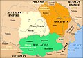
 AtlBalk1600.jpg 318 × 327; 171 KB
-
 AtlHistMold4.jpg 1,020 × 946; 504 KB
-
 AtlHistMold5.jpg 986 × 893; 465 KB
-
 AtlHistMold6.jpg 993 × 893; 238 KB
-
 AtlHistMold7.jpg 993 × 893; 208 KB
-
 AtlHistMold8.jpg 979 × 906; 212 KB
-
 Cahul Ismail si Bolgrad.PNG 2,259 × 2,886; 3.07 MB
-
 Central europe 1683.png 1,280 × 971; 406 KB
-
 Vassal states of the Ottoman Empire in 1683 hu.svg 877 × 688; 397 KB
-
 Vassal states of the Ottoman Empire in 1683.svg 877 × 688; 278 KB
-
 Danubian Principalities 1800 es.svg 551 × 387; 381 KB
-
 Danubian Principalities 1800 no.svg 549 × 386; 89 KB
-
 Danubian Principalities 1800.svg 549 × 386; 89 KB
-
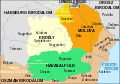
 Danubian Principalities basic locator map, 1861, with counties.svg 800 × 600; 38 KB
-
 Heraclid Despot's invasion in northern Moldavia, 1561.svg 1,115 × 789; 341 KB
-
 Industry in the Danubian Principalities before 1800.svg 5,307 × 5,022; 303 KB
-

-
 Map of the Holy League in 1595.svg 1,140 × 990; 525 KB
-
 Map of Turkey in Europe, Greece and the Balkans.png 1,209 × 879; 2.3 MB
-
 Mihai 1600 es.svg 551 × 387; 457 KB
-
 Mihai 1600-ar.png 587 × 413; 79 KB
-
 Mold. 1810.png 1,405 × 929; 2.39 MB
-
 Moldavia map.jpg 650 × 478; 285 KB
-
 Moldavia map.png 622 × 470; 27 KB
-

-
 Moldavian-Ottoman wars.jpg 299 × 294; 133 KB
-
 Moldova (1483)-en.png 1,769 × 1,614; 4.29 MB
-
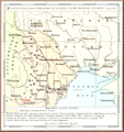
 Moldova judete 1601-1718.jpg 1,570 × 1,154; 833 KB
-
 Moldova1483.jpg 657 × 599; 604 KB
-
 Moldvai Jászság.jpg 175 × 153; 587 KB
-

-
 Partitions of Moldavia.jpg 665 × 1,848; 635 KB
-
 PhysicalAncientMoldavia.jpg 404 × 272; 177 KB
-
 Principate Judete 1711.jpg 1,249 × 1,024; 819 KB
-
 Principate Judete 1800.jpg 1,249 × 1,024; 616 KB
-
 Raiale sec 17-18-es.svg 2,500 × 2,200; 2.46 MB
-
 Raiale sec 17-18.svg 2,500 × 2,200; 1.9 MB
-
 Reformation and Counterreformation in Moldavia-hu.svg 3,054 × 2,387; 240 KB
-
 Reformation and Counterreformation in Moldavia.svg 3,054 × 2,387; 421 KB
-
 Regiunile Principatului Moldovei.jpg 665 × 599; 199 KB
-
 Roemenië 1600.png 360 × 284; 37 KB
-
 Rom1856-1859.png 588 × 413; 73 KB
-
 Romania 1600.png 367 × 285; 27 KB
-
 Romania1484-1672.jpg 587 × 413; 77 KB
-
 Romania1673-1713-es.svg 551 × 387; 432 KB
-
 Romania1673-1713.jpg 587 × 413; 92 KB
-
 Romania1713-1812.jpg 587 × 413; 81 KB
-
 Romania1812-1829.jpg 588 × 413; 77 KB
-
 Romania1829-56.jpg 588 × 413; 70 KB
-
 Romania1856-1859-es.svg 551 × 387; 458 KB
-
 RomanianPrincipalities1812-1829.jpg 588 × 413; 78 KB
-
 RomanianPrincipalities1848.jpg 588 × 413; 72 KB
-
 Romantart.png 588 × 413; 44 KB
-
 Románia területe 1713-1812.svg 551 × 387; 168 KB
-
 Rumanía1713-1812.svg 551 × 387; 168 KB
-
 Southern Bessarabia.tif 2,791 × 4,133; 44.03 MB
-

-
 Stamp of Moldova md491a.jpg 648 × 548; 44 KB
-
 Treaty of Bucharest-1812.png 464 × 354; 75 KB
-
 Vexilographic maps of Pontic littoral by end of 13th-17th century.svg 1,640 × 895; 2.58 MB
-
 Voivodeship of Moldavia (1789).svg 450 × 456; 792 KB
-
 Voivodeship of Moldavia (1812).svg 450 × 456; 585 KB
-
 Европейская часть Турции (1526-1699).png 1,171 × 1,547; 2.44 MB
-


_and_the_Crown_of_the_Kingdom_of_Poland_(red)_and_its_neighborhood_in_1386_%E2%80%93_1434_(English_version).png)


.svg)
.svg)
.png)

.png)