Category:Maps of the Protectorate of Bohemia and Moravia
Subcategories
This category has only the following subcategory.
M
- Maps of Czechoslovakia (1939) (28 F)
Media in category "Maps of the Protectorate of Bohemia and Moravia"
The following 22 files are in this category, out of 22 total.
-
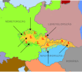
 BungsplatzBoehmen.JPG 463 × 289; 16 KB
-
 CzechRepublicTerritory1944.svg 1,522 × 870; 3.75 MB
-
 Deutschesreich1939 (cropped to Czechoslovakia).png 632 × 357; 92 KB
-
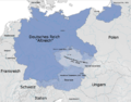 Deutschesreich1939.png 1,032 × 810; 262 KB
-
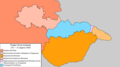 Division of Czechoslovakia, round 2 (RU).png 1,920 × 1,080; 113 KB
-
 Germany1941.png 698 × 600; 240 KB
-
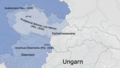
 Partition of Czechoslovakia (1938) hu.svg 587 × 511; 54 KB
-
 Partition of Czechoslovakia (1938).png 440 × 383; 27 KB
-
 Podział Czechosłowacji (1938).png 439 × 382; 30 KB
-
 ProtectoradoBohemiaMoravia.PNG 698 × 415; 107 KB
-
 Protectorate of Bohemia and Moravia (1939).svg 450 × 456; 472 KB
-
 Protectorate of Bohemia and Moravia (1942).svg 450 × 456; 500 KB
-
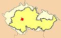
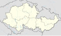 Protectorate of Bohemia and Moravia adm location map.svg 653 × 383; 175 KB
-
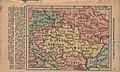 Protectorate of Bohemia and Moravia map.jpg 1,462 × 883; 633 KB
-
 Protectorate Of Bohemia and Moravia.png 3,000 × 1,896; 1.21 MB
-
 Protektorat Bohmen-Mahren Vector Outline.svg 750 × 421; 194 KB
-
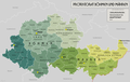
 Protektorat Bohmen-Mahren-2010-29-12.png 1,588 × 1,066; 1.11 MB
-
 Protektorat Bohmen-Mahren.png 3,000 × 1,896; 1.21 MB
-
 RAB v roku 1939.svg 1,276 × 709; 197 KB
-
 Reichsgaue.png 700 × 600; 323 KB
-
 Skica německého vpádu do českých zemí.gif 600 × 412; 237 KB
-
 Wehrkreise Boh.Mah.jpg 1,605 × 945; 258 KB


.png)

.png)

_hu.svg)
.png)
.png)

.svg)
.svg)


