Category:Maps of the Royal Borough of Windsor and Maidenhead
English: Maps of the Windsor and Maidenhead district, in the ceremonial county of Berkshire, England.
Subcategories
This category has only the following subcategory.
Media in category "Maps of the Royal Borough of Windsor and Maidenhead"
The following 8 files are in this category, out of 8 total.
-
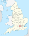
 EnglandWindsorAndMaidenhead.png 200 × 247; 29 KB
-
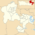
 Maidenhead unparished area UK locator map.svg 1,259 × 1,266; 308 KB
-
 Windsor and Maidenhead in England (special marker).svg 816 × 991; 1.32 MB
-
 Windsor and Maidenhead in England (zoom).svg 816 × 991; 1.31 MB
-
 Windsor and Maidenhead in England.svg 816 × 991; 1.32 MB
-
 Windsor and Maidenhead UK locator map.svg 1,425 × 741; 735 KB
-
 Windsor and Maidenhead UK ward map 2010 (blank).svg 1,259 × 1,266; 304 KB
-
 Windsor unparished area UK locator map.svg 1,259 × 1,266; 308 KB


.svg)
.svg)


.svg)