Category:Maps of the Samanid Empire
Media in category "Maps of the Samanid Empire"
The following 19 files are in this category, out of 19 total.
-
 Arab world 946 (old Russian).jpg 543 × 268; 68 KB
-
 Asia 900ad.jpg 2,222 × 1,518; 855 KB
-
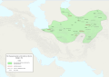
 Carte Iran 933-fa.svg 973 × 646; 379 KB
-
 DinastíaSamaní819-999.svg 1,040 × 527; 809 KB
-
 Diyaleme.svg 973 × 646; 411 KB
-
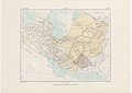 Historical Atlas of Iran - Plate No. 11.jpg 4,963 × 3,509; 2.23 MB
-
 Map of the Samanid amirate at the death of Abd al-Malik I, 961-es.svg 1,603 × 1,127; 6.13 MB
-
 Map of the Samanid amirate at the death of Abd al-Malik I, 961.svg 1,603 × 1,127; 6.89 MB
-
 Map of the Samanid amirate at the death of Nasr II, 943-es.svg 1,603 × 1,127; 6.15 MB
-
 Map of the Samanid amirate at the death of Nasr II, 943.svg 1,603 × 1,127; 6.95 MB
-
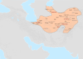
 Persia circa 1000AD-pt.svg 912 × 606; 198 KB
-
 Saman1.jpg 900 × 702; 234 KB
-
 Samanian - mhk.png 879 × 605; 90 KB
-
 Samanid and Alavid - 316.svg 1,114 × 538; 636 KB
-
 Samanid dynasty (819–999)-ar.png 729 × 568; 125 KB
-
 Samanid dynasty (819–999).GIF 861 × 671; 20 KB
-
 Samanid dynasty.gif 861 × 671; 19 KB
-
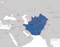
 Samanid Empire (greatest extent).svg 553 × 553; 277 KB
-
 Samanid khorasan 900 ad.jpg 1,309 × 981; 593 KB
.jpg)


-ar.png)
.GIF)

.svg)
