Category:Maps of the Sava watercourse system
Deutsch: Karten des Gewässersystems der Save.
English: Maps of the Sava watercourse system.
Slovenščina: Zemljevidi porečja Save.
Subcategories
This category has only the following subcategory.
D
Media in category "Maps of the Sava watercourse system"
The following 12 files are in this category, out of 12 total.
-
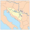
 Savarivermap ru.png 300 × 300; 48 KB
-
 Savarivermap tr.png 300 × 300; 59 KB
-
 Aliniamentul Sava-Dunăre.png 1,299 × 1,026; 2.6 MB
-
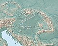 Carpathian Basin-Pannonian Basin.jpg 965 × 774; 282 KB
-
 Dinaric Alps map-fr.svg 1,857 × 1,503; 3.63 MB
-
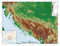 Dinarisches Gebirge Topo.png 2,900 × 2,250; 7.61 MB
-
 Drina jõgi.png 300 × 300; 58 KB
-

-
 Savarivermap hr.png 287 × 287; 49 KB
-
 Savarivermap.png 287 × 287; 37 KB
-
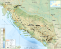
 Sava River Basin.png 3,307 × 2,338; 4.81 MB
-
 Savarivermap hu.png 765 × 765; 295 KB


.jpg)


