Category:Maps of the Upper Silesia plebiscite
Media in category "Maps of the Upper Silesia plebiscite"
The following 12 files are in this category, out of 12 total.
-
 Abstimmungsgebiet Oberschlesien.jpg 6,246 × 9,846; 75.61 MB
-
 Granice 1921 slask 1 hu.svg 1,852 × 3,080; 1.13 MB
-
 Granice 1921 slask 1.png 1,852 × 3,080; 1.84 MB
-
 Granice 1921 slask 2.png 1,887 × 2,901; 1.19 MB
-
 IIIPowstanieŚląskie.PNG 628 × 820; 33 KB
-
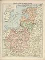 London-geographical-institute the-peoples-atlas 1920 poland-and-the-new-baltic-states.jpg 3,012 × 3,992; 2.02 MB
-
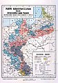 Mapa narodowosciowa 1910.jpg 3,409 × 4,833; 8.66 MB
-

-
 Oberschlesien 1921 Voten.png 411 × 323; 13 KB
-
 Plebiscyt na Górnym Śląsku-mapa.gif 815 × 807; 31 KB
-
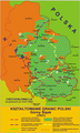
 Poland & The New Baltic States.jpg 1,376 × 1,784; 1.22 MB
-
 Polska-ww1-nation.png 791 × 1,000; 560 KB


.png)


