Category:Maps of the War of the Pacific-Boundaries
Media in category "Maps of the War of the Pacific-Boundaries"
The following 33 files are in this category, out of 33 total.
-
 Border Peru-Chile acc. 1929 Treaty.jpg 981 × 743; 209 KB
-
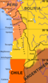
 Borders Chile 1879 and 2006.png 363 × 526; 12 KB
-

-
 Cuestión de Tacna y Arica.png 4,213 × 4,090; 922 KB
-
 Cuestión de Tacna y Arica.svg 3,954 × 3,837; 1.03 MB
-
 Departamento de Arica, Chile.svg 3,093 × 2,937; 787 KB
-
 Guerra-del-pacifico-01-a.svg 349 × 612; 69 KB
-
 Map of the War of the Pacific.cs.svg 804 × 1,026; 228 KB
-
 Map of the War of the Pacific.en.svg 761 × 886; 180 KB
-
 Map of the War of the Pacific.en2.svg 546 × 887; 164 KB
-
 Map of the War of the Pacific.es.svg 761 × 886; 424 KB
-
 Map of the War of the Pacific.es2.svg 546 × 887; 164 KB
-
 Map of the War of the Pacific.he2.svg 546 × 887; 163 KB
-
 MBT.en.svg 545 × 885; 76 KB
-
 MBT.es.svg 547 × 886; 110 KB
-
 Pacifico1879-mk.svg 595 × 842; 53 KB
-
 Pacifico1879.svg 570 × 824; 51 KB
-
 Provincia de Tacna, Chile (1884-1925).svg 2,268 × 2,764; 285 KB
-
 Provincia de Tacna, Chile (1925-1929).svg 2,268 × 2,764; 252 KB
-
 South America 1879.png 465 × 768; 130 KB
-
 Tacna province (1884-1925) Chile location map.svg 2,268 × 2,764; 146 KB
-
 Tacna province (1925-1929) Chile location map.svg 2,268 × 2,764; 80 KB
-
 Tacna-Arica Dispute (1883-1929).svg 3,954 × 3,837; 1 MB
-
The War of the Pacific Every Week.ogv 41 s, 320 × 240; 1.73 MB
-
 Tratado de Ancón.svg 4,591 × 6,024; 547 KB
-
 Treaty of Ancón.svg 4,606 × 6,024; 513 KB
-
 War of the pacific loc map-fr.jpg 1,648 × 2,517; 624 KB
-
 War of the Pacific LOC map-fr.png 1,648 × 2,517; 274 KB
-
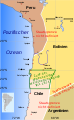
 War of the Pacific LOC map.png 472 × 722; 22 KB
-
 War of the Pacific LOC map.svg 445 × 584; 166 KB
-
 War of the Pacific LOCK map.png 472 × 722; 20 KB
-
 Wotp.de.png 259 × 447; 78 KB
-
 Wotp.de.svg 547 × 886; 108 KB


.svg)
.svg)

_Chile_location_map.svg)
_Chile_location_map.svg)
.svg)


