Category:Maps of the West Midlands (county)
Subcategories
This category has the following 6 subcategories, out of 6 total.
!
E
M
R
Media in category "Maps of the West Midlands (county)"
The following 47 files are in this category, out of 47 total.
-
 African West Midlands 2011 census.png 25,894 × 17,058; 18.67 MB
-
 Arab West Midlands 2011 census.png 25,895 × 17,058; 17.77 MB
-
 Asian West Midlands 2011 census.png 26,067 × 17,171; 28.42 MB
-
 Bangladeshi West Midlands 2011 census.png 25,895 × 17,058; 27.95 MB
-
 Birmingham UK ward map 2010 (blank).svg 1,045 × 1,266; 448 KB
-
 Birmingham-Worcester rail routes.png 839 × 1,599; 76 KB
-
 Black West Midlands 2011 census.png 25,895 × 17,058; 26.04 MB
-
 BlackPatchMap.jpg 1,005 × 880; 172 KB
-
 Bordesley&Highgate.png 798 × 968; 106 KB
-
 British West Midlands 2011 census.png 25,895 × 17,058; 25.08 MB
-
 Buddhism West Midlands 2011 census.png 25,981 × 17,114; 29 MB
-
 Caribbean West Midlands 2011 census.png 25,895 × 17,058; 28.23 MB
-
 Chinese West Midlands 2011 census.png 25,895 × 17,058; 28.44 MB
-
 Christianity West Midlands 2011 census.png 25,894 × 17,058; 27.63 MB
-
 Coventry UK ward map 2010 (blank).svg 1,340 × 1,266; 259 KB
-
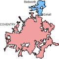 CoventryBedworthUrbanArea.svg 459 × 458; 36 KB
-
 Day 148 -.jpeg 592 × 541; 49 KB
-
 England Police Forces (West Midlands).svg 1,108 × 1,345; 312 KB
-
 EnglandPoliceWestMidlands.png 2,165 × 2,670; 87 KB
-
 EnglishNorthMidlandsCountiesMap.png 623 × 567; 27 KB
-
 Hinduism West Midlands 2011 census.png 25,895 × 17,058; 28.61 MB
-
 Indian West Midlands 2011 census.png 25,895 × 17,058; 28.46 MB
-

-
 Ministry of Defence Series 1404 sheet 171-C Birmingham, published 1967.jpg 6,936 × 5,430; 10.81 MB
-
 Ordnance Survey 1-250000 - SJ.jpg 4,000 × 4,000; 9.38 MB
-
 Ordnance Survey 1-250000 - SK.jpg 4,000 × 4,000; 9.31 MB
-
 Ordnance Survey 1-250000 - SO.jpg 4,000 × 4,000; 9.7 MB
-
 Ordnance Survey 1-250000 - SP.jpg 4,000 × 4,000; 9.22 MB
-
 Staffs & Worcs Canal Map.png 918 × 2,474; 2.59 MB
-
 West Midlands 2011 Census Kurdish ethnicity.svg 1,425 × 974; 723 KB
-
 West Midlands County.png 3,358 × 2,443; 868 KB
-
 West Midlands Green Belt.svg 1,920 × 1,574; 4.32 MB
-
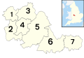 West Midlands numbered districts.svg 1,425 × 974; 573 KB
-
 West Midlands Order 1965.png 801 × 567; 147 KB
-
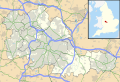
 West Midlands outline map with UK.png 600 × 419; 253 KB
-
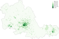
 West Midlands population density map, 2011 census.png 4,933 × 3,173; 14.18 MB
-
 West Midlands UK constituency map (blank).svg 1,425 × 974; 902 KB
-
 West Midlands UK district map (blank).svg 1,425 × 974; 720 KB
-
 West Midlands UK location map.svg 1,425 × 974; 1.35 MB
-
 West Midlands UK locator map 2010.svg 1,108 × 1,345; 302 KB
-
 West Midlands UK parish map (blank).svg 1,425 × 974; 802 KB
-
 West Midlands UK relief location map.jpg 1,999 × 1,366; 286 KB
-
 West Midlands UK ward map (blank).svg 1,425 × 974; 1.36 MB
-
 West penn 2.JPG 464 × 365; 29 KB
-
 WestMidlandsNumbered.png 200 × 134; 11 KB
-
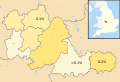
 WMid.svg 1,129 × 1,385; 107 KB
-
 Worcester & Birmingham, & Droitwich Canal map.png 1,156 × 1,558; 2.13 MB


.svg)


_Boundaries_with_Bromsgrove_(Hereford_%26_Worcester)%22.png)


.svg)
.svg)
.svg)
.svg)
.svg)
.svg)