Category:Maps of the White Croatia
Media in category "Maps of the White Croatia"
The following 24 files are in this category, out of 24 total.
-
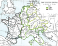 Western empire verdun 843.png 1,013 × 800; 284 KB
-
 1742 р. Гійом Деліль ФРАГМЕНТ.png 1,423 × 605; 1.76 MB
-
 1856 р. Луї-Етьєн Дюсьє Фрагмент.png 1,110 × 608; 1.14 MB
-
 1861 р.. Ходзько Борейко Леонард Стан на 862 р.jpg 1,600 × 1,198; 553 KB
-

-
 Die Völker und Reiche der Slaven zwichen Elbe und Don bis 1125 - Chrobacia.jpg 1,296 × 1,320; 703 KB
-
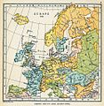
 Europe 1000.jpg 1,932 × 1,544; 689 KB
-
 Europe 912.jpg 998 × 1,024; 414 KB
-
 Heiliges Römisches Reich 1000.PNG 6,170 × 4,941; 50.04 MB
-
 Migration of the Croats.png 600 × 600; 49 KB
-
 Origins 700.png 670 × 458; 620 KB
-
 Plemiona wschodniosłowiańskie.png 2,310 × 2,284; 867 KB
-
 Poland under Boleslaw Chrobry.jpg 604 × 384; 83 KB
-
 Polska Rosja Skandynawia w IX w.jpg 1,408 × 1,180; 522 KB
-
 Rus-10c-ethn.png 2,241 × 2,731; 257 KB
-
 Slavic people X century.jpg 1,213 × 1,683; 263 KB
-
 Slavic peoples 9c map.jpg 776 × 583; 144 KB
-
 Territorial and ethnic border of White Croats.jpg 383 × 263; 41 KB
-
 West slavs 9th-10th c.2-es.svg 1,454 × 1,092; 897 KB
-
 White serbia white croatia01.png 870 × 966; 49 KB
-
 White serbia white croatia02.png 870 × 966; 48 KB
-
 Západní Slované 9.-10. st.png 876 × 723; 489 KB
-
 Белые сербия и хорватия 560 год ру.png 870 × 966; 59 KB
-
 Славянские-племена-Силезии-и-их-соседи.png 700 × 864; 369 KB


_(cropped).jpg)


