Category:Maps of the history of Amsterdam
Media in category "Maps of the history of Amsterdam"
The following 10 files are in this category, out of 10 total.
-
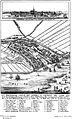 Amsterdam in the year 1300 full.jpg 1,086 × 1,797; 498 KB
-
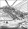 Amsterdam in the year 1300 crop.jpg 1,058 × 1,124; 355 KB
-

-

-

-
-
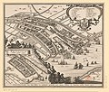
 15 of 'Het Tegenwoordig Amsterdam. Met 8 platen' (11219785666).jpg 1,159 × 1,696; 502 KB
-
 Historische Plattegrond van Amsterdam - Amsterdam - 20010804 - RCE.jpg 1,200 × 881; 281 KB
-

-


,_RP-P-AO-20-4.jpg)

,_RP-P-AO-20-5.jpg)
_Vier_historische_kaarten_van_Amsterdam_(Schut_Vissche,_RP-P-AO-20-6.jpg)
.jpg)

_(14578509819).jpg)
_(14742146866).jpg)