Category:Maps of the history of Castile-La Mancha
Autonomous communities of Spain: Andalusia · Aragon · Asturias · Balearic Islands · Cantabria · Castile-La Mancha · Catalonia · Galicia · Community of Madrid · Region of Murcia · Navarre · Valencian Community · Autonomous cities: Ceuta · Melilla
Use the appropriate category for maps showing all or a large part of Castile-La Mancha. See subcategories for smaller areas:
| If the map shows | Category to use |
|---|---|
| Castile-La Mancha on a recently created map | Category:Maps of Castile-La Mancha or its subcategories |
| Castile-La Mancha on a map created more than 70 years ago | Category:Old maps of Castile-La Mancha or its subcategories |
| the history of Castile-La Mancha on a recently created map | Category:Maps of the history of Castile-La Mancha or its subcategories |
| the history of Castile-La Mancha on a map created more than 70 years ago | Category:Old maps of the history of Castile-La Mancha or its subcategories |
Media in category "Maps of the history of Castile-La Mancha"
The following 10 files are in this category, out of 10 total.
-
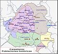 Carpetania Ciudades.jpg 725 × 675; 179 KB
-
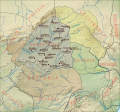
 Carpetania Territorios.jpg 725 × 675; 163 KB
-
 Carpetania Vias Romanas.jpg 725 × 675; 182 KB
-
 Carpetania-Ciudades y Vias Romanas.jpg 725 × 675; 112 KB
-
 Carpetania-Ciudades.svg 724 × 675; 1.32 MB
-
 Carpetania-Territorios.svg 724 × 675; 1.32 MB
-
 Carpetania-Vias Romanas.svg 724 × 675; 1.32 MB
-
 Mapa de las Tierra del Priorato de la Orden de San Juan Bautista de Jerusalem.jpg 1,640 × 1,059; 487 KB
-
 Prerromanos.jpg 804 × 748; 75 KB
-
 Pueblos prerromanos en Castilla-La Mancha y Madrid.svg 721 × 672; 421 KB


