Category:Maps of the history of Corsica
Media in category "Maps of the history of Corsica"
The following 11 files are in this category, out of 11 total.
-
 France 1552 to 1798-en.png 800 × 600; 40 KB
-
 CarthageMap.png 770 × 447; 106 KB
-
 CarthageMapDe.png 770 × 447; 106 KB
-
 CarthageMapFr.png 770 × 447; 114 KB
-
 CarthageMapZh.png 770 × 447; 105 KB
-
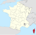 Corse in France (1789).svg 2,000 × 1,922; 1.05 MB
-
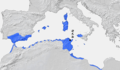
 Corsica SPQR.png 1,600 × 1,096; 42 KB
-
 Diocèse Nebbio 1789.svg 2,000 × 1,922; 801 KB
-
 Pievi corsica 1730.png 424 × 600; 59 KB
-
 Province de Gênes 1789.svg 2,000 × 1,922; 787 KB
-
 Province de Pise 1789.svg 2,000 × 1,922; 787 KB


.svg)


