Category:Maps of the history of Costa Rica
Subcategories
This category has the following 3 subcategories, out of 3 total.
M
O
Media in category "Maps of the history of Costa Rica"
The following 23 files are in this category, out of 23 total.
-
 Ciudades del Reino de Nicoya. Costa Rica.jpg 421 × 464; 61 KB
-
 Costa Rica - Conquistadors routes.svg 722 × 664; 307 KB
-
 Costa Rica - Rutas de conquistadores.svg 722 × 664; 331 KB
-
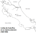 Costa Rica 1824-1836.png 575 × 534; 64 KB
-
 Costa Rica Archaeological Areas Central and Atlantic.png 2,000 × 1,925; 62 KB
-
 Costa Rica Archaeological Areas Diquis.png 2,000 × 1,925; 50 KB
-
 Costa Rica Archaeological Areas Nicoya.png 2,000 × 1,925; 55 KB
-
 Costa Rica Archaeological Areas.png 2,000 × 1,925; 63 KB
-
 Costa Rica Partido de Nicoya.png 2,000 × 1,925; 45 KB
-
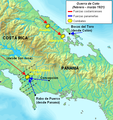 Coto.PNG 536 × 567; 471 KB
-
 Gran Nicoya.jpg 451 × 595; 25 KB
-
 Heredia capital.png 954 × 752; 101 KB
-
 History of the discovery and conquest of Costa Rica (1913) (14576755668).jpg 2,992 × 2,032; 619 KB
-
 Mapa de Costa Rica, ruta de los conquistadores.JPG 1,000 × 920; 91 KB
-
 MapaSociedadesAutóctonasCostaRica cropped.jpg 238 × 299; 22 KB
-
 MapaSociedadesAutóctonasCostaRica.JPG 1,000 × 920; 102 KB
-
 Nueva Cartago y Costa Rica (1540).PNG 393 × 456; 14 KB
-
 Nueva Cartago y Costa Rica.jpg 424 × 450; 38 KB
-
 Reino de Nicoya. Costa Rica.jpg 421 × 464; 47 KB
-
 Territories of the Governorate of Veragua.jpg 720 × 960; 137 KB
-
 Territorio guatuso.png 410 × 636; 105 KB
-
 Territorio Quepoa. Costa Rica.JPG 618 × 600; 27 KB
-
 Territorio tradicional guatuso.png 530 × 631; 159 KB


_(14576755668).jpg)


.PNG)


