Category:Maps of the history of Croatia (1526–1918)
Subcategories
This category has the following 10 subcategories, out of 10 total.
A
H
M
- Maps of the Austrian Littoral (37 F)
- Maps of the Illyrian Provinces (35 F)
- Maps of the Kingdom of Dalmatia (17 F)
O
R
- Maps of the Republic of Ragusa (26 F)
Media in category "Maps of the history of Croatia (1526–1918)"
The following 74 files are in this category, out of 74 total.
-
 Hrvatska (Croatia) 1593..jpg 2,048 × 1,536; 1,000 KB
-
 1815년 발칸 반도.png 1,000 × 1,000; 136 KB
-

-
 AtlBalk1700.jpg 318 × 327; 173 KB
-
 AtlBalk1730.jpg 318 × 327; 175 KB
-
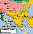 AtlBalk1750.jpg 318 × 327; 179 KB
-
 AtlBalk1850.jpg 318 × 327; 158 KB
-
 Balkans 1815.png 1,000 × 1,000; 92 KB
-
 Balkans map 1810.jpg 318 × 327; 153 KB
-
 Bosna srebrena 1679.jpg 1,339 × 1,474; 177 KB
-
 Bosna srebrena 1729.jpg 1,339 × 1,390; 171 KB
-
 Central europe 1572 hu.svg 922 × 880; 117 KB
-
 Central europe 1572.png 922 × 880; 120 KB
-
 Central Erope 1572 es.svg 1,122 × 883; 248 KB
-
 Central Erope 1572 HU.svg 1,122 × 883; 243 KB
-
 A' budai pasaság 1650-ben Hadzsi Chalfa szerint.png 1,246 × 1,520; 1.62 MB
-
 Budin Eyalet, Central europe 1683-ar.png 1,499 × 974; 796 KB
-
 Budin Eyalet, Central europe 1683.png 1,499 × 974; 789 KB
-
 Central europe 1683.png 1,280 × 971; 406 KB
-
 Vassal states of the Ottoman Empire in 1683 hu.svg 877 × 688; 397 KB
-
 Vassal states of the Ottoman Empire in 1683.svg 877 × 688; 278 KB
-
 Vassal states of the Ottoman Empire in 1683-es.svg 2,557 × 2,000; 1.11 MB
-
 Vassal states of the Ottoman Empire in 1683-pt.svg 2,557 × 2,000; 583 KB
-
 Kanije Eyalet, Central europe 1683.png 1,499 × 974; 848 KB
-
 Corso del Fiume Narenta dalla Citta di Ciclut... desc. dal -Vincenzo Maria- Coronelli 1694.png 5,360 × 4,049; 29.06 MB
-
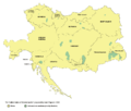
 Croatia slavonia counties 1908 01.png 1,380 × 861; 110 KB
-
 Croatia slavonia counties 1908 02.png 1,380 × 861; 112 KB
-
 Croatiae, et circumiacentium Regionum versus Turcam nova delineatio.jpg 2,832 × 2,249; 2.97 MB
-
 Croatian Military Frontier-1868.png 387 × 294; 20 KB
-
 Dalmatia1911.png 460 × 363; 438 KB
-
 Dalmazia1560.png 516 × 424; 586 KB
-

-
 Donaumonarchie Fiume.png 519 × 393; 12 KB
-
 Eastern Adriatic 1558-es.svg 1,920 × 1,753; 3.96 MB
-
 Eastern Adriatic 1558.svg 1,920 × 1,753; 6.84 MB
-
 Eastern Adriatic 1576-es.svg 1,920 × 1,753; 3.95 MB
-
 Eastern Adriatic 1576.svg 1,920 × 1,753; 6.83 MB
-
 Fiume Donaumonarchie.png 674 × 510; 7 KB
-
 Forte Opus - Coronelli Vincenzo - 1687.jpg 800 × 599; 177 KB
-
 Greater austria.png 1,500 × 1,280; 45 KB
-
 Vereinigte Staaten von Groß-Österreich.png 1,500 × 1,280; 192 KB
-
 대 오스트리아.png 1,500 × 1,280; 64 KB
-
 Greater austriaPL.png 1,500 × 1,280; 74 KB
-
 Hercegovački sandžak.png 2,250 × 1,341; 827 KB
-
 Josephinische Landaufnahme Karlstadter.jpg 1,234 × 1,953; 316 KB
-
 Josephinische Landaufnahme Kroatien.jpg 2,399 × 1,520; 354 KB
-
 Josephinische Landaufnahme Slavonien.jpg 1,898 × 1,486; 213 KB
-
 Josephinische Landaufnahme Slavonischen Distrikt.jpg 2,749 × 1,831; 370 KB
-
 Josephinische Landaufnahme Varasdi.jpg 1,625 × 1,139; 146 KB
-
 Kingdom of Croatia 1573.png 2,088 × 1,955; 200 KB
-
 Kingdom of Croatia 1591.png 2,088 × 1,955; 202 KB
-
 Kingdom of Croatia 1593.png 2,088 × 1,955; 202 KB
-
 Kingdom of Hungary counties (sk-Bjelovarsko-križevetská).svg 1,772 × 1,166; 314 KB
-
 Kingdom of Hungary counties (sk-Licko-krbavská).svg 1,772 × 1,166; 314 KB
-
 Kingdom of Hungary counties (sk-Modrušsko-skorjecká).svg 1,772 × 1,166; 314 KB
-
 Lageplan von Pola, Meyers Lexikon. tom. 13, 1896.jpg 5,029 × 3,829; 3.45 MB
-
 Lands of the Crown of Saint Stephen in 1914.png 2,000 × 2,027; 433 KB
-
 Map of the Kingdom of Croatia (1848).png 542 × 502; 39 KB
-
 Map of the Kingdom of Croatia (1868).png 542 × 502; 40 KB
-
 Map of the Kingdom of Croatia-Slavonia (1885).png 542 × 502; 31 KB
-
 Maps20 001.jpg 3,096 × 2,475; 3.35 MB
-
 Militargrenze, Wojwodowena und Banat.jpg 900 × 312; 115 KB
-
 Panství habsburské v XVI. století.jpg 952 × 823; 191 KB
-
 Pozega pakrac 1606 en.png 720 × 431; 47 KB
-
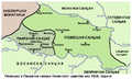 Pozega pakrac 1606 sr.png 720 × 431; 45 KB
-
 Situationsplan von Pola.jpg 351 × 360; 61 KB
-
 Skradinska biskupija.png 1,058 × 673; 210 KB
-
 Slavonia01.png 797 × 674; 80 KB
-
 Slavonia02.png 797 × 674; 81 KB
-
 Eslavonia02.png 797 × 674; 69 KB
-
 Triune Kingdom of Croatia (1868-1918)-de.svg 512 × 382; 189 KB
-
 Triune Kingdom of Croatia (1868-1918)-es.svg 2,162 × 1,614; 385 KB
-
 Triune Kingdom of Croatia (1868-1918)-hu.svg 2,162 × 1,614; 257 KB
-
 Triune Kingdom of Croatia (1868-1918).png 826 × 798; 113 KB
_1593..jpg)

.jpg)


.svg)
.svg)
.svg)


.png)
.png)
.png)


-de.svg)
-es.svg)
-hu.svg)
.png)