Category:Maps of the history of the Rhineland
Deutsch: Karten der Geschichte des Rheinlands
English: maps of the history of the Rhineland
Use the appropriate category for maps showing all or a large part of the Rhineland. See subcategories for smaller areas:
| If the map shows | Category to use |
|---|---|
| the Rhineland on a recently created map | Category:Maps of the Rhineland or its subcategories |
| the Rhineland on a map created more than 70 years ago | Category:Old maps of the Rhineland or its subcategories |
| the history of the Rhineland on a recently created map | Category:Maps of the history of the Rhineland or its subcategories |
| the history of the Rhineland on a map created more than 70 years ago | Category:Old maps of the history of the Rhineland or its subcategories |
Subcategories
This category has the following 6 subcategories, out of 6 total.
#
M
Media in category "Maps of the history of the Rhineland"
The following 32 files are in this category, out of 32 total.
-
 1794-1795 Franse invasie in de Nederlanden-es.svg 1,655 × 2,180; 2.91 MB
-
 1794-1795 Franse invasie in de Nederlanden.svg 1,655 × 2,180; 1.11 MB
-
 Crossing of the Rhine.jpg 1,261 × 956; 1.91 MB
-
 De Franken tussen 400 en 440 jp.svg 2,323 × 1,729; 660 KB
-
 De Franken tussen 400 en 440 nl.svg 2,323 × 1,729; 644 KB
-
 Franken Expans1.jpg 1,009 × 868; 250 KB
-
 Franken Expansion bis 6Jhdt.png 2,102 × 1,674; 856 KB
-
 Frankish Foederatus.png 570 × 471; 73 KB
-
 German counter in Alsace Lorraine.jpg 1,265 × 965; 2.1 MB
-
 History Information Board Oppenheimer Kellerlabyrinth.JPG 4,272 × 2,848; 4.7 MB
-
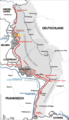 Karte westwall.png 800 × 1,391; 161 KB
-
 Karte Wikinger-Raubzüge im Rheinland.png 525 × 633; 323 KB
-
 Les Francs en Belgique romaine-de.svg 1,280 × 883; 553 KB
-
 Les Francs en Belgique romaine-es.svg 1,280 × 883; 382 KB
-
 Les Francs en Belgique romaine-pt.svg 1,280 × 883; 35 KB
-
 Les Francs en Belgique romaine-ru.svg 1,280 × 883; 62 KB
-
 Les Francs en Belgique romaine.svg 1,280 × 883; 353 KB
-
 Les Francs entre 400 et 440-es.svg 2,323 × 1,729; 355 KB
-
 Les Francs entre 400 et 440-pt.svg 2,323 × 1,729; 62 KB
-
 Les Francs entre 400 et 440.svg 2,323 × 1,729; 430 KB
-
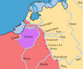
 Map of the Freistaat Flaschenhals (1919-1923).png 2,362 × 2,109; 1.23 MB
-
 Occupation of the Rhineland.png 1,505 × 2,362; 533 KB
-
 Proposed WW-1 Rhineland Occupation Map.png 1,991 × 2,370; 633 KB
-
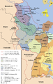
 Rheinland innerhalb der britischen Besatzungszone 1946.svg 639 × 779; 584 KB
-
 Rhineland c. 1700.png 1,040 × 944; 442 KB
-
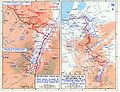
 Rhineland Campaign - 11-21 March 1945.jpg 1,261 × 956; 2.05 MB
-
 Roer Triangle Map.jpg 600 × 454; 156 KB
-
 Spruner and Menke - Deutschland's Gaue. II. Mittleres Lothringen (...).jpeg 3,346 × 2,792; 2.54 MB
-
 Veritable grenade.png 1,228 × 1,200; 689 KB
-
 WWIIEurope76combined.png 2,505 × 1,912; 2.06 MB
-
 WWIIEurope76combined.svg 1,127 × 860; 1.14 MB
-
 احتلال راينلاند.jpg 1,505 × 2,362; 836 KB


.png)


.jpeg)


