Category:Maps of the islands of the North Atlantic
This category is for maps which show the various countries of the area known as the wikipedia:Islands of the North Atlantic.
See also:
Subcategories
This category has the following 13 subcategories, out of 13 total.
Media in category "Maps of the islands of the North Atlantic"
The following 3 files are in this category, out of 3 total.
-
 1827 Finley Map of Rhode Island - Geographicus - RhodeIsland-finley-1827.jpg 2,314 × 3,000; 1.67 MB
-
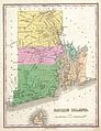
 Block Island Map of Rhode Island.png 238 × 310; 12 KB
-


