Category:Maps showing 1721
| ← 1721 |
English: Maps showing the year 1721 (i.e. history maps)
See also category: 1721 maps. and 1720s maps for old maps created in this time.
See also category: 1721 maps. and 1720s maps for old maps created in this time.
Media in category "Maps showing 1721"
The following 3 files are in this category, out of 3 total.
-
 Flag Map of The Austrian Empire (1721).png 2,128 × 3,170; 428 KB
-
 Russian history of the Baltic Sea, 1712-1721.jpg 1,571 × 1,894; 468 KB
-
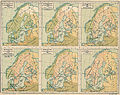 Skandinavien mellan 1397 och 1815.jpg 3,474 × 2,747; 3.45 MB
.png)

