Category:Maps showing the 1630s
| Maps showing the 17th century:
←1600s 1610s 1620s 1630s 1640s 1650s 1660s 1670s 1680s 1690s → |
Not to be confused with maps made in the 1630s.
Subcategories
This category has only the following subcategory.
Media in category "Maps showing the 1630s"
The following 2 files are in this category, out of 2 total.
-
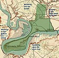 Map of William Farrar's Patent for Farrar's Island and Environs.jpg 903 × 889; 1,008 KB
-
 Wallachian revolt of Aslan and Aga Matei, 1630–1632.svg 1,019 × 687; 593 KB

