Category:Maps showing the 1880s
| Maps showing the 19th century:
←1800s 1810s 1820s 1830s 1840s 1850s 1860s 1870s 1880s 1890s → |
Not to be confused with maps made in the 1880s.
Subcategories
This category has the following 7 subcategories, out of 7 total.
- Maps showing 1883 (4 F)
Media in category "Maps showing the 1880s"
The following 2 files are in this category, out of 2 total.
-
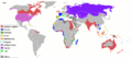 20121103152406!Colonisation 1885.png 1,425 × 625; 54 KB
-
 Global Temperatures 1880-2011 (6731502729).jpg 1,280 × 720; 196 KB

.jpg)