Category:Maps with cartouches (duplicate, not extracted)
English: this category is intended for maps from which the cartouche was not extracted because it would be a duplicate of another, already extracted cartouche coming from a different scan
Media in category "Maps with cartouches (duplicate, not extracted)"
The following 122 files are in this category, out of 122 total.
-
 1584 map of Greece and Western Turkey by Abraham Ortelius.jpg 12,525 × 9,061; 26.74 MB
-
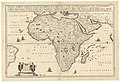
 1591 map of Africa by Filippo Pigafetta.jpg 10,355 × 14,642; 28.17 MB
-

-
 1680s maps of Asia by Frederick de Wit.tif 7,313 × 6,149; 128.68 MB
-
 1701 Guillaume Delisle map of the Ottoman and Persian Empires (cropped).jpg 8,875 × 6,466; 50.25 MB
-
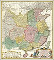 1740 map of China, published by Homann Heirs.jpg 12,726 × 14,291; 45.99 MB
-
 1769 edition of the 1720 map of the Principality of Catalonia by Josep Aparici i Fins.jpg 15,941 × 14,167; 44.73 MB
-
 1787 Carte très exacte de la Mer de Marmara avec toutes ses profondeurs.jpg 10,488 × 7,136; 9.46 MB
-
 1935 pictorial map of Germany.tif 6,018 × 4,468; 76.95 MB
-

-
-

-
 A pictorial map of Germany.tif 5,898 × 4,516; 76.23 MB
-
 Abraham Ortelius - Tvrcici imperii descriptio.jpg 3,085 × 2,279; 2.64 MB
-
 Abraham Ortelius Map of Asia 1595.jpg 645 × 497; 275 KB
-
 Abrahami Ortelii. Pontvs Euxinvs (17th century).jpg 6,200 × 4,864; 5.95 MB
-

-
 Asia recens summa cura delineata (8429935589).jpg 800 × 712; 144 KB
-
 Atlas Cosmographicae (Mercator) 035.jpg 2,809 × 2,299; 2.1 MB
-
 Atlas Ortelius KB PPN369376781-007av-007br.jpg 3,000 × 2,194; 4.42 MB
-
 Atlas Ortelius KB PPN369376781-075av-075br.jpg 3,000 × 2,194; 4.72 MB
-
 Blaeu 1645 - Prussia.jpg 3,000 × 2,300; 2.23 MB
-
 Blaeu 1645 - Transylvania Sibenburgen.jpg 3,619 × 3,029; 4.12 MB
-
 Bodleian Libraries, Germaniae typvs.jpg 1,000 × 675; 219 KB
-
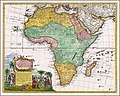 Ca. 1737 map of Africa, published by Homannsche Erben.jpg 14,526 × 11,679; 44.2 MB
-
 Ca. 1740 map of China, published by Homannsche Erben.jpg 12,863 × 14,455; 32.53 MB
-

-
 Carta de la isla de la Jamayca; dividida en diez y nueve parroquias ó quarteles. LOC 73691844.tif 7,644 × 6,682; 146.13 MB
-
 Carta de la isla de la Martinica LOC 74691153.tif 5,429 × 4,979; 77.34 MB
-
-
 Carta general de las islas Antillas Menores, llamadas de Barlovento, y tambien Caribes- LOC 74695785.tif 6,308 × 11,094; 200.22 MB
-
 Carta reducida de las islas de Canaria - T. Lopez - btv1b53177502v.jpg 10,740 × 5,248; 6.43 MB
-

-

-

-
 Carte du Canada ou de la Nouvelle France et des decouvertes qui y ont ete faites.jpg 1,888 × 1,631; 611 KB
-
 Carte géométrique du diocèse de Cambrai - par le Sr Villaret - btv1b530526428.jpg 14,706 × 12,964; 57.28 MB
-

-

-

-

-
 Claudii Ptolemaei Tabulae geographicae Orbis Terrarum veteribus cogniti (1704) 07.jpg 9,825 × 7,296; 6.41 MB
-
 Claudii Ptolemaei Tabulae geographicae Orbis Terrarum veteribus cogniti (1704) 08.jpg 9,824 × 7,362; 7.09 MB
-
 Claudii Ptolemaei Tabulae geographicae Orbis Terrarum veteribus cogniti (1704) 09.jpg 9,846 × 7,328; 6.17 MB
-
 Claudii Ptolemaei Tabulae geographicae Orbis Terrarum veteribus cogniti (1704) 12.jpg 9,848 × 7,228; 8.03 MB
-
 Claudii Ptolemaei Tabulae geographicae Orbis Terrarum veteribus cogniti (1704) 14.jpg 9,857 × 7,381; 6.07 MB
-
 Claudii Ptolemaei Tabulae geographicae Orbis Terrarum veteribus cogniti (1704) 16.jpg 9,868 × 7,283; 6.8 MB
-
 Claudii Ptolemaei Tabulae geographicae Orbis Terrarum veteribus cogniti (1704) 17.jpg 9,855 × 7,253; 6.67 MB
-
 Claudii Ptolemaei Tabulae geographicae Orbis Terrarum veteribus cogniti (1704) 18.jpg 9,860 × 7,359; 7.61 MB
-
 Claudii Ptolemaei Tabulae geographicae Orbis Terrarum veteribus cogniti (1704) 20.jpg 9,863 × 7,308; 5.73 MB
-
 Claudii Ptolemaei Tabulae geographicae Orbis Terrarum veteribus cogniti (1704) 21.jpg 9,837 × 7,318; 6.48 MB
-
 Claudii Ptolemaei Tabulae geographicae Orbis Terrarum veteribus cogniti (1704) 22.jpg 9,864 × 7,375; 7.37 MB
-
 Claudii Ptolemaei Tabulae geographicae Orbis Terrarum veteribus cogniti (1704) 28.jpg 9,897 × 7,334; 6.13 MB
-
 Claudii Ptolemaei Tabulae geographicae Orbis Terrarum veteribus cogniti (1704) 29.jpg 9,997 × 7,387; 6.87 MB
-
 Claudii Ptolemaei Tabulae geographicae Orbis Terrarum veteribus cogniti (1704) 31.jpg 9,894 × 7,389; 7.47 MB
-
 Claudii Ptolemaei Tabulae geographicae Orbis Terrarum veteribus cogniti (1704) 32.jpg 9,893 × 7,373; 6.5 MB
-

-
 Insula Ceilon olim Taprobana Incolis Tenarisin et Lankawn (Nicolaas Visscher).jpg 5,500 × 4,637; 4.4 MB
-

-
-
 Kurlandyja-Žamojć. Курляндыя-Жамойць (N. Sanson, 1659).jpg 4,348 × 3,195; 4.47 MB
-
-

-

-

-

-

-

-

-

-

-

-

-

-

-

-
 Map of Moscovy, Poland, Little Tartary, and ye Black Sea etc NYPL1630438.tiff 7,070 × 5,084; 102.84 MB
-

-

-
 Mapa de America sujeto à las observaciones astronomicas - por D. Tomàs Lopez... - btv1b8469136g.jpg 10,836 × 8,508; 12.64 MB
-
 MAPA DE AVILA EN 1769.JPG 2,497 × 2,496; 1.42 MB
-

-

-
 Mapa de la provincia de Avila (1769, Tomás López).jpg 3,291 × 3,217; 1.81 MB
-
 Mapa de la provincia de Estremadura (1766).jpg 6,078 × 3,304; 3.49 MB
-
 Mapa de la provincia de Estremadura, Tomás López (1766).jpg 2,292 × 1,212; 635 KB
-
 Mapa de la Provincia de Segovia en 1773.jpg 2,643 × 2,400; 1.07 MB
-
 Mapa de la provincia de Toledo (1768, Tomás López).jpg 3,447 × 3,353; 2.13 MB
-
 Mapa de La Rioja de Tomás López 1769.jpg 1,500 × 1,352; 437 KB
-
 Mapa de La Rioja de Tomás López, año 1769.jpg 3,440 × 3,376; 3.24 MB
-

-
 Mapa del Caribe de 1755.jpg 9,704 × 7,124; 11.09 MB
-
 Mapa del Reyno de Cordova - Por Thomas Lopez - btv1b53056300z.jpg 5,344 × 5,288; 4.24 MB
-
 Mapa del Reyno de Cordova - por Tomas Lopez - btv1b53226979s (1 of 2).jpg 7,420 × 5,692; 5.14 MB
-

-
 Mapa geográfico del Reyno de Galicia 1784.jpg 2,504 × 2,440; 1.61 MB
-
 Mapa Gran Canaria Siglo xviii.jpg 718 × 643; 593 KB
-

-

-

-
-
 Natoliæ sive Asia Minor.tif 7,866 × 5,736; 43.06 MB
-
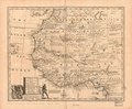
 New & Accurate Map of Negroland.jpg 4,000 × 3,117; 3.09 MB
-
 Ortelius Lithuania.jpg 2,220 × 1,682; 822 KB
-
-

-
 Poland and Lit.jpg 7,600 × 6,400; 79.72 MB
-

-
 Provincia de Guadalajara 1766.png 1,179 × 1,100; 1.83 MB
-
 Provincia del Vierzo.jpg 1,187 × 1,747; 1.94 MB
-
 PRVSSIA1576Casparo Henneberg.png 2,973 × 2,289; 4.5 MB
-

-
 Regnorum Hispaniae et Portugalliae Tabula generalis.jpg 7,251 × 6,257; 15.35 MB
-
 Russian Empire 1745 (Map III in Latin).jpg 7,704 × 6,754; 17.16 MB
-
 Russian Empire 1745 (Map III).jpg 2,208 × 1,912; 2.89 MB
-

-
-
 Tartaria D Europa ouro Piccola Tartaria.jpg 2,500 × 1,985; 2.89 MB
-
 Tavola Cosmografica I. Mappa Dell' Universo e de due ui celebri Sistemi Planetarj.jpg 12,020 × 8,232; 14.72 MB
-
 The story map of flying (35048880341).jpg 1,525 × 2,000; 2.96 MB
-
-
 Vialikaje Kniastva Litoŭskaje. Вялікае Княства Літоўскае (G. Mercator, 1630).jpg 11,738 × 9,694; 23.37 MB


.2.(22).jpg)
.jpg)


.jpg)
_-_btv1b53103258x_(1_of_2).jpg)
.jpg)
_035.jpg)


.jpg)


re_du_Roi_-_btv1b53179417t_(1_of_2).jpg)
.jpg)

_07.jpg)
_08.jpg)
_09.jpg)
_12.jpg)
_14.jpg)
_16.jpg)
_17.jpg)
_18.jpg)
_20.jpg)
_21.jpg)
_22.jpg)
_28.jpg)
_29.jpg)
_31.jpg)
_32.jpg)

.jpg)


.jpg)
.jpg)


.jpg)
_Bourgoin_-_btv1b8469166m.jpg)
_Bourgoin_-_btv1b8469603t.jpg)
.jpg)
r_Rollin_-_par_le_Sr._d%27Anville,_G%C3%A9ographe_du_Roi_;_grav%C3%A9e_par_P(ierre)_Bourgoin_-_btv1b8468737n.jpg)
r_Rollin_-_par_le_Sr._d%27Anville,_G%C3%A9ographe_du_Roi_;_grav%C3%A9e_par_P(ierre)_Bourgoin_-_btv1b8490644s.jpg)
_romaine_de_M._Rollin_-_par_le_Sr._d%27Anville,_G%C3%A9ographe_ord._du_Roi_;_grav%C3%A9_par_Bourgoin_L._-_btv1b84906404.jpg)


_du_Roi_Dec._1740_-_btv1b53177720j_(1_of_2).jpg)

.jpg)
.jpg)


.jpg)
.jpg)
.jpg)

.jpg)


.jpg)


.jpg)
.jpg)


.jpg)


_de_la_carte_des_anciennes_monarchies,_Carte_pour_servir_%C3%A0_la_lecture_de_l%27histoire_ancienne..._-_par_M._Rollin..._;_Dress%C3%A9e_par_le_Sr_Robert..._-_btv1b53093700p_(1_of_2).jpg)
_de_la_carte_des_anciennes_monarchies,_Carte_pour_servir_%C3%A0_la_lecture_de_l%27histoire_ancienne..._-_par_M._Rollin..._;_Dress%C3%A9e_par_le_Sr_Robert..._-_btv1b530937014_(1_of_2).jpg)


.jpg)
.jpg)


.jpg)

.jpg)