Category:March 2008 Ireland photographs
Countries of Europe: Albania · Andorra · Armenia‡ · Austria · Azerbaijan‡ · Belarus · Belgium · Bosnia and Herzegovina · Bulgaria · Croatia · Cyprus‡ · Czech Republic · Denmark · Estonia · Finland · France‡ · Georgia‡ · Germany · Greece · Hungary · Iceland · Republic of Ireland · Italy · Kazakhstan‡ · Latvia · Lithuania · Luxembourg · Malta · Monaco · Montenegro · Netherlands‡ · North Macedonia · Norway · Poland · Portugal‡ · Romania · Russia‡ · San Marino · Serbia · Slovakia · Slovenia · Spain‡ · Sweden · Switzerland · Turkey‡ · Ukraine · United Kingdom · Vatican City
Specific status: Isle of Man – Limited recognition: Kosovo
‡: partly located in Europe
Specific status: Isle of Man – Limited recognition: Kosovo
‡: partly located in Europe
English: Images taken in Ireland during this month of 2008 (not the date of the upload). With CatScan, this allows one to browse any Ireland-related category by year or month. Images should be placed directly in this category, not in subcategories. Note: Images from 2008 should be also added into the appropriate province, territory or city category of Category:2008 photographs of Ireland.
| Jan | Feb | Mar | Apr | May | Jun | Jul | Aug | Sep | Oct | Nov | Dec | ||
| ← | 61 | 129 | 107 | 117 | 406 | 98 | 328 | 929 | 120 | 127 | 55 | 92 | → |
|---|
Subcategories
This category has only the following subcategory.
Media in category "March 2008 Ireland photographs"
The following 106 files are in this category, out of 106 total.
-

-
 "Wild" goats at Lough Caragh - geograph.org.uk - 1166983.jpg 640 × 480; 92 KB
-
 'Rodden's', Buncrana - geograph.org.uk - 746546.jpg 434 × 640; 70 KB
-
 Shop at Shankill, County Dublin.jpg 1,536 × 2,048; 818 KB
-
 Temple Bar detail.jpg 1,536 × 2,048; 1.01 MB
-
-

-
 Foerst Road, Killeter Forest - geograph.org.uk - 722709.jpg 640 × 479; 73 KB
-
 One Horse Power - geograph.org.uk - 739902.jpg 640 × 480; 104 KB
-
 St. Stephens Green - geograph.org.uk - 739999.jpg 640 × 480; 110 KB
-
 Anspideal.JPG 2,048 × 1,536; 1.53 MB
-
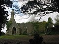
 Ballinakill Church - geograph.org.uk - 1476445.jpg 480 × 640; 145 KB
-
 Ballinakill Church - geograph.org.uk - 1477982.jpg 640 × 480; 125 KB
-
 Boat at Mizen Head exhibition centre - geograph.org.uk - 1167057.jpg 640 × 480; 78 KB
-
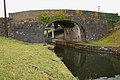
 Bridge and lock - geograph.org.uk - 739149.jpg 640 × 426; 83 KB
-
 Bridge over Gearhameen River - geograph.org.uk - 1121084.jpg 640 × 480; 112 KB
-

-
 Broadboyne Bridge, Co. Meath - geograph.org.uk - 721560.jpg 640 × 480; 147 KB
-
 Buncrana - geograph - 746502.jpg 640 × 329; 80 KB
-
 Buncrana Fire Station - geograph.org.uk - 746525.jpg 640 × 480; 73 KB
-
-
 Cairn Hill5.JPG 640 × 480; 111 KB
-
 Canal bridge - geograph.org.uk - 730213.jpg 640 × 426; 90 KB
-
 Canal bridge - geograph.org.uk - 739179.jpg 640 × 426; 77 KB
-
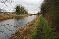 Canal towpath - geograph.org.uk - 730205.jpg 640 × 426; 96 KB
-
 Car Park - geograph.org.uk - 727116.jpg 640 × 427; 77 KB
-

-
 Church at Ballymackney, Co. Monaghan - geograph.org.uk - 718215.jpg 640 × 480; 118 KB
-
 Church at Crosschapel, Blessington - geograph.org.uk - 746329.jpg 640 × 480; 73 KB
-
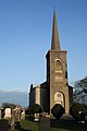 Church with steeple - geograph.org.uk - 730272.jpg 426 × 640; 40 KB
-
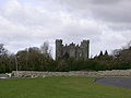 Clonyn-Castle-Delvin.jpg 2,816 × 2,112; 548 KB
-
 Coastline at Mizen Head - geograph.org.uk - 1167071.jpg 480 × 640; 84 KB
-
 Coolieragh Harbour at Bantry Bay - geograph.org.uk - 1167124.jpg 640 × 480; 88 KB
-

-
 Corcomroe Abbey.JPG 2,288 × 1,712; 1.31 MB
-
 Coulagh Bay near Bofickil - geograph.org.uk - 1167105.jpg 640 × 480; 79 KB
-
 Cronalaghy Townland - geograph.org.uk - 723516.jpg 640 × 479; 49 KB
-
 Dublin Airport Entrance.jpg 2,816 × 2,112; 1.82 MB
-
 Entrance gate - geograph.org.uk - 730290.jpg 640 × 426; 89 KB
-
 Erithacus-rubecula-melophilus Dublin-Ireland.jpg 620 × 1,000; 508 KB
-
 Eyeries quay - geograph.org.uk - 1167110.jpg 480 × 640; 77 KB
-
 Galway Harbour.jpg 1,049 × 600; 77 KB
-
 Galway's River near Galway's Bridge - geograph.org.uk - 1120068.jpg 480 × 640; 120 KB
-
 Gnarled beech - geograph.org.uk - 730298.jpg 426 × 640; 87 KB
-
 Holiday cottages - geograph.org.uk - 773037.jpg 640 × 360; 59 KB
-
 Idyllic scenery at Lough Caragh - geograph.org.uk - 1166997.jpg 640 × 480; 90 KB
-
 Inishowen Gateway Hotel, Buncrana - geograph.org.uk - 746523.jpg 640 × 480; 61 KB
-
 Kilbeggan Canal.JPG 2,288 × 1,712; 2.27 MB
-
 KKY-EIKLtower2008-03-04.jpg 640 × 426; 68 KB
-
 Larus argentatus -Bray Head, County Wicklow, Ireland-8.jpg 3,872 × 2,592; 1.12 MB
-

-
 M9CarlowBypass.JPG 3,888 × 2,592; 1.57 MB
-
 Maginn Avenue, Buncrana - geograph.org.uk - 746535.jpg 597 × 640; 95 KB
-
 Mainistir Bhuithe cross Muiredach.jpg 1,536 × 2,048; 1.36 MB
-
 Mainistir Bhuithe cruz de Muiredach (vista virada para leste).jpg 1,536 × 2,048; 850 KB
-
 Malin Pier - geograph.org.uk - 799132.jpg 640 × 480; 75 KB
-
 Millbrae, Buncrana - geograph.org.uk - 746531.jpg 640 × 502; 81 KB
-
 Mouth of the Mill River, Buncrana - geograph.org.uk - 746530.jpg 480 × 640; 121 KB
-
 Mulroy Bay - geograph.org.uk - 773101.jpg 640 × 360; 57 KB
-
 Near Buncrana - geograph.org.uk - 746493.jpg 640 × 394; 79 KB
-
 Near Luddan - geograph.org.uk - 746518.jpg 640 × 480; 78 KB
-
 Near the shore at Malin - geograph.org.uk - 813078.jpg 640 × 480; 98 KB
-
 New road - geograph.org.uk - 739189.jpg 640 × 426; 63 KB
-
 North West Golf Club (1) - geograph.org.uk - 746498.jpg 640 × 513; 121 KB
-
 North West Golf Club (3) - geograph.org.uk - 746519.jpg 480 × 640; 80 KB
-

-

-
 Owenreagh River near Knockbrack - geograph.org.uk - 1121051.jpg 640 × 480; 121 KB
-
 Owenreagh River near Knockbrack - geograph.org.uk - 1121059.jpg 640 × 480; 118 KB
-
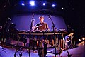 Pascal Schumacher Dublin.jpg 640 × 428; 170 KB
-
 Petrol pump, Buncrana - geograph.org.uk - 746549.jpg 484 × 640; 68 KB
-
 Propeller by the Foyle - geograph.org.uk - 746428.jpg 640 × 480; 154 KB
-
 Pubs, Buncrana - geograph.org.uk - 746539.jpg 514 × 640; 81 KB
-

-
 Queen of the sea memorial.jpg 3,452 × 2,432; 5.44 MB
-
 RNLI Buoy, Buncrana - geograph.org.uk - 746544.jpg 466 × 640; 89 KB
-
 Road at Cronalaghy - geograph.org.uk - 723515.jpg 640 × 479; 82 KB
-
 Rosslare Harbour 2008.JPG 800 × 600; 316 KB
-
 Rough Island - geograph.org.uk - 773108.jpg 640 × 480; 102 KB
-
 Ruin near Eyeries - geograph.org.uk - 1167098.jpg 640 × 480; 50 KB
-
 Ruins of Lowther Lodge - geograph.org.uk - 735958.jpg 640 × 480; 86 KB
-
 Slieve Bloom Way - geograph.org.uk - 727572.jpg 640 × 427; 103 KB
-
 Small Cave - geograph.org.uk - 744967.jpg 640 × 480; 129 KB
-
 Snow on Carlingford Town - geograph.org.uk - 987265.jpg 640 × 379; 75 KB
-
 Spink.JPG 3,888 × 2,592; 1.3 MB
-
 Spire of Dublin in the morning.jpg 1,536 × 2,048; 858 KB
-
 Street in Drogheda.jpg 1,536 × 2,048; 686 KB
-
 Sunset at Mizen Head - geograph.org.uk - 1167065.jpg 640 × 480; 67 KB
-
 SwanBrick.JPG 3,882 × 2,430; 1.18 MB
-
 The Cut - geograph.org.uk - 727143.jpg 640 × 427; 87 KB
-
 The River Dodder In Flood.jpg 1,024 × 683; 316 KB
-
 The shore at Carlingford - geograph.org.uk - 732447.jpg 640 × 369; 68 KB
-

-
 The White Strand (2) - geograph.org.uk - 746487.jpg 640 × 480; 59 KB
-
 TheSwanPub.JPG 3,372 × 2,213; 1.27 MB
-
 Tied up Game - geograph.org.uk - 744929.jpg 640 × 480; 137 KB
-
 TRINITY COLLEGE - DUBLIN.jpg 683 × 1,024; 978 KB
-

-

-
 Upper Main Street, Buncrana - geograph.org.uk - 746538.jpg 640 × 480; 83 KB
-
 View across lough - geograph.org.uk - 773047.jpg 640 × 480; 86 KB
-
-

-
 Western shore of Glanmore Lake - geograph.org.uk - 1121194.jpg 640 × 480; 95 KB
-
 Windswept tree in Ireland.jpg 3,888 × 2,592; 4.61 MB
-
 Youghal.jpg 2,048 × 1,536; 1.47 MB
_at_Coornagillagh_-_geograph.org.uk_-_1167153.jpg)


_-_geograph.org.uk_-_715735.jpg)
_-_geograph.org.uk_-_715737.jpg)


.jpg)


_-_geograph.org.uk_-_746498.jpg)
_-_geograph.org.uk_-_746519.jpg)


_-_geograph.org.uk_-_746487.jpg)


_(1)_-_geograph.org.uk_-_746552.jpg)
_(2)_-_geograph.org.uk_-_746553.jpg)


