Category:March 2010 in Cheshire
Deutsch: Bilder, die im März 2010 in Cheshire aufgenommen worden sind. Bitte beachten Sie, dass dies weder das Datum des Uploads noch das Datum des Scannens eines Fotos ist.
English: Images/pictures taken in Cheshire during March 2010. Note this is not the date of the upload, nor the date a photo was scanned.
Español: Fotografías o imágenes tomadas en Cheshire durante marzo 2010. No es la fecha de subida ni escaneo, sino la fecha en que las fotografías o imágenes se crearon.
Esperanto: Bildoj faritaj en Cheshire en marto 2010. Tio ne estas la dato, kiam la bildoj estis alŝutitaj aŭ skanitaj.
Français : Photographies ou images prises en Cheshire durant mars 2010. Ce n'est pas la date du téléchargement ou du scan.
Galego: Fotografías ou imaxes tomadas en Cheshire durante marzo 2010. Non é a data de subida nin escaneamento, senón a data na que se crearon as fotografías ou imaxes.
Italiano: Fotografie o immagini scattate a Cheshire nel marzo 2010. Nota bene: la data non si riferisce né a quella di upload né a quella in cui la foto è stata digitalizzata.
Norsk bokmål: Bilder tatt i Cheshire i løpet av mars 2010. Merk at dette ikke er datoen for opplasting, eller når et bilde har blitt skannet.
Norsk nynorsk: Bilete teke i Cheshire i løpet av mars 2010. Merk at dette ikkje er datoen for opplasting, eller når eit bilete har vorte skanna.
Русский: Изображения, сделанные в Cheshire в течение март 2010 (не дата загрузки изображения).
Українська: Зображення, зроблені в Cheshire протягом березень 2010. Зауважте, що це не дата завантаження чи дата сканування фотографії.
| March 2009 | ← | March 2010 | → | March 2011 | |||||||
| Jan | Feb | Mar | Apr | May | Jun | Jul | Aug | Sep | Oct | Nov | Dec |
| 18 | 17 | 43 | 43 | 37 | 136 | 47 | 19 | 10 | 16 | 1 | 8 |
|---|---|---|---|---|---|---|---|---|---|---|---|
Media in category "March 2010 in Cheshire"
The following 43 files are in this category, out of 43 total.
-
 Sandiway 1a.jpg 1,778 × 1,897; 1.02 MB
-
 A trio of Scots Pine - geograph.org.uk - 1750728.jpg 1,536 × 2,048; 642 KB
-
 Caravan Site - geograph.org.uk - 1735055.jpg 3,648 × 2,736; 4.25 MB
-
 Approaching bridge 80 at Audlem - geograph.org.uk - 1748947.jpg 3,296 × 2,472; 1.96 MB
-

-
 Canal boat at Audlem - geograph.org.uk - 1766056.jpg 3,296 × 2,472; 2.01 MB
-
 Canal milepost - geograph.org.uk - 1742220.jpg 1,024 × 768; 348 KB
-
 Coole Lane bridge - number 82 - near Audlem - geograph.org.uk - 1749166.jpg 3,296 × 2,472; 1.97 MB
-
 Drain entering the forest - geograph.org.uk - 1750674.jpg 2,048 × 1,536; 1.14 MB
-
 Entering Hatchmere - geograph.org.uk - 1752338.jpg 2,048 × 1,536; 898 KB
-
 Entrance to new marina - Overwater - near Audlem - geograph.org.uk - 1749153.jpg 3,296 × 2,472; 1.84 MB
-
 Field edge boundary - geograph.org.uk - 1773440.jpg 3,072 × 2,304; 1.45 MB
-
 Field edge boundary - geograph.org.uk - 1773543.jpg 3,072 × 2,304; 1.29 MB
-
 Field edge boundary - geograph.org.uk - 1773703.jpg 3,072 × 2,304; 1.02 MB
-
 Footbridge over drainage ditch - geograph.org.uk - 1738532.jpg 2,048 × 1,536; 1.19 MB
-
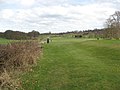 Footpath actually on golf course - geograph.org.uk - 1773740.jpg 3,072 × 2,304; 799 KB
-
 Footpath at rear of cottages in Acton Bridge - geograph.org.uk - 1773490.jpg 2,304 × 3,072; 3.26 MB
-
 Footpath beside the A556 Chester road - geograph.org.uk - 1773708.jpg 2,304 × 3,072; 2.96 MB
-
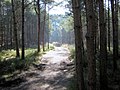
 Footpath to Blakemere Moss, in Delamere Forest, Cheshire.jpg 2,048 × 1,536; 1.37 MB
-
 Footpath to Prince's Wood - geograph.org.uk - 1778729.jpg 1,280 × 959; 359 KB
-
 Horse riders below Hunger Hill - geograph.org.uk - 1750738.jpg 2,048 × 1,536; 1.19 MB
-
 Linmere Visitor Centre, Delamere Forest.jpg 1,780 × 1,239; 1.45 MB
-
 Lock 15 and bridge 79 Shropshire Union Canal Audlem - geograph.org.uk - 1751562.jpg 3,296 × 2,472; 1.95 MB
-
 Lock gate 14 Shropshire Union Canal - geograph.org.uk - 1766075.jpg 3,296 × 2,472; 2.03 MB
-
 Looking towards Delamere Station - geograph.org.uk - 1752350.jpg 2,048 × 1,536; 847 KB
-
 Morning mist - geograph.org.uk - 1750691.jpg 2,048 × 1,536; 852 KB
-
 Muck spreading by Dorfold Dairy House - geograph.org.uk - 1742207.jpg 1,024 × 768; 260 KB
-
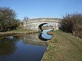
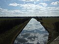
 Nantwich Aqueduct - geograph.org.uk - 1742224.jpg 1,024 × 768; 263 KB
-
 Not to be loose shunted in Audlem - geograph.org.uk - 1748172.jpg 3,296 × 2,472; 1.94 MB
-
 River Weaver viewed from the aqueduct bridge - geograph.org.uk - 1749145.jpg 3,296 × 2,472; 2.01 MB
-
 Seat with a view - geograph.org.uk - 1752459.jpg 2,048 × 1,536; 1.09 MB
-
 The bridges over the canal at Edleston Bridge - geograph.org.uk - 1742217.jpg 1,024 × 768; 253 KB
-
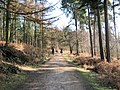
 The original Delamere Way - geograph.org.uk - 1750669.jpg 2,048 × 1,536; 696 KB
-
 Track to the Linmere Visitor Centre - geograph.org.uk - 1750722.jpg 2,048 × 1,536; 790 KB
-
 View from bridge 80 NNW - Shropshire Union Canal - geograph.org.uk - 1748949.jpg 3,296 × 2,472; 1.91 MB
-
 View from lock gate Shropshire Union Canal Audlem - geograph.org.uk - 1765760.jpg 3,296 × 2,472; 1.98 MB
-
 View NNW from beneath Coole Lane Bridge - geograph.org.uk - 1765711.jpg 3,296 × 2,472; 1.85 MB
-
 View NNW from Coole Lane Bridge - geograph.org.uk - 1765655.jpg 3,296 × 2,472; 1.9 MB
-
 View SSE from Coole Lane Bridge - geograph.org.uk - 1765671.jpg 3,296 × 2,472; 1.83 MB
-
 Vying for space - geograph.org.uk - 1752385.jpg 2,048 × 1,536; 1.12 MB
-
 Warrington's fine Town Hall - geograph.org.uk - 1961153.jpg 3,264 × 2,448; 3.26 MB
-
 Whortleberries and pine trees - geograph.org.uk - 1752405.jpg 2,048 × 1,536; 1.09 MB
-
 Wild Woods Visitor Centre - geograph.org.uk - 1746295.jpg 2,048 × 1,536; 670 KB


