Category:Margaret Roding
village and civil parish in Essex, England, UK | |||||
| Upload media | |||||
| Instance of | |||||
|---|---|---|---|---|---|
| Part of | |||||
| Location | Uttlesford, Essex, East of England, England | ||||
 | |||||
Margaret Roding in west Essex, England, is a village and civil parish in the district of Uttlesford, and is one of eight villages in The Rodings, an area through which flows the River Roding.
Subcategories
This category has the following 3 subcategories, out of 3 total.
G
- Garnish Hall, Uttlesford (4 F)
P
- Pepper's Green (1 F)
Media in category "Margaret Roding"
The following 19 files are in this category, out of 19 total.
-
 Margaret Roding, Essex, Ordnance Survey map 1805.jpg 582 × 394; 282 KB
-
 A consultation on the A1060 - geograph.org.uk - 2603088.jpg 640 × 428; 77 KB
-
 Barn at Blue House Farm, Four Wantz - geograph.org.uk - 5696999.jpg 1,935 × 1,413; 805 KB
-
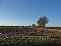
 Deer in a field - geograph.org.uk - 3400663.jpg 1,600 × 1,064; 261 KB
-

-
 Essex Way at Salt's Green - geograph.org.uk - 5937800.jpg 5,184 × 3,456; 6.51 MB
-
 Field by Ongar Road near Margaret Roding - geograph.org.uk - 5701496.jpg 2,048 × 1,536; 1.53 MB
-
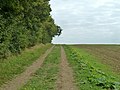
 Footpath at Pig's Spring - geograph.org.uk - 3400649.jpg 1,600 × 1,064; 734 KB
-
 House on Chelmsford Road, Four Wantz - geograph.org.uk - 5697000.jpg 2,000 × 1,470; 1.2 MB
-
 Lee's farm at Salt Green - geograph.org.uk - 3389573.jpg 3,648 × 2,736; 2.58 MB
-
 Marks Hall Lane, Margaret Roding - geograph.org.uk - 5691476.jpg 2,048 × 1,536; 1.49 MB
-
 Old building, Pinchers Farm, Pepper's Green - geograph.org.uk - 5943975.jpg 3,776 × 2,520; 3.03 MB
-
 Old pig shelter - geograph.org.uk - 2591744.jpg 640 × 480; 78 KB
-
 Ongar Road, Margaret Roding - geograph.org.uk - 5702376.jpg 2,006 × 1,478; 1.47 MB
-
 The A1060 entering the 'City' of Chelmsford - geograph.org.uk - 5943985.jpg 3,776 × 2,520; 3.32 MB
-
 The Essex Way 39, house at Pepper's Green - geograph.org.uk - 1881679.jpg 3,008 × 2,000; 1.56 MB
-
 The Essex Way 40, at Pepper's Green - geograph.org.uk - 1881682.jpg 2,000 × 3,008; 1.57 MB
-
 Uphill bridleway - geograph.org.uk - 4183327.jpg 640 × 480; 140 KB
-
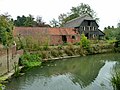 Waples Mill Farm - derelict - geograph.org.uk - 4183223.jpg 640 × 480; 144 KB


