Category:Maria, Leur
| Object location | | View all coordinates using: OpenStreetMap |
|---|
church in Leur (Wijchen), Netherlands _church.JPG) | |||||
| Upload media | |||||
| Instance of | |||||
|---|---|---|---|---|---|
| Location | Leur, Wijchen, Gelderland, Netherlands | ||||
| Street address |
| ||||
| Located on street |
| ||||
| Has part(s) |
| ||||
| Heritage designation |
| ||||
| Significant event |
| ||||
| Religion or worldview | |||||
 | |||||
Kerk:
|
This is a category about rijksmonument number 9324
|
Toren:
|
This is a category about rijksmonument number 9327
|
| Address |
|
Media in category "Maria, Leur"
The following 117 files are in this category, out of 117 total.
-
 "Onde Vader", bord - Leur - 20138936 - RCE.jpg 952 × 1,200; 146 KB
-
 Altaarsteen (in toren-portaal) - Leur - 20138831 - RCE.jpg 1,196 × 1,200; 371 KB
-
 Briefpaneel - Leur - 20138836 - RCE.jpg 1,192 × 1,200; 391 KB
-
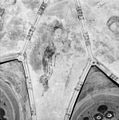 Detail gewelfschildering koor, madonna met kind - Leur - 20138866 - RCE.jpg 1,192 × 1,200; 392 KB
-
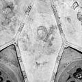
 Detail koorgewelf - Leur - 20138865 - RCE.jpg 1,191 × 1,200; 459 KB
-
 Detail koorgewelf schildering (St. Bernardus van Clairvaux) - Leur - 20138868 - RCE.jpg 1,200 × 1,197; 382 KB
-
 Detail koorgewelf schildering (St. Damianus?) - Leur - 20138869 - RCE.jpg 1,197 × 1,200; 340 KB
-
 Detail muurschildering rechts van het sacramentshuisje - Leur - 20138876 - RCE.jpg 1,192 × 1,200; 375 KB
-
 Detail muurschildering rond sacramentshuisje - Leur - 20138873 - RCE.jpg 1,188 × 1,200; 371 KB
-

-
 Detail schildering koorgewelf (St.Stephanus?) - Leur - 20138867 - RCE.jpg 1,196 × 1,200; 343 KB
-
 Deurklink - Leur - 20138877 - RCE.jpg 1,188 × 1,200; 397 KB
-
 Doopvont - Leur - 20138830 - RCE.jpg 1,197 × 1,200; 265 KB
-
 Doopvont plaat no. 44 - Leur - 20138818 - RCE.jpg 861 × 1,200; 179 KB
-
 Exterieur OVERZICHT ZUIDGEVEL - Leur - 20263709 - RCE.jpg 1,200 × 776; 148 KB
-
 Fundering noordgevel - Leur - 20138878 - RCE.jpg 1,188 × 1,200; 450 KB
-
 Fundering noordgevel - Leur - 20138879 - RCE.jpg 1,192 × 1,200; 445 KB
-
 Fundering noordgevel - Leur - 20138880 - RCE.jpg 1,200 × 1,197; 481 KB
-
 Fundering noordgevel - Leur - 20138881 - RCE.jpg 1,195 × 1,200; 474 KB
-
 Fundering noordgevel - Leur - 20138882 - RCE.jpg 1,188 × 1,200; 484 KB
-
 Fundering zvidgevel - Leur - 20138883 - RCE.jpg 1,188 × 1,200; 468 KB
-
 Gedeelte zuidgevel - Leur - 20138821 - RCE.jpg 972 × 1,200; 267 KB
-

-
 Gestoelte waarin laatgothische briefpanelen - Leur - 20138835 - RCE.jpg 1,197 × 1,200; 277 KB
-
 Gewelfschildering koor - Leur - 20138815 - RCE.jpg 879 × 1,200; 187 KB
-
 Gewelfschildering schip - Leur - 20138817 - RCE.jpg 886 × 1,200; 181 KB
-
 Gezicht op de Hervormde kerk te Leur, RP-F-00-10593.jpg 5,500 × 8,274; 2.78 MB
-
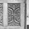
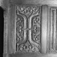
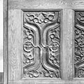 Gothisch briefpaneel - Leur - 20138837 - RCE.jpg 1,200 × 1,200; 409 KB
-
 Gothisch briefpaneel - Leur - 20138838 - RCE.jpg 1,195 × 1,200; 410 KB
-
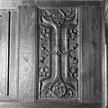
 Gothisch briefpaneel - Leur - 20138839 - RCE.jpg 1,200 × 1,188; 317 KB
-
 Gothisch briefpaneel - Leur - 20138840 - RCE.jpg 1,200 × 1,192; 361 KB
-
 Gothisch briefpaneel - Leur - 20138841 - RCE.jpg 1,185 × 1,200; 362 KB
-
 Gothisch briefpaneel - Leur - 20138842 - RCE.jpg 1,192 × 1,200; 415 KB
-
 Gothisch briefpaneel - Leur - 20138843 - RCE.jpg 1,195 × 1,200; 411 KB
-
 Gothisch briefpaneel - Leur - 20138844 - RCE.jpg 1,134 × 1,200; 375 KB
-
 Gothisch briefpaneel - Leur - 20138845 - RCE.jpg 1,192 × 1,200; 402 KB
-
 Gothisch briefpaneel - Leur - 20138846 - RCE.jpg 1,197 × 1,200; 342 KB
-
 Gothisch briefpaneel - Leur - 20138847 - RCE.jpg 1,200 × 1,197; 398 KB
-
 Gothisch briefpaneel - Leur - 20138848 - RCE.jpg 1,200 × 1,197; 433 KB
-
 Gothisch briefpaneel - Leur - 20138849 - RCE.jpg 1,200 × 1,197; 360 KB
-
 Gothisch briefpaneel - Leur - 20138850 - RCE.jpg 1,192 × 1,200; 385 KB
-
 Gothisch briefpaneel - Leur - 20138851 - RCE.jpg 1,195 × 1,200; 395 KB
-
 Gothisch briefpaneel - Leur - 20138852 - RCE.jpg 1,200 × 1,197; 402 KB
-
 Gothisch briefpaneel - Leur - 20138853 - RCE.jpg 1,200 × 1,192; 405 KB
-
 Gothisch briefpaneel - Leur - 20138854 - RCE.jpg 1,192 × 1,200; 415 KB
-
 Gothisch briefpaneel - Leur - 20138855 - RCE.jpg 1,200 × 1,192; 404 KB
-
 Gothisch briefpaneel - Leur - 20138856 - RCE.jpg 1,185 × 1,200; 335 KB
-
 Gothisch briefpaneel - Leur - 20138857 - RCE.jpg 1,198 × 1,200; 388 KB
-
 Gothisch briefpaneel - Leur - 20138858 - RCE.jpg 1,200 × 1,197; 412 KB
-
 Gothisch briefpaneel - Leur - 20138859 - RCE.jpg 1,192 × 1,200; 401 KB
-
 Grafsteen opgesteld tegen de zuidmuur van het koor - Leur - 20138832 - RCE.jpg 1,196 × 1,200; 295 KB
-
 Grafzerk - Leur - 20138935 - RCE.jpg 962 × 1,200; 223 KB
-
 Intenieur, aanzicht orgel, orgelnummer 1328 - Leur - 20417358 - RCE.jpg 832 × 1,200; 161 KB
-
 Interieur koor met gewelfschildering - Leur - 20138814 - RCE.jpg 896 × 1,200; 152 KB
-

-
 Interieur naar het oosten - Leur - 20138827 - RCE.jpg 946 × 1,200; 207 KB
-
 Interieur naar het westen - Leur - 20138828 - RCE.jpg 953 × 1,200; 230 KB
-
 INTERIEUR, KOOR, GEWELFSCHILDERINGEN - Leur - 20263711 - RCE.jpg 1,200 × 773; 157 KB
-
 INTERIEUR, KOOR, GEWELFSCHILDERINGEN - Leur - 20263712 - RCE.jpg 1,200 × 774; 147 KB
-

-
 INTERIEUR, MUURSCHILDERING - Leur - 20263713 - RCE.jpg 778 × 1,200; 129 KB
-
 INTERIEUR, MUURSCHILDERING - Leur - 20263714 - RCE.jpg 797 × 1,200; 149 KB
-
 INTERIEUR, MUURSCHILDERING - Leur - 20263715 - RCE.jpg 1,200 × 772; 180 KB
-
 INTERIEUR, MUURSCHILDERING, DETAIL - Leur - 20263716 - RCE.jpg 1,200 × 773; 166 KB
-
 INTERIEUR, MUURSCHILDERING, DETAIL - Leur - 20263717 - RCE.jpg 1,200 × 779; 239 KB
-
 INTERIEUR, MUURSCHILDERING, DETAIL - Leur - 20263718 - RCE.jpg 1,200 × 777; 207 KB
-
 INTERIEUR, MUURSCHILDERING, DETAIL - Leur - 20263719 - RCE.jpg 1,200 × 772; 181 KB
-
 INTERIEUR, MUURSCHILDERING, DETAIL - Leur - 20263720 - RCE.jpg 772 × 1,200; 178 KB
-
 INTERIEUR, MUURSCHILDERING, DETAIL - Leur - 20263721 - RCE.jpg 1,200 × 780; 211 KB
-
 INTERIEUR, MUURSCHILDERING, DETAIL - Leur - 20263722 - RCE.jpg 1,200 × 780; 253 KB
-
 INTERIEUR, MUURSCHILDERING, DETAIL - Leur - 20263723 - RCE.jpg 735 × 1,200; 156 KB
-
 INTERIEUR, MUURSCHILDERING, DETAIL - Leur - 20263724 - RCE.jpg 793 × 1,200; 175 KB
-
 INTERIEUR, MUURSCHILDERING, DETAIL - Leur - 20263725 - RCE.jpg 730 × 1,200; 210 KB
-
 INTERIEUR, MUURSCHILDERING, DETAIL - Leur - 20263726 - RCE.jpg 774 × 1,200; 152 KB
-
 INTERIEUR, MUURSCHILDERING, DETAIL - Leur - 20263727 - RCE.jpg 773 × 1,200; 165 KB
-
 INTERIEUR, MUURSCHILDERING, DETAIL - Leur - 20263728 - RCE.jpg 1,200 × 778; 243 KB
-
 INTERIEUR, MUURSCHILDERING, DETAIL - Leur - 20263729 - RCE.jpg 774 × 1,200; 201 KB
-
 INTERIEUR, MUURSCHILDERING, DETAIL - Leur - 20263730 - RCE.jpg 778 × 1,200; 170 KB
-
 INTERIEUR, MUURSCHILDERING, DETAIL - Leur - 20263731 - RCE.jpg 792 × 1,200; 211 KB
-

-
 INTERIEUR, OVERZICHT MIDDENSCHIP NAAR HET OOSTEN - Leur - 20263708 - RCE.jpg 796 × 1,200; 158 KB
-
 Interieur, preekstoel en tiengebodenborden - Leur - 20138934 - RCE.jpg 887 × 1,200; 213 KB
-

-
 Kerk en toren vanuit het zuid-westen - Leur - 20138812 - RCE.jpg 882 × 1,200; 163 KB
-
 Kerk vanuit het zuiden - Leur - 20138813 - RCE.jpg 1,200 × 887; 211 KB
-
 Leur (Wijchen) Rijksmonument 9327 kerktoren Van Balverenlaan 4.jpg 2,241 × 3,362; 1.11 MB
-
 Leur (Wijchen, Gld, NL) church.JPG 4,000 × 3,000; 3.93 MB
-
-
 Muurschildering koor - Leur - 20138816 - RCE.jpg 890 × 1,200; 162 KB
-

-

-
 Noord aanzicht - Leur - 20138808 - RCE.jpg 1,200 × 884; 206 KB
-
 Noordgevel - Leur - 20138824 - RCE.jpg 1,200 × 960; 346 KB
-
 Oost aanzicht - Leur - 20138805 - RCE.jpg 939 × 1,200; 178 KB
-
 Oostgevel koor - Leur - 20138825 - RCE.jpg 958 × 1,200; 303 KB
-
 Oostgevel koor - Leur - 20138826 - RCE.jpg 952 × 1,200; 321 KB
-
 Oostmuur acten des Geloofs - Leur - 20138937 - RCE.jpg 950 × 1,200; 133 KB
-
 Oostmuur X geboden bord. - Leur - 20138938 - RCE.jpg 952 × 1,200; 150 KB
-
 Overzicht koorgewelf-schildering - Leur - 20138862 - RCE.jpg 1,190 × 1,200; 374 KB
-
 Overzicht koorgewelf-schildering - Leur - 20138863 - RCE.jpg 1,181 × 1,200; 304 KB
-
 Preekstoel - Leur - 20138829 - RCE.jpg 953 × 1,200; 219 KB
-
 Preekstoel met doophek - Leur - 20138942 - RCE.jpg 1,200 × 953; 184 KB
-

-
 Schildering - Leur - 20138810 - RCE.jpg 890 × 1,200; 191 KB
-
 Schildering - Leur - 20138811 - RCE.jpg 1,200 × 863; 170 KB
-
 Schildering koorgewelf - Leur - 20138864 - RCE.jpg 1,195 × 1,200; 359 KB
-

-
 Westgevel toren - Leur - 20138823 - RCE.jpg 952 × 1,200; 393 KB
-
 Wijdingskruisje op zuid-oost muur -sluiting van het koor - Leur - 20138861 - RCE.jpg 1,200 × 1,200; 464 KB
-
 WLM - 23dingenvoormusea - kerkje in Leur (1).jpg 803 × 1,200; 576 KB
-
 WLM - 23dingenvoormusea - kerkje in Leur (2).jpg 798 × 1,200; 772 KB
-
 WLM - 23dingenvoormusea - kerkje in Leur.jpg 1,200 × 900; 790 KB
-
 Zuid aanzicht - Leur - 20138809 - RCE.jpg 1,200 × 857; 241 KB
-
 Zuid-oost aanzicht - Leur - 20138806 - RCE.jpg 1,200 × 881; 193 KB
-
 Zuid-west aanzicht - Leur - 20138807 - RCE.jpg 868 × 1,200; 243 KB
-
 Zuidgevel - Leur - 20138820 - RCE.jpg 1,200 × 952; 292 KB
-
 Zuidgevel - Leur - 20138822 - RCE.jpg 959 × 1,200; 407 KB

_-_Leur_-_20138831_-_RCE.jpg)


_-_Leur_-_20138868_-_RCE.jpg)
_-_Leur_-_20138869_-_RCE.jpg)


_-_Leur_-_20138867_-_RCE.jpg)


_-_Leur_-_20138860_-_RCE.jpg)


_-_Leur_-_20263710_-_RCE.jpg)


_Rijksmonument_9327_kerktoren_Van_Balverenlaan_4.jpg)


_-_Leur_-_20138871_-_RCE.jpg)


_-_Leur_-_20138872_-_RCE.jpg)


.jpg)
.jpg)


