Category:Markeaton
village in United Kingdom  | |||||
| Upload media | |||||
| Instance of | |||||
|---|---|---|---|---|---|
| Location | City of Derby, Derbyshire, East Midlands, England | ||||
 | |||||
Media in category "Markeaton"
The following 200 files are in this category, out of 223 total.
(previous page) (next page)-
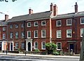
 1-11 Vernon Street, Derby - geograph.org.uk - 4164397.jpg 640 × 426; 141 KB
-
 100 Friar Gate, Derby - geograph.org.uk - 4187735.jpg 590 × 640; 234 KB
-
 27-29 Friar Gate, Derby - geograph.org.uk - 4171445.jpg 486 × 640; 216 KB
-
 32 Friar Gate, Derby - geograph.org.uk - 4171427.jpg 558 × 640; 219 KB
-
 34 Ashbourne Road, Derby - geograph.org.uk - 4164409.jpg 640 × 359; 108 KB
-
 35 Ashbourne Road, Derby - geograph.org.uk - 4164419.jpg 640 × 436; 169 KB
-
 41 Friar Gate, Derby - geograph.org.uk - 4171388.jpg 640 × 508; 219 KB
-
 44 Friar Gate, Derby - geograph.org.uk - 4171335.jpg 542 × 640; 228 KB
-
 46 Friar Gate, Derby - geograph.org.uk - 4171301.jpg 640 × 476; 213 KB
-
 47-51 Friar Gate, Derby - geograph.org.uk - 4171269.jpg 640 × 496; 195 KB
-
 56-57 Friar Gate, Derby - geograph.org.uk - 4171260.jpg 640 × 431; 183 KB
-
 59-60 Friar Gate, Derby - geograph.org.uk - 4171247.jpg 574 × 640; 308 KB
-
 6-10 Bridge Street, Derby - geograph.org.uk - 4165115.jpg 640 × 449; 140 KB
-
 61-62 Friar Gate, Derby - geograph.org.uk - 4165031.jpg 640 × 465; 183 KB
-
 65 Friar Gate, Derby - geograph.org.uk - 4165053.jpg 640 × 517; 195 KB
-
 99 Friar Gate, Derby - geograph.org.uk - 4187722.jpg 549 × 640; 270 KB
-
 A terrace of four houses - geograph.org.uk - 2555933.jpg 2,430 × 1,824; 716 KB
-
 A wet summer morning in Vernon Street - geograph.org.uk - 5632020.jpg 1,024 × 683; 957 KB
-
 Approaching Markeaton Island - geograph.org.uk - 1837316.jpg 640 × 480; 76 KB
-
 Ashbourne Road - geograph.org.uk - 1814555.jpg 2,816 × 2,112; 889 KB
-
 Ashbourne Road Church - geograph.org.uk - 1815206.jpg 2,816 × 2,112; 1.09 MB
-
 Ashbourne Road, Derby - geograph.org.uk - 1837313.jpg 640 × 480; 86 KB
-
 Ashbourne Road, Derby - geograph.org.uk - 1837314.jpg 640 × 480; 71 KB
-
 Ashbourne Road, Derby - geograph.org.uk - 1837315.jpg 640 × 480; 59 KB
-
 Ashbourne Road, Derby - geograph.org.uk - 3616506.jpg 1,280 × 856; 192 KB
-
 Ashbourne Road, junction Vernon Street, Derby - geograph.org.uk - 6164910.jpg 4,608 × 3,456; 6.28 MB
-
 At Five Lamps - geograph.org.uk - 3950266.jpg 1,200 × 934; 1.34 MB
-
 Banks's Mill, Brook Street, Derby - geograph.org.uk - 4165099.jpg 568 × 640; 227 KB
-
 Bench mark on social club - geograph.org.uk - 4389012.jpg 2,560 × 1,920; 1.03 MB
-
 Bench mark on St John's Church - geograph.org.uk - 4389042.jpg 2,560 × 1,920; 1.04 MB
-
 Bench mark on Vernon Gate - geograph.org.uk - 4389031.jpg 2,560 × 1,920; 1.04 MB
-
 Brick and Tile - geograph.org.uk - 1814564.jpg 2,112 × 2,816; 1.17 MB
-
 Brick Street, Derby - geograph.org.uk - 1815009.jpg 2,816 × 2,112; 1.05 MB
-
 Bridge, Woodland, Markeaton, Derby (4949670598).jpg 3,072 × 2,304; 1.1 MB
-
 Bridge, Woodland, Markeaton, Derby (4949680666).jpg 2,304 × 3,072; 1.29 MB
-
 Bridge, Woodland, Markeaton, Derby (4949680672).jpg 2,304 × 3,072; 1.42 MB
-
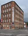
 Britannia Mill on Markeaton Street - geograph.org.uk - 3502411.jpg 3,918 × 2,888; 1.96 MB
-
 Buildings alongside Jury Street - geograph.org.uk - 2354997.jpg 1,280 × 959; 369 KB
-
 By the Markeaton Brook - geograph.org.uk - 6291049.jpg 2,000 × 1,333; 2.18 MB
-
 Ceramic head under a tree - geograph.org.uk - 6164952.jpg 4,608 × 3,456; 5.35 MB
-
 Children's play park at Markeaton Rec - geograph.org.uk - 5035615.jpg 1,280 × 960; 653 KB
-
 Derby - Alnwick Terrace - geograph.org.uk - 4402934.jpg 1,600 × 1,203; 497 KB
-
 Derby - approach to former GN goods yard - geograph.org.uk - 4254038.jpg 1,600 × 1,200; 700 KB
-

-
 Derby - Ashbourne Road - No 40 - geograph.org.uk - 4587320.jpg 1,600 × 1,170; 536 KB
-
 Derby - Ashbourne Road No 38 - geograph.org.uk - 4587399.jpg 1,600 × 1,166; 573 KB
-
 Derby - Ashbourne Road Nos 28 and 30 - geograph.org.uk - 4587404.jpg 1,600 × 1,190; 474 KB
-
 Derby - Ashgate Primary School - geograph.org.uk - 4577382.jpg 1,600 × 1,172; 607 KB
-
 Derby - Ashgate Primary School - geograph.org.uk - 4578585.jpg 1,600 × 1,209; 583 KB
-
 Derby - Ashgate Primary School - geograph.org.uk - 4578586.jpg 640 × 489; 102 KB
-
 Derby - Ashgate Primary School - geograph.org.uk - 4578588.jpg 1,600 × 1,207; 548 KB
-
 Derby - Ashgate Primary School - geograph.org.uk - 4578592.jpg 640 × 474; 88 KB
-
 Derby - Ashgate Primary School - geograph.org.uk - 4578594.jpg 640 × 471; 90 KB
-
 Derby - Ashgate Primary School - geograph.org.uk - 4578596.jpg 470 × 640; 97 KB
-
 Derby - Ashgate Primary School - geograph.org.uk - 4578600.jpg 1,600 × 1,179; 580 KB
-
 Derby - Ashgate Primary School - geograph.org.uk - 4578604.jpg 1,306 × 980; 394 KB
-
 Derby - Banks Mill - from south - geograph.org.uk - 4202448.jpg 1,367 × 1,600; 831 KB
-
 Derby - Banks Mill - geograph.org.uk - 3235885.jpg 1,190 × 1,600; 602 KB
-
 Derby - Bridge Street - geograph.org.uk - 3244278.jpg 3,079 × 2,505; 1.88 MB
-
 Derby - Bridge Street - No 2 - geograph.org.uk - 4254041.jpg 1,600 × 1,233; 572 KB
-
 Derby - Bridge Street - Nos 1 and 3 - geograph.org.uk - 4254043.jpg 1,600 × 1,211; 438 KB
-
 Derby - Bridge Street - Nos 6 to 10 - geograph.org.uk - 4254042.jpg 1,600 × 1,195; 544 KB
-
 Derby - Bridge Street Area - geograph.org.uk - 3244267.jpg 3,847 × 2,840; 2.64 MB
-
 Derby - Britannia Mill - from Merchant Street - geograph.org.uk - 4587310.jpg 1,600 × 1,268; 568 KB
-
 Derby - Britannia Mill - from west - geograph.org.uk - 4587314.jpg 1,600 × 1,222; 472 KB
-
 Derby - Brook Street - geograph.org.uk - 3244261.jpg 3,319 × 2,879; 1.78 MB
-
 Derby - Brook Walk - geograph.org.uk - 4226274.jpg 1,600 × 1,200; 707 KB
-
 Derby - buildings at NW end of crescent on South Street - geograph.org.uk - 4226126.jpg 1,600 × 1,197; 641 KB
-
 Derby - Cathedral Quarter - geograph.org.uk - 3244236.jpg 2,947 × 1,972; 1.21 MB
-
 Derby - east side of Vernon Street - geograph.org.uk - 4226127.jpg 1,600 × 804; 301 KB
-
 Derby - east side of Vernon Street - geograph.org.uk - 4226133.jpg 1,600 × 1,200; 474 KB
-
 Derby - former Baptist Chapel on Brook Street - geograph.org.uk - 4202460.jpg 1,173 × 1,600; 714 KB
-
 Derby - former mills off of Lodge Lane - geograph.org.uk - 4398837.jpg 1,024 × 768; 167 KB
-
 Derby - Former Railway Line - geograph.org.uk - 3244387.jpg 3,451 × 2,833; 2.26 MB
-
 Derby - Friar Gate - Nos 78 to 82 - geograph.org.uk - 4254040.jpg 1,600 × 924; 609 KB
-
 Derby - Friar Gate - Nos 83 and 84 - geograph.org.uk - 4254039.jpg 1,600 × 1,185; 479 KB
-
 Derby - Friar Gate Bridge - geograph.org.uk - 3244375.jpg 3,497 × 2,532; 1.96 MB
-
 Derby - Friargate Bridge - geograph.org.uk - 3244391.jpg 2,936 × 2,297; 1.16 MB
-

-
 Derby - Horse ^ Groom on Elms Street - geograph.org.uk - 4385402.jpg 1,600 × 1,229; 629 KB
-

-
 Derby - houses on north side of Kedleston Road - geograph.org.uk - 4402938.jpg 1,600 × 964; 393 KB
-
 Derby - houses on south side of Kedleston Road - geograph.org.uk - 4402943.jpg 1,600 × 1,183; 442 KB
-
 Derby - Kedleston Road Training Centre - geograph.org.uk - 4277847.jpg 1,600 × 1,229; 691 KB
-
 Derby - Off Friar Gate - geograph.org.uk - 3244314.jpg 2,733 × 4,000; 2.06 MB
-
 Derby - pre-1964 road sign on Lodge Lane - geograph.org.uk - 4209530.jpg 1,600 × 1,200; 499 KB
-
 Derby - rear of Brook Street buildings - geograph.org.uk - 3321103.jpg 1,600 × 1,189; 512 KB
-
 Derby - St Alkmunds Church - geograph.org.uk - 4385411.jpg 1,600 × 1,484; 540 KB
-
 Derby - St John's Church - geograph.org.uk - 4226276.jpg 1,600 × 1,200; 698 KB
-
 Derby - St John's Church - window detail - geograph.org.uk - 4202439.jpg 640 × 491; 116 KB
-
 Derby - Sterne House - geograph.org.uk - 3265191.jpg 1,179 × 1,600; 560 KB
-
 Derby - The 102 Club - Vernon Street frontage - geograph.org.uk - 4226124.jpg 1,600 × 1,118; 476 KB
-
 Derby - The Mile on Friar Gate - geograph.org.uk - 3379087.jpg 1,600 × 1,200; 480 KB
-
 Derby - The Mill and Sterne House - geograph.org.uk - 4226271.jpg 1,600 × 1,219; 605 KB
-
 Derby - The York Tavern - geograph.org.uk - 4226264.jpg 1,600 × 1,217; 491 KB
-
 Derby - Vernon Gate - geograph.org.uk - 3244308.jpg 2,668 × 3,615; 1.98 MB
-
 Derby - Vernon Street - geograph.org.uk - 3244290.jpg 3,612 × 2,700; 1.89 MB
-

-
 Derby - west side of Vernon Street - geograph.org.uk - 4226081.jpg 1,600 × 1,484; 532 KB
-
 Derby - west side of Vernon Street - geograph.org.uk - 4226144.jpg 1,600 × 1,076; 468 KB
-
 Derby - Wheel Buildings on Friargate - geograph.org.uk - 4202433.jpg 1,600 × 983; 418 KB
-
 Derby College - geograph.org.uk - 6291057.jpg 2,000 × 1,333; 1.75 MB
-
 Derby Gas Light and Coke Company - geograph.org.uk - 2354034.jpg 1,280 × 845; 224 KB
-
 Derby west, aerial 2014 - geograph.org.uk - 3926019.jpg 1,024 × 604; 167 KB
-
 Derby, 1 Friar Gate Square - geograph.org.uk - 4536371.jpg 1,024 × 732; 852 KB
-
 Derby, 126 Nuns Street - geograph.org.uk - 4536634.jpg 1,024 × 1,024; 1.21 MB
-
 Derby, a wet summer morning in Friar Gate - geograph.org.uk - 5491289.jpg 731 × 1,024; 782 KB
-
 Derby, Ashbourne Road from Uttoxeter Old Road - geograph.org.uk - 5125329.jpg 1,600 × 1,064; 280 KB
-
 Derby, Banks Mill Studios - geograph.org.uk - 4536431.jpg 819 × 1,024; 1.03 MB
-
 Derby, beside Markeaton Brook - geograph.org.uk - 4536409.jpg 819 × 1,024; 1.02 MB
-
 Derby, Ford Street and 1 Friar Gate Square - geograph.org.uk - 4536384.jpg 1,024 × 682; 766 KB
-
 Derby, Friar Gate in the rain - geograph.org.uk - 5725677.jpg 1,024 × 768; 1.06 MB
-
 Derby, Mackworth Road and park alongside it - geograph.org.uk - 5125335.jpg 1,600 × 924; 453 KB
-
 Derby, Nuns Street - geograph.org.uk - 4536631.jpg 1,024 × 559; 764 KB
-
 Derby, Park Grove - geograph.org.uk - 5704502.jpg 1,024 × 1,024; 1.18 MB
-
 Derby, Ponsonby Terrace - geograph.org.uk - 5513248.jpg 1,024 × 1,024; 1.16 MB
-

-
 Derby, South Street - geograph.org.uk - 5513255.jpg 1,024 × 683; 708 KB
-
 Derby, St John the Evangelist - geograph.org.uk - 2329899.jpg 800 × 561; 438 KB
-
 Derby, Stafford Street on a wet morning - geograph.org.uk - 5538446.jpg 1,024 × 768; 881 KB
-

-
 Derby, the corner of Friar Gate and Ford Street - geograph.org.uk - 4536374.jpg 1,024 × 731; 1.02 MB
-
 Derby, the derelict Friargate Goods Warehouse - geograph.org.uk - 5492358.jpg 768 × 1,024; 1.4 MB
-
 Derby, the inner ring road - geograph.org.uk - 4536391.jpg 1,024 × 682; 738 KB
-

-
 Detail of 12 Vernon Street, Derby - geograph.org.uk - 4164399.jpg 453 × 640; 169 KB
-
 Detail of 28 Friar Gate, Derby - geograph.org.uk - 4171450.jpg 640 × 533; 169 KB
-
 Detail of 41 Friar Gate, Derby - geograph.org.uk - 4171404.jpg 592 × 640; 207 KB
-
 Detail of 44 Friar Gate, Derby - geograph.org.uk - 4171342.jpg 640 × 344; 115 KB
-
 Detail of 65 Friar Gate, Derby - geograph.org.uk - 4165057.jpg 345 × 640; 115 KB
-
 Detail of 99 Friar Gate, Derby - geograph.org.uk - 4187727.jpg 536 × 640; 169 KB
-

-
 Etwall St. Derby - geograph.org.uk - 5339038.jpg 2,000 × 1,333; 2.13 MB
-
 Findern Street - geograph.org.uk - 4074238.jpg 640 × 480; 73 KB
-
 Foot and cycle bridge over A38, Queensway - geograph.org.uk - 5533959.jpg 1,600 × 1,280; 777 KB
-
 Ford Street, old and new - geograph.org.uk - 3520783.jpg 1,200 × 1,200; 1.76 MB
-

-
 Former gaol, South Street, Derby - geograph.org.uk - 4160971.jpg 640 × 405; 160 KB
-
 Former Great Northern Railway warehouse - geograph.org.uk - 6070405.jpg 1,280 × 943; 464 KB
-
 Former Great Northern Railway warehouse - geograph.org.uk - 6070406.jpg 1,280 × 960; 501 KB
-
 Former Great Northern Railway warehouse - geograph.org.uk - 6070411.jpg 1,280 × 1,280; 445 KB
-
 Former Great Northern Railway warehouse - geograph.org.uk - 6070416.jpg 1,280 × 850; 304 KB
-
 Former nurses' home - geograph.org.uk - 4273932.jpg 1,200 × 900; 257 KB
-
 Friar gate , Derby - geograph.org.uk - 6164957.jpg 4,608 × 3,456; 6.45 MB
-
 Friar Gate Studios - geograph.org.uk - 3725648.jpg 3,284 × 2,729; 1.69 MB
-
 Friar Gate Studios, Derby - geograph.org.uk - 3165328.jpg 4,752 × 3,168; 4.19 MB
-
 Friar Gate Surgery and flats - geograph.org.uk - 6291045.jpg 2,000 × 1,333; 1.93 MB
-
 Friar Gate, The Greyhound - geograph.org.uk - 4180904.jpg 1,024 × 768; 1.21 MB
-
 Friargate Railway Bridge - geograph.org.uk - 1815097.jpg 2,400 × 1,800; 961 KB
-
 Friargate Railway Bridge, Derby - geograph.org.uk - 1837310.jpg 640 × 480; 82 KB
-
 Friargate, Derby - geograph.org.uk - 1837311.jpg 640 × 480; 86 KB
-
 Garden Street with misleading sign - geograph.org.uk - 1822778.jpg 1,024 × 683; 331 KB
-
 Hydraulic pump house, Great Northern Road, Derby - geograph.org.uk - 6070418.jpg 1,280 × 960; 311 KB
-
 Jesus Christ Of Latter-Day Saints, Mackworth - geograph.org.uk - 2157022.jpg 1,496 × 1,122; 437 KB
-

-

-
 Kedleston Road shops - geograph.org.uk - 3954853.jpg 1,024 × 539; 647 KB
-
 Kedleston Road, Derby - geograph.org.uk - 3995718.jpg 640 × 480; 70 KB
-
 Kedleston Road, Derby - geograph.org.uk - 5876525.jpg 1,024 × 768; 245 KB
-
 Manchester Street Maltings, Derby - geograph.org.uk - 2288623.jpg 640 × 422; 72 KB
-

-
 Markeaton Island Petrol Station - geograph.org.uk - 180319.jpg 640 × 480; 91 KB
-
 Markeaton Lady, Light Railway Locomotive.jpg 500 × 333; 22 KB
-
-

-
 Markeaton Primary School - geograph.org.uk - 141814.jpg 640 × 445; 153 KB
-
 Markeaton Roundabout on the A38 at Derby - geograph.org.uk - 2617393.jpg 800 × 600; 295 KB
-
 Markeaton village hamlet, Derby (4427475808).jpg 1,200 × 1,600; 249 KB
-
 Markeaton village hamlet, Derby (4427475810).jpg 1,600 × 1,200; 395 KB
-
 Markeaton village hamlet, Derby (4427478910).jpg 1,600 × 1,200; 159 KB
-
 Markeaton village hamlet, Derby (4427478912).jpg 1,600 × 1,200; 456 KB
-
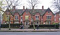
 Markeaton village-hamlet, Derby - geograph.org.uk - 1807045.jpg 1,600 × 1,200; 419 KB
-
 Masa Restaurant and Wine Bar - geograph.org.uk - 2943709.jpg 900 × 1,200; 271 KB
-
 McDonald's and Markeaton roundabout - geograph.org.uk - 3002945.jpg 640 × 380; 52 KB
-
 Mercian Way Derby - geograph.org.uk - 5315911.jpg 2,000 × 1,333; 1.65 MB
-
 More student accommodation - geograph.org.uk - 6291052.jpg 2,000 × 1,333; 2.49 MB
-
 Mr Grundy's Tavern - geograph.org.uk - 3614376.jpg 856 × 1,280; 279 KB
-
 Mr Grundy's Tavern, Derby - geograph.org.uk - 4535257.jpg 640 × 480; 79 KB
-
 New University Buildings near Markeaton Park - geograph.org.uk - 3502379.jpg 3,906 × 2,872; 2.29 MB
-
 Old Forge in Markeaton village hamlet, Derby (4427475816).jpg 1,600 × 1,200; 284 KB
-
 Old Forge in Markeaton village-hamlet, Derby - geograph.org.uk - 1807034.jpg 1,600 × 1,200; 241 KB
-
 On Kedleston Road - geograph.org.uk - 3950267.jpg 1,200 × 802; 1.16 MB
-
 Path off Markeaton Lane, Markeaton, Derby (4967349507).jpg 2,304 × 3,072; 1.56 MB
-

-
 Post Office on Kedleston Road - geograph.org.uk - 3995723.jpg 640 × 480; 68 KB
-
 Pre-Worboys road sign on Lodge Lane - geograph.org.uk - 4634521.jpg 1,200 × 900; 199 KB
-
 Pre-Worboys road sign on Lodge Lane - geograph.org.uk - 4634524.jpg 900 × 1,200; 229 KB
-
 Quaker Way, Derby - geograph.org.uk - 2396057.jpg 640 × 480; 76 KB
-
 Road Junction at Five Lamps - geograph.org.uk - 3579902.jpg 3,884 × 2,840; 2.03 MB
-

-
 Sign for Mr Grundy's Tavern, Derby - geograph.org.uk - 4535258.jpg 612 × 640; 75 KB
-
 Sign for the Greyhound - geograph.org.uk - 4578388.jpg 497 × 640; 88 KB
-
 Sign for the Mile, Derby - geograph.org.uk - 4535266.jpg 494 × 640; 76 KB
-
 Sign for the Travellers Rest, Derby - geograph.org.uk - 4535252.jpg 576 × 640; 65 KB
-
 Slack Lane - geograph.org.uk - 4074236.jpg 640 × 480; 57 KB
-
 Soap fiction - geograph.org.uk - 6070409.jpg 1,280 × 973; 486 KB
-
 St John the Evangelist, Derby - geograph.org.uk - 1815023.jpg 2,400 × 1,800; 951 KB
-
 St. Alkmund's Way, Derby - geograph.org.uk - 1837308.jpg 640 × 480; 49 KB
-
 St. John the Evangelist Church - geograph.org.uk - 6291047.jpg 2,000 × 1,333; 2.14 MB
-
 Swan and Salmon - geograph.org.uk - 1815176.jpg 2,816 × 2,112; 1.04 MB


.jpg)
.jpg)
.jpg)


.jpg)
.jpg)
.jpg)
.jpg)


.jpg)


.jpg)


