Category:Market Weighton
English: Market Weighton is a small town and civil parish in the East Riding of Yorkshire, England. It is one of the main market towns in the East Yorkshire Wolds and lies midway between Hull and York, about 20 miles (32 km) from either one.
town and civil parish in the East Riding of Yorkshire, England  | |||||
| Upload media | |||||
| Instance of | |||||
|---|---|---|---|---|---|
| Location | East Riding of Yorkshire, Yorkshire and the Humber, England | ||||
| Said to be the same as | Market Weighton (Wikimedia duplicated page, civil parish) | ||||
 | |||||
Subcategories
This category has the following 7 subcategories, out of 7 total.
Media in category "Market Weighton"
The following 200 files are in this category, out of 344 total.
(previous page) (next page)-
 A Church Spire - geograph.org.uk - 1989190.jpg 800 × 600; 311 KB
-
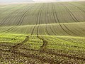
 A field alongside Londesborough Road - geograph.org.uk - 562527.jpg 640 × 480; 95 KB
-
 A finger post o Weighton Common - geograph.org.uk - 3733920.jpg 1,024 × 681; 343 KB
-
 A fishing lake on Weighton Common - geograph.org.uk - 3733904.jpg 1,024 × 681; 350 KB
-
 A fishing lake on Weighton Common - geograph.org.uk - 3733907.jpg 1,024 × 681; 297 KB
-
 A footbridge at Weighton Common - geograph.org.uk - 3733882.jpg 1,024 × 681; 408 KB
-
 A glimpse of the church, Market Weighton - geograph.org.uk - 3403302.jpg 768 × 1,024; 309 KB
-
 A layby on the A1079 at Arras Hill - geograph.org.uk - 2519391.jpg 800 × 600; 263 KB
-
 A path leading to Shipman Road - geograph.org.uk - 3734019.jpg 1,024 × 681; 347 KB
-
 A path leading to Weighton Common - geograph.org.uk - 3733863.jpg 1,024 × 681; 398 KB
-
 A path leading to Weighton Common - geograph.org.uk - 3733869.jpg 1,024 × 681; 443 KB
-
 A path leading to Weighton Common - geograph.org.uk - 3733871.jpg 1,024 × 681; 397 KB
-
 A path leading to Weighton Common - geograph.org.uk - 3733872.jpg 1,024 × 681; 414 KB
-
 A path leading to Weighton Common - geograph.org.uk - 3733876.jpg 1,024 × 681; 429 KB
-
 A path leading to Weighton Common - geograph.org.uk - 3733899.jpg 1,024 × 681; 344 KB
-
 A path off River Lane towards Market Weighton - geograph.org.uk - 3733856.jpg 1,024 × 681; 393 KB
-
 A path on Weighton Common, East Yorkshire - geograph.org.uk - 3733884.jpg 1,024 × 681; 352 KB
-
 A path on Weighton Common, East Yorkshire - geograph.org.uk - 3733897.jpg 1,024 × 681; 411 KB
-
 A path on Weighton Common, East Yorkshire - geograph.org.uk - 3733908.jpg 1,024 × 681; 392 KB
-
 A path on Weighton Common, East Yorkshire - geograph.org.uk - 3733909.jpg 1,024 × 681; 358 KB
-
 A path on Weighton Common, East Yorkshire - geograph.org.uk - 3733917.jpg 1,024 × 681; 219 KB
-
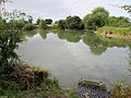
 A pond on Weighton Common - geograph.org.uk - 3733878.jpg 1,024 × 681; 333 KB
-
 A pond on Weighton Common - geograph.org.uk - 3733879.jpg 1,024 × 681; 427 KB
-
 A track leading to Hawling Road - geograph.org.uk - 3733927.jpg 1,024 × 681; 295 KB
-
 A track leading to Hawling Road - geograph.org.uk - 3733938.jpg 1,024 × 681; 244 KB
-
 A track leading to Hawling Road - geograph.org.uk - 3733944.jpg 1,024 × 681; 334 KB
-
 A Wesleyan Chapel, Market Weighton - geograph.org.uk - 3735299.jpg 1,024 × 681; 183 KB
-
 A Wesleyan Chapel, Market Weighton - geograph.org.uk - 3735303.jpg 681 × 1,024; 193 KB
-
 A wet day on the A1079 - geograph.org.uk - 6147931.jpg 1,024 × 768; 89 KB
-
 A1079 and new style speed cameras - geograph.org.uk - 5054255.jpg 2,742 × 1,687; 1.65 MB
-
 A1079 at Market Weighton turn - geograph.org.uk - 5922772.jpg 1,024 × 756; 107 KB
-
 A1079 at Sancton Road Roundabout - geograph.org.uk - 3187465.jpg 2,560 × 1,920; 1.8 MB
-
 A1079 climbing Weighton Hill - geograph.org.uk - 5923744.jpg 1,024 × 771; 101 KB
-
 A1079 Giant Bradley Way - geograph.org.uk - 5923721.jpg 1,024 × 777; 118 KB
-
 A1079 Market Weighton by-pass - geograph.org.uk - 5922773.jpg 1,024 × 753; 122 KB
-
 A1079 near Arras Farm - geograph.org.uk - 5923759.jpg 1,024 × 741; 66 KB
-
 A1079 nears A1034 roundabout - geograph.org.uk - 5923727.jpg 1,024 × 767; 126 KB
-
 A1079 on Weighton Hill - geograph.org.uk - 5923751.jpg 1,024 × 769; 93 KB
-
 A1079 over Yorkshire Wolds - geograph.org.uk - 5054248.jpg 3,043 × 2,265; 1.7 MB
-
 A1079 towards Beverley - geograph.org.uk - 1861932.jpg 640 × 480; 73 KB
-
 A1079 towards Market Weighton - geograph.org.uk - 1861944.jpg 640 × 480; 43 KB
-
 A1079 up Weighton Hill (2) - geograph.org.uk - 5054240.jpg 2,919 × 2,086; 1.65 MB
-
 A1079 up Weighton Hill - geograph.org.uk - 5054234.jpg 3,099 × 2,260; 1.71 MB
-
 All Saints Church, Market Weighton - geograph.org.uk - 3738090.jpg 1,024 × 681; 264 KB
-
 All Saints Church, Market Weighton - geograph.org.uk - 5708981.jpg 1,600 × 1,065; 401 KB
-
 All Saints Church, Market Weighton - geograph.org.uk - 5708983.jpg 903 × 1,600; 671 KB
-
 All Saints Church, Market Weighton - geograph.org.uk - 5709003.jpg 1,600 × 1,065; 702 KB
-
 All Saints Church, Market Weighton - geograph.org.uk - 5709005.jpg 840 × 1,600; 637 KB
-
 All Saints Church, Market Weighton - geograph.org.uk - 5709009.jpg 1,065 × 1,600; 652 KB
-
 All Saints Church, Market Weighton - geograph.org.uk - 5709012.jpg 1,600 × 1,065; 530 KB
-
 All Saints Church, Market Weighton - geograph.org.uk - 5709014.jpg 1,065 × 1,600; 504 KB
-
 All Saints Church, Market Weighton - geograph.org.uk - 5709018.jpg 1,065 × 1,600; 525 KB
-
 All Saints Church, Market Weighton - geograph.org.uk - 5709059.jpg 1,121 × 1,600; 755 KB
-
 All Saints Church, Market Weighton - geograph.org.uk - 5709062.jpg 1,064 × 1,600; 636 KB
-
 All Saints Church, Market Weighton - geograph.org.uk - 5709063.jpg 1,102 × 1,600; 643 KB
-
 All Saints Court, Market Weighton - geograph.org.uk - 3738101.jpg 1,024 × 681; 282 KB
-
 All Saints' Church, Market Weighton - geograph.org.uk - 3140492.jpg 4,320 × 3,240; 4.7 MB
-
 All Saints' Church, Market Weighton - geograph.org.uk - 3403311.jpg 1,024 × 768; 275 KB
-
 Approaching Arras Hill on the A1079 - geograph.org.uk - 3166200.jpg 2,560 × 1,920; 1.74 MB
-
 Arras Cottages, Arras - geograph.org.uk - 3937665.jpg 1,600 × 1,064; 474 KB
-
 Arras Farm Avenue in winter - geograph.org.uk - 6023242.jpg 2,048 × 1,365; 1.38 MB
-
 Arras Farm left Kiplingcotes Lane right - geograph.org.uk - 2210030.jpg 800 × 600; 260 KB
-
 Arras Farm left Kiplingcotes Lane right - geograph.org.uk - 3937652.jpg 1,600 × 1,064; 680 KB
-
 Arras Farm, Arras, East Yorkshire - geograph.org.uk - 3937677.jpg 1,600 × 1,064; 510 KB
-

-
 Arras Reservoir and communication towers - geograph.org.uk - 5682574.jpg 1,024 × 768; 122 KB
-
 Arras Wold - geograph.org.uk - 1003886.jpg 640 × 480; 213 KB
-
 Arras Wold - geograph.org.uk - 2336692.jpg 640 × 480; 44 KB
-
 Avenue to Arras Farm - geograph.org.uk - 5842334.jpg 1,024 × 768; 308 KB
-
 Behind the hedge - geograph.org.uk - 4347290.jpg 1,024 × 768; 172 KB
-
 Beilsbeck Farm - geograph.org.uk - 234316.jpg 640 × 426; 143 KB
-
 Beilsbeck Farm Near Market Weighton - geograph.org.uk - 234193.jpg 640 × 426; 142 KB
-
 Beverley Road meets A1079 - geograph.org.uk - 6276844.jpg 1,024 × 768; 173 KB
-
 Big sky big field at Arras Farm - geograph.org.uk - 4476677.jpg 4,604 × 3,450; 7.75 MB
-
 Bowman Drain crossing Weighton Common - geograph.org.uk - 4665832.jpg 4,608 × 3,456; 7.66 MB
-
 Brickyard Cottage on Sweep Road - geograph.org.uk - 3734014.jpg 1,024 × 681; 289 KB
-
 Bridge Farm, Market Weighton - geograph.org.uk - 4389715.jpg 1,600 × 1,062; 421 KB
-
 Bridge over Weighton Beck - geograph.org.uk - 6028988.jpg 1,024 × 768; 275 KB
-
 Bright Ideas - geograph.org.uk - 5159338.jpg 1,600 × 1,065; 518 KB
-
 Building at Arras Farm - geograph.org.uk - 5842879.jpg 1,024 × 768; 170 KB
-
 Building at Arras Farm, Arras, East Yorkshire - geograph.org.uk - 3937669.jpg 1,600 × 1,064; 685 KB
-
 Carpenters Arms, Market Weighton - geograph.org.uk - 3736466.jpg 681 × 1,024; 268 KB
-
 Carpenters Arms, Market Weighton - geograph.org.uk - 3736469.jpg 1,024 × 681; 281 KB
-
 Carpenters Arms, Market Weighton - geograph.org.uk - 3736474.jpg 681 × 1,024; 198 KB
-
 Carrot tops, near Market Weighton - geograph.org.uk - 934266.jpg 460 × 640; 202 KB
-
 Carving of Britain's tallest ever man - geograph.org.uk - 3403277.jpg 768 × 1,024; 366 KB
-
 Church, Market Weighton - geograph.org.uk - 4758810.jpg 640 × 480; 71 KB
-
 Cliffe Road, Market Weighton - geograph.org.uk - 6029093.jpg 1,024 × 768; 139 KB
-
 Council buildings at Market Weighton - geograph.org.uk - 4389650.jpg 1,600 × 1,039; 529 KB
-
 Croft Close off Hawling Road - geograph.org.uk - 3734076.jpg 1,024 × 681; 227 KB
-
 Crop watering equipment at Weighton Common - geograph.org.uk - 3733895.jpg 1,024 × 681; 413 KB
-
 Decorative Tree at St Helen's Well - geograph.org.uk - 5104025.jpg 1,600 × 1,065; 916 KB
-
 Descending The Wolds, A614 - geograph.org.uk - 5429806.jpg 640 × 426; 37 KB
-
 Diamond Jubilee Plaque on Beverley Road - geograph.org.uk - 3738117.jpg 681 × 1,024; 310 KB
-
 Disused railway bridge - geograph.org.uk - 5996482.jpg 1,024 × 768; 241 KB
-
 Disused railway bridge on Goodmanham Road - geograph.org.uk - 5103967.jpg 1,600 × 1,065; 586 KB
-
 Disused railway bridge on Goodmanham Road - geograph.org.uk - 5103975.jpg 1,600 × 1,065; 644 KB
-
 Disused railway line towards Market Weighton - geograph.org.uk - 5103980.jpg 1,600 × 1,065; 774 KB
-
 Disused railway line towards Market Weighton - geograph.org.uk - 5103987.jpg 1,600 × 1,065; 809 KB
-
 Driveway to Towthorpe Grange - geograph.org.uk - 4389792.jpg 1,600 × 1,062; 978 KB
-

-
 Farm access road on the left to Low Grange - geograph.org.uk - 5410588.jpg 1,816 × 1,291; 851 KB
-
 Farm buildings at Arras Farm, East Yorkshire - geograph.org.uk - 3937681.jpg 1,600 × 1,064; 814 KB
-
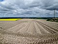
 Farmland near Market Weighton - geograph.org.uk - 1601047.jpg 640 × 480; 93 KB
-
 Farmland off Goodmanham Road - geograph.org.uk - 1563845.jpg 640 × 480; 74 KB
-
 Farmland off Holme Road - geograph.org.uk - 1600647.jpg 640 × 480; 101 KB
-
 Farmland off the A1079 - geograph.org.uk - 1861927.jpg 640 × 480; 61 KB
-
 Field at Weighton Common - geograph.org.uk - 249049.jpg 640 × 426; 414 KB
-
 Field boundary near Common Farm - geograph.org.uk - 4346945.jpg 1,024 × 768; 110 KB
-
 Field boundary near High Common Farm - geograph.org.uk - 4346929.jpg 1,024 × 768; 144 KB
-

-
 Field Near East Common - geograph.org.uk - 234188.jpg 640 × 426; 144 KB
-
 Fields off Kiplingcotes Lane - geograph.org.uk - 2336688.jpg 640 × 480; 42 KB
-
 Fishing Pond on Weighton Common - geograph.org.uk - 4665076.jpg 4,608 × 3,456; 5.57 MB
-
 Flush Bracket 2276 - Market Weighton - geograph.org.uk - 525315.jpg 480 × 640; 113 KB
-
 Footbridge at Weighton Clay Field - geograph.org.uk - 4389732.jpg 1,600 × 1,062; 693 KB
-
 Footbridge near Bridge Farm - geograph.org.uk - 4389725.jpg 1,600 × 1,062; 804 KB
-
 Footpath gate and steps to A1079 - geograph.org.uk - 4665797.jpg 4,606 × 3,452; 6.23 MB
-
 Footpath to River Lane - geograph.org.uk - 4665859.jpg 4,510 × 3,322; 7.43 MB
-
 Footpath to Sancton Road - geograph.org.uk - 5682590.jpg 1,024 × 768; 157 KB
-
 Footpath under dismantled railway line - geograph.org.uk - 4478356.jpg 3,456 × 4,608; 4.2 MB
-
 For sale, The Londesbrough Arms Hotel - geograph.org.uk - 3403296.jpg 1,024 × 768; 316 KB
-
 Former Rail Bridge near Goodmanham Road - geograph.org.uk - 5159357.jpg 1,600 × 1,065; 891 KB
-
 From Wold to Vale - geograph.org.uk - 3187430.jpg 2,560 × 1,920; 1.84 MB
-
 Golden Jubilee plaque on Beverley Road - geograph.org.uk - 3738109.jpg 681 × 1,024; 352 KB
-
 Grange Farm - geograph.org.uk - 2034885.jpg 800 × 536; 93 KB
-
 Growing crop on Weighton Wold - geograph.org.uk - 4476746.jpg 4,510 × 3,322; 4.48 MB
-
 Half Moon public house for sale on High Street - geograph.org.uk - 4101814.jpg 1,600 × 1,064; 634 KB
-
 Hall ^ Featherstone on York Road, Market Weighton - geograph.org.uk - 5159340.jpg 1,600 × 1,065; 561 KB
-
 Hawling Road towards Market Weighton - geograph.org.uk - 3733977.jpg 1,024 × 681; 331 KB
-
 Hawling Road towards Market Weighton - geograph.org.uk - 3733986.jpg 1,024 × 681; 255 KB
-
 Hawling Road towards Market Weighton - geograph.org.uk - 3734011.jpg 1,024 × 681; 370 KB
-
 Hawling Road, Market Weighton - geograph.org.uk - 3734065.jpg 1,024 × 681; 280 KB
-
 Hawling Road, Market Weighton - geograph.org.uk - 3734070.jpg 1,024 × 681; 255 KB
-
 Hawling Road, Market Weighton - geograph.org.uk - 3735362.jpg 1,024 × 681; 243 KB
-
 Heading down hill on Arras Hill - geograph.org.uk - 2519409.jpg 800 × 600; 190 KB
-
 Hedgerow and Field - geograph.org.uk - 1601035.jpg 640 × 480; 75 KB
-
 Henleys Nurseries, Weighton Common - geograph.org.uk - 2194417.jpg 800 × 600; 269 KB
-
 High hedge behind Henley's Nurseries - geograph.org.uk - 4347285.jpg 1,024 × 768; 124 KB
-
 High Street, Market Weighton - geograph.org.uk - 3735256.jpg 1,024 × 681; 256 KB
-
 High Street, Market Weighton - geograph.org.uk - 5890545.jpg 1,024 × 768; 216 KB
-
 High Wold Farm - geograph.org.uk - 1861940.jpg 640 × 480; 35 KB
-
 High Wold Farm - geograph.org.uk - 5682578.jpg 1,024 × 768; 199 KB
-
 Holme Road approaching Market Weighton Bypass - geograph.org.uk - 5410599.jpg 1,889 × 1,397; 846 KB
-
 House on York Road, Market Weighton - geograph.org.uk - 4389672.jpg 1,600 × 1,062; 559 KB
-
 Houses on Scotts Croft, Market Weighton - geograph.org.uk - 3735360.jpg 1,024 × 657; 240 KB
-
 Houses on Southgate, Market Weighton - geograph.org.uk - 3736552.jpg 1,024 × 681; 260 KB
-
 Housing, Market Weighton - geograph.org.uk - 3403269.jpg 1,024 × 768; 309 KB
-
 Hudson Way towards Kiplingcotes - geograph.org.uk - 5104016.jpg 1,600 × 1,065; 742 KB
-
 Hudson Way towards Kiplingcotes - geograph.org.uk - 5104028.jpg 1,600 × 1,065; 689 KB
-
 Humber Street - geograph.org.uk - 4254871.jpg 1,024 × 768; 175 KB
-
 Humber Street - geograph.org.uk - 4254878.jpg 1,024 × 768; 208 KB
-
 Huntercombe Hospital driveway - geograph.org.uk - 3733841.jpg 1,024 × 681; 385 KB
-
 Huntercombe Hospital driveway - geograph.org.uk - 3733848.jpg 1,024 × 681; 361 KB
-
 Ideal Motor Services Coach on York Road - geograph.org.uk - 4131373.jpg 1,600 × 1,299; 756 KB
-
 Information Board at St Helen's Well - geograph.org.uk - 5104021.jpg 1,600 × 1,065; 637 KB
-
 Kiplingcotes Lane - geograph.org.uk - 2304969.jpg 1,024 × 768; 166 KB
-
 Kiplingcotes Lane going right Arras Farm to the left - geograph.org.uk - 4476627.jpg 4,608 × 3,456; 6.51 MB
-
 Lamp at Market Weighton - geograph.org.uk - 4389622.jpg 908 × 1,414; 238 KB
-
 Lay-by on the A1079 - geograph.org.uk - 6276842.jpg 1,024 × 768; 107 KB
-
 Layby on Weighton Hill - geograph.org.uk - 3187452.jpg 2,560 × 1,920; 1.74 MB
-
 Leaning poles - geograph.org.uk - 5682580.jpg 1,024 × 768; 94 KB
-
 Londesborough Street Car Park, Market Weighton - geograph.org.uk - 5159355.jpg 1,600 × 1,065; 527 KB
-
 Looking South to Weighton Common - geograph.org.uk - 248313.jpg 640 × 426; 431 KB
-

-
 Lorry descending The Wolds, A614 - geograph.org.uk - 5429807.jpg 640 × 426; 43 KB
-
 Manor Farm, Weighton Common - geograph.org.uk - 4346931.jpg 1,024 × 768; 138 KB
-
 Market Place, Market Weighton - geograph.org.uk - 3403282.jpg 1,024 × 768; 253 KB
-
 Market Place, Market Weighton - geograph.org.uk - 3735318.jpg 1,024 × 681; 278 KB
-
 Market Weighton - A Bird's Eye View - geograph.org.uk - 85042.jpg 640 × 457; 103 KB
-
 Market Weighton bypass A1079 - geograph.org.uk - 3166217.jpg 2,560 × 1,920; 1.99 MB
-
 Market Weighton cemetery - geograph.org.uk - 1272690.jpg 471 × 640; 200 KB
-
 Market Weighton Cemetery - geograph.org.uk - 1600618.jpg 640 × 480; 123 KB
-
 Market Weighton Fire Station on Cliffe Road - geograph.org.uk - 5103218.jpg 1,600 × 1,065; 463 KB
-
 Market Weighton High Street, 1995 - geograph.org.uk - 5065043.jpg 2,415 × 1,604; 3.74 MB
-
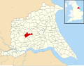 Market Weighton UK parish locator map.svg 1,425 × 1,107; 1.68 MB
-

-
 Mill Beck, Goodmanham - geograph.org.uk - 1432045.jpg 480 × 640; 120 KB
-
 Mill Beck, Market Weighton - geograph.org.uk - 1231337.jpg 426 × 640; 191 KB
-
 Muddy Field and Hedgerow - geograph.org.uk - 1601064.jpg 640 × 480; 84 KB
-
 Muddy field entrance - geograph.org.uk - 4347284.jpg 1,024 × 768; 165 KB
-
 New house under construction - geograph.org.uk - 4347288.jpg 1,024 × 768; 171 KB
-
 No.2, Beverley Road - geograph.org.uk - 3988101.jpg 1,024 × 758; 95 KB
-
 Nornabell’s Yard ^1 - geograph.org.uk - 3988194.jpg 1,280 × 960; 748 KB
-
 Nornabell’s Yard ^2 - geograph.org.uk - 3988227.jpg 768 × 1,024; 168 KB
-
 Nornabell’s Yard ^3 - geograph.org.uk - 3988247.jpg 1,024 × 768; 208 KB
-
 Nothing but barley - geograph.org.uk - 5842306.jpg 1,024 × 768; 177 KB
-
 Old meeting new - geograph.org.uk - 2003746.jpg 800 × 600; 197 KB
-
 Ordnance Survey One-Inch Sheet 98 Market Weighton, Published 1947.jpg 10,963 × 12,738; 14.55 MB
-
 Ordnance Survey One-Inch Sheet 98 Market Weighton, Published 1962.jpg 8,278 × 9,881; 9.6 MB
-
 Over fields to Goodmanham Dale - geograph.org.uk - 4476766.jpg 4,594 × 3,436; 6.2 MB
-
 Plaques on Beverley Road, Market Weighton. - geograph.org.uk - 3738132.jpg 1,024 × 681; 313 KB
-
 Pond on Weighton Common - geograph.org.uk - 4665809.jpg 4,596 × 3,440; 7.34 MB
-
 Poppies in amongst the Peas - geograph.org.uk - 910184.jpg 640 × 480; 150 KB
-
 Potato field near Arras - geograph.org.uk - 5842267.jpg 1,024 × 768; 208 KB
-
 Potato field near Arras - geograph.org.uk - 5842890.jpg 1,024 × 768; 220 KB
-
 Power lines crossing Wold Road - geograph.org.uk - 5682586.jpg 1,024 × 768; 133 KB
-
 Power lines near Market Weighton - geograph.org.uk - 2034874.jpg 640 × 480; 47 KB
-
 Princess Parade Allotments from Sweep Road - geograph.org.uk - 3734060.jpg 1,024 × 681; 327 KB
-
 Rear of No.2, Beverley Road - geograph.org.uk - 3988112.jpg 1,024 × 768; 113 KB


_-_geograph.org.uk_-_5054240.jpg)


