Category:Marlow, Buckinghamshire
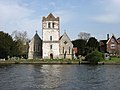
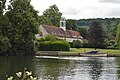
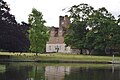
English: Marlow (previously Great Marlow or Chipping Marlow) is a town and civil parish within Wycombe district in south Buckinghamshire, England. It is located on the River Thames, four miles south-south-west of High Wycombe, and four miles north west of Maidenhead.
Français : Marlow est une ville du Buckinghamshire, Angleterre. Elle se trouve entre les villes de Henley-on-Thames et Maidenhead à côté du fleuve la Tamise.
Italiano: Marlow (in passato detta Great Marlow o Chipping Marlow) è una cittadina di 14.004 abitanti della contea del Buckinghamshire, in Inghilterra che sorge lungo il corso del fiume Tamigi.
Nederlands: Marlow is een plaats in het bestuurlijke gebied Wycombe, in het Engelse graafschap Buckinghamshire. De plaats telt 14.000 inwoners.
Română: Marlow este un oraş în comitatul Buckinghamshire, regiunea South East, Anglia. Oraşul se află în districtul Wycombe.
Simple English: Marlow is a town on the banks of the River Thames, on the southern tip of Buckinghamshire, England.
Svenska: Marlow (tidigare Great Marlow eller Chipping Marlow) är en stad i södra Buckinghamshire i England. Staden ligger vid floden Themsen, sydväst om High Wycombe och nordväst om Maidenhead.
town and civil parish in Buckinghamshire, England  | |||||
| Upload media | |||||
| Instance of | |||||
|---|---|---|---|---|---|
| Location | Buckinghamshire, South East England, England | ||||
| Located in or next to body of water | |||||
| official website | |||||
 | |||||
Subcategories
This category has the following 25 subcategories, out of 25 total.
4
A
B
- Brampton House, Marlow (3 F)
C
- Chequers, Marlow (6 F)
- The Churchill Tap (4 F)
- Court Garden, Marlow (18 F)
E
- The End House, Marlow (8 F)
H
- The Hand & Flowers (1 F)
L
M
- Marlow Bridge (87 F)
- Marlow Bypass bridge (7 F)
- Marlow Place (11 F)
- Marlow Town Hall (4 F)
- Marlow War Memorial (6 F)
- May Balfour Garden Sundial (4 F)
P
- Pizza Express, Marlow (4 F)
R
- Marlow railway station (27 F)
- Remnantz (3 F)
S
W
- The White House, Marlow (2 F)
Media in category "Marlow, Buckinghamshire"
The following 200 files are in this category, out of 1,153 total.
(previous page) (next page)-
 'Hare and Hounds', Henley Road - geograph.org.uk - 5981037.jpg 1,024 × 683; 186 KB
-
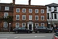
 101 High Street, Marlow.jpg 1,200 × 1,600; 228 KB
-
 17, St Peter's Street - geograph.org.uk - 5276018.jpg 640 × 426; 82 KB
-
 19, High St - geograph.org.uk - 5608432.jpg 640 × 426; 81 KB
-

-

-
 29-31 West St, Marlow.jpg 4,608 × 3,456; 3.9 MB
-
 35 High Street, Marlow.jpg 1,600 × 1,200; 209 KB
-
 35 Mill Road, Marlow (27994034035).jpg 4,288 × 3,216; 4.17 MB
-
 48 West St, Marlow (The Botanist).jpg 4,608 × 3,456; 3.8 MB
-
 56 High Street, Marlow.jpg 1,200 × 1,600; 204 KB
-
 65 High St, Marlow.jpg 4,608 × 3,456; 3.7 MB
-
 65, High St - geograph.org.uk - 5251672.jpg 640 × 426; 73 KB
-
 7, St Peter's St (geograph 6649432).jpg 1,024 × 684; 156 KB
-
 74 - 76, High St - geograph.org.uk - 4233488.jpg 640 × 430; 83 KB
-
 74 - 76, High St - geograph.org.uk - 5608406.jpg 640 × 425; 63 KB
-
 74 - 76, High St - geograph.org.uk - 5928448.jpg 1,024 × 681; 168 KB
-
 74 High Street, Marlow.jpg 1,200 × 1,600; 196 KB
-
 78 - 80, High St - geograph.org.uk - 5608401.jpg 640 × 426; 80 KB
-
 78 - 80, High St - geograph.org.uk - 5928449.jpg 1,024 × 681; 158 KB
-
 79 High Street, Marlow.jpg 4,608 × 3,456; 3.95 MB
-
 79, High St - geograph.org.uk - 3760033.jpg 640 × 430; 78 KB
-
 80, High St (geograph 6638539).jpg 1,024 × 684; 177 KB
-
 80, High St - geograph.org.uk - 3760019.jpg 640 × 430; 80 KB
-
 80, High St - geograph.org.uk - 5251695.jpg 640 × 426; 73 KB
-
 88 High Street, Marlow.jpg 1,600 × 1,200; 190 KB
-
 88, High St - geograph.org.uk - 5608399.jpg 640 × 426; 65 KB
-
 88, High St - geograph.org.uk - 5928452.jpg 1,024 × 681; 122 KB
-
 9, St Peter's St (geograph 6649434).jpg 1,024 × 685; 138 KB
-
 90 High Street, Marlow.jpg 1,200 × 1,600; 172 KB
-
 90, High St - geograph.org.uk - 5251691.jpg 640 × 426; 65 KB
-
 90, High St - geograph.org.uk - 5608397.jpg 640 × 425; 59 KB
-
 90, High St - geograph.org.uk - 5928454.jpg 1,024 × 681; 129 KB
-
 92 - 94, High St - geograph.org.uk - 5928455.jpg 1,024 × 681; 127 KB
-
 92 and 94 High Street, Marlow.jpg 1,600 × 1,200; 190 KB
-
 96 High Street - Sahara - geograph.org.uk - 649459.jpg 640 × 479; 71 KB
-
 A classic view - geograph.org.uk - 649862.jpg 640 × 481; 67 KB
-
 A Leaning Tree by the Thames - geograph.org.uk - 795744.jpg 640 × 471; 111 KB
-
 A new pavilion - geograph.org.uk - 649436.jpg 640 × 477; 91 KB
-

-
 A row of houses on Dedmere Road - geograph.org.uk - 5981127.jpg 1,024 × 683; 181 KB
-
 A swan a-swimming, Marlow, Buckinghamshire - geograph.org.uk - 2556870.jpg 1,024 × 570; 267 KB
-
 A404 bridge - geograph.org.uk - 3753617.jpg 640 × 430; 53 KB
-
 A404 bridge over the Thames - geograph.org.uk - 5309787.jpg 5,202 × 3,465; 4.16 MB
-
 A404 Bridge, River Thames - geograph.org.uk - 3748688.jpg 640 × 430; 37 KB
-
 A404 Bridge, River Thames - geograph.org.uk - 3748702.jpg 640 × 430; 56 KB
-

-
 A404 enters Buckinghamshire - geograph.org.uk - 5608348.jpg 640 × 480; 89 KB
-
 A404 near Marlow - geograph.org.uk - 4485216.jpg 640 × 427; 276 KB
-
 A404 northbound - geograph.org.uk - 3885280.jpg 640 × 459; 43 KB
-
 A404 northbound - geograph.org.uk - 3885292.jpg 640 × 480; 40 KB
-
 A404 northbound - geograph.org.uk - 3885295.jpg 640 × 408; 44 KB
-
 A404 Northbound - geograph.org.uk - 4485214.jpg 640 × 427; 243 KB
-
 A404 northbound - geograph.org.uk - 5608288.jpg 640 × 428; 90 KB
-
 A4155 - geograph.org.uk - 5251713.jpg 640 × 426; 69 KB
-
 A4155 - geograph.org.uk - 5924726.jpg 1,024 × 681; 137 KB
-
 A4155 - geograph.org.uk - 5924863.jpg 1,024 × 681; 221 KB
-

-
 AlfredDavisGroundMarlow.jpg 2,191 × 1,353; 906 KB
-
 All Saints Church at Bisham - geograph.org.uk - 3973183.jpg 1,600 × 1,200; 464 KB
-
 All Saints Church Hall (geograph 6638507).jpg 1,024 × 684; 189 KB
-
 All Saints church hall - geograph.org.uk - 3211724.jpg 640 × 430; 69 KB
-
 All Saints Church Hall - geograph.org.uk - 3753645.jpg 640 × 430; 79 KB
-
 All Saints Church Hall - geograph.org.uk - 5608370.jpg 640 × 425; 74 KB
-
 All Saints Church Hall - geograph.org.uk - 5928463.jpg 1,024 × 681; 169 KB
-
 All Saints Church Hall - geograph.org.uk - 649482.jpg 640 × 493; 73 KB
-
 All Saints Church, Bisham - geograph.org.uk - 3207619.jpg 640 × 430; 74 KB
-
 All Saints church, Bisham - geograph.org.uk - 4438327.jpg 2,592 × 1,944; 1.54 MB
-
 All Saints Church, Bisham, Bucks - geograph.org.uk - 2872972.jpg 1,600 × 1,200; 1.11 MB
-
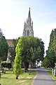
 All Saints Church, Marlow - geograph.org.uk - 5314707.jpg 480 × 640; 69 KB
-
 All Saints Church, Marlow - geograph.org.uk - 5377260.jpg 1,600 × 1,200; 367 KB
-
 All Saints Church, Marlow - geograph.org.uk - 5377301.jpg 1,200 × 1,600; 395 KB
-
 All Saints Church, Marlow - geograph.org.uk - 5379854.jpg 1,600 × 1,200; 437 KB
-
 All Saints Parish Hall - geograph.org.uk - 4754840.jpg 640 × 426; 88 KB
-
 All Saints' Church - geograph.org.uk - 5931739.jpg 662 × 1,024; 109 KB
-

-
 All Saints' church, Marlow - geograph.org.uk - 4196656.jpg 3,240 × 4,320; 4.54 MB
-
 All Saints' churchyard and Old Bridge House Marlow - geograph.org.uk - 4196685.jpg 4,320 × 3,240; 3.83 MB
-
 All walled in - geograph.org.uk - 3748653.jpg 640 × 430; 88 KB
-
 An interesting piece of metalwork - geograph.org.uk - 4438286.jpg 2,592 × 1,944; 2.33 MB
-
 Approaching Marlow - geograph.org.uk - 4438273.jpg 2,592 × 1,944; 1.97 MB
-
 Approaching Marlow Lock - geograph.org.uk - 5379790.jpg 1,600 × 1,200; 442 KB
-
 Approaching Marlow Lock, River Thames - geograph.org.uk - 378925.jpg 640 × 514; 100 KB
-
 Assembly House - geograph.org.uk - 5251707.jpg 640 × 492; 72 KB
-
 At the rivers edge - geograph.org.uk - 3404571.jpg 640 × 426; 117 KB
-
 Avenue of trees near the Thames - geograph.org.uk - 4438222.jpg 1,944 × 2,592; 1.92 MB
-
 B482 - geograph.org.uk - 5924849.jpg 1,024 × 681; 140 KB
-
 B482 southeast of High Rews Farm - geograph.org.uk - 3417853.jpg 3,261 × 2,377; 2.31 MB
-
 B482 T-junction with A4155 - geograph.org.uk - 3417860.jpg 3,648 × 2,736; 1.5 MB
-
 Backwater channel - geograph.org.uk - 5283928.jpg 640 × 426; 108 KB
-
 Bank Apartments, Dean Street, Marlow - geograph.org.uk - 3431428.jpg 2,560 × 1,788; 1.14 MB
-
 Barclays Bank - geograph.org.uk - 5251648.jpg 640 × 560; 98 KB
-
 Barclays, High St - geograph.org.uk - 3215799.jpg 640 × 430; 82 KB
-
 Barley Way - geograph.org.uk - 4233432.jpg 640 × 430; 72 KB
-
 Barn, Bisham Abbey - geograph.org.uk - 5283998.jpg 640 × 426; 86 KB
-
 Barnhill Road, Marlow - geograph.org.uk - 748485.jpg 640 × 480; 166 KB
-
 Baroosh - geograph.org.uk - 5608418.jpg 640 × 426; 78 KB
-
 Basin, Marlow Lock - geograph.org.uk - 3753622.jpg 640 × 430; 58 KB
-
 Beaumont Rd - geograph.org.uk - 5920121.jpg 1,024 × 681; 174 KB
-
 Below the A404 bridge - geograph.org.uk - 3748690.jpg 640 × 430; 58 KB
-
 Below the A404 bridge from the north side - geograph.org.uk - 5309798.jpg 5,202 × 3,465; 3.58 MB
-
 Benchmark on All Saints' Church - geograph.org.uk - 5931844.jpg 683 × 1,024; 297 KB
-

-
 Bennetons, High St - geograph.org.uk - 3215803.jpg 640 × 430; 86 KB
-
 Berks from Bucks - geograph.org.uk - 3415315.jpg 625 × 459; 117 KB
-
 Bikers by the Curry House - geograph.org.uk - 3423681.jpg 2,261 × 1,770; 1.13 MB
-
 Bisham Abbey - geograph.org.uk - 2513486.jpg 1,024 × 680; 264 KB
-
 Bisham Abbey - geograph.org.uk - 2513493.jpg 1,024 × 680; 210 KB
-
 Bisham Abbey - geograph.org.uk - 4219048.jpg 640 × 430; 69 KB
-
 Bisham Abbey - geograph.org.uk - 4219055.jpg 640 × 430; 73 KB
-
 Bisham Abbey - geograph.org.uk - 5283990.jpg 640 × 426; 82 KB
-
 Bisham Abbey - geograph.org.uk - 5289228.jpg 640 × 426; 87 KB
-
 Bisham Abbey - geograph.org.uk - 5289239.jpg 640 × 426; 75 KB
-
 Bisham Abbey - geograph.org.uk - 5619572.jpg 640 × 426; 75 KB
-
 Bisham Abbey - geograph.org.uk - 5619573.jpg 640 × 426; 82 KB
-
 Bisham Abbey - geograph.org.uk - 5619575.jpg 640 × 426; 87 KB
-
 Bisham Abbey - geograph.org.uk - 5624824.jpg 640 × 426; 69 KB
-
 Bisham Abbey Sailing School - geograph.org.uk - 5283991.jpg 640 × 426; 82 KB
-
 Bisham Abbey Sailing School - geograph.org.uk - 5283993.jpg 640 × 426; 88 KB
-
 Bisham church - geograph.org.uk - 2512155.jpg 680 × 1,024; 200 KB
-
 Bisham church - geograph.org.uk - 2512161.jpg 680 × 1,024; 203 KB
-
 Bisham church - geograph.org.uk - 2512164.jpg 680 × 1,024; 210 KB
-
 Bisham, Berkshire, All Saints Church - geograph.org.uk - 5891954.jpg 4,608 × 3,456; 5.28 MB
-
 Bisham, Quarry Wood Restricted Byway - geograph.org.uk - 489306.jpg 640 × 480; 158 KB
-
 Bluebells in All Saints Churchyard - geograph.org.uk - 5378152.jpg 1,200 × 1,600; 800 KB
-
 Boat moored - geograph.org.uk - 5284004.jpg 640 × 426; 67 KB
-
 Boat moored near Bisham - geograph.org.uk - 4218993.jpg 640 × 430; 76 KB
-

-
 Boats moored on the River Thames - geograph.org.uk - 5289225.jpg 640 × 426; 77 KB
-

-
 Borlase 1.JPG 480 × 640; 160 KB
-
 Brampton House - geograph.org.uk - 5251692.jpg 640 × 426; 71 KB
-
 Brampton House - geograph.org.uk - 5608394.jpg 640 × 426; 88 KB
-
 Brampton House - geograph.org.uk - 5928456.jpg 1,024 × 681; 171 KB
-
 Brampton Mews - geograph.org.uk - 3214695.jpg 640 × 430; 56 KB
-
 Brampton Mews - geograph.org.uk - 5624877.jpg 640 × 426; 75 KB
-
 Brew Tower - geograph.org.uk - 1670004.jpg 640 × 480; 96 KB
-
 Brewery House - geograph.org.uk - 3214705.jpg 640 × 430; 93 KB
-
 Brewery House - geograph.org.uk - 3760026.jpg 640 × 430; 73 KB
-
 Brewery Quarter, Marlow - geograph.org.uk - 1671150.jpg 2,560 × 1,920; 1.81 MB
-
 Brick and flint at Marlow - geograph.org.uk - 3607618.jpg 640 × 427; 201 KB
-
 Bridge Close - geograph.org.uk - 5608371.jpg 640 × 426; 71 KB
-
 Bridge Close School - geograph.org.uk - 4233441.jpg 640 × 430; 63 KB
-
 Bridge Close School - geograph.org.uk - 5251677.jpg 426 × 640; 78 KB
-
 Bridge over the River Thames - geograph.org.uk - 4438250.jpg 2,592 × 1,944; 1.36 MB
-
 Bridge to Marlow Lock - geograph.org.uk - 5270713.jpg 640 × 426; 70 KB
-
 Bridge, Lower Pound Lane - geograph.org.uk - 4211262.jpg 640 × 430; 107 KB
-
 Buckingham Antiques - geograph.org.uk - 4233492.jpg 640 × 430; 68 KB
-
 Buckingham Antiques, High St - geograph.org.uk - 3214702.jpg 640 × 430; 80 KB
-
 Buckinghamshire - birthplace of the Paralympics - geograph.org.uk - 3083465.jpg 1,176 × 1,569; 972 KB
-
 Building on Stilts - geograph.org.uk - 5075726.jpg 1,600 × 1,200; 733 KB
-
 Burgers Cafe - geograph.org.uk - 5614672.jpg 640 × 426; 50 KB
-
 Burgers of Marlow - geograph.org.uk - 5378087.jpg 1,024 × 768; 119 KB
-
 Burgers Tea Room - geograph.org.uk - 649503.jpg 640 × 474; 62 KB
-
 Can you see Hitchcock^ - geograph.org.uk - 649858.jpg 640 × 476; 70 KB
-
 Canoeists on the Thames - geograph.org.uk - 5314709.jpg 640 × 480; 107 KB
-
 Canoes under Marlow Bypass Bridge - geograph.org.uk - 3084657.jpg 2,544 × 1,906; 2.25 MB
-
 Car park. Mill Rd - geograph.org.uk - 5275974.jpg 640 × 426; 81 KB
-
 Castellated house on the Thames - geograph.org.uk - 2542929.jpg 1,024 × 680; 273 KB
-
 Castellated riverside house - geograph.org.uk - 3748830.jpg 640 × 430; 71 KB
-
 Castle on the Thames - geograph.org.uk - 1867471.jpg 2,048 × 1,536; 1,011 KB
-
 Catherine Clark - geograph.org.uk - 3207629.jpg 640 × 430; 52 KB
-
 Catholic Church of St Peter - geograph.org.uk - 5276011.jpg 640 × 426; 87 KB
-
 Cedar House - geograph.org.uk - 5924720.jpg 1,024 × 681; 168 KB
-
 Cedar Trees - geograph.org.uk - 649598.jpg 640 × 480; 106 KB
-
 Channel into the River Thames - geograph.org.uk - 5619550.jpg 640 × 426; 114 KB
-
 Chapel Street, Marlow, Bucks - geograph.org.uk - 4000893.jpg 1,280 × 960; 1,021 KB
-
 Charles Frohman memorial - geograph.org.uk - 5309753.jpg 4,130 × 2,737; 2.04 MB
-
 Charles Frohman memorial, Marlow - geograph.org.uk - 5177087.jpg 640 × 480; 133 KB
-
 Children's roundabout, Higginson Park, Marlow - geograph.org.uk - 3083800.jpg 1,613 × 1,210; 1.24 MB
-
 Church of All Saints - geograph.org.uk - 3759976.jpg 640 × 430; 49 KB
-
 Church of All Saints - geograph.org.uk - 3759980.jpg 640 × 430; 57 KB
-
 Church of All Saints - geograph.org.uk - 5251687.jpg 640 × 426; 76 KB
-
 Church of All Saints - geograph.org.uk - 5270706.jpg 640 × 426; 64 KB
-
 Church of All Saints - geograph.org.uk - 5275844.jpg 426 × 640; 72 KB
-
 Church of All Saints - geograph.org.uk - 5275845.jpg 425 × 640; 76 KB
-
 Church of All Saints - geograph.org.uk - 5275846.jpg 426 × 640; 86 KB
-
 Church of All Saints - geograph.org.uk - 5283874.jpg 640 × 425; 77 KB
-
 Church of All Saints - geograph.org.uk - 5283882.jpg 426 × 640; 61 KB
-
 Church of All Saints - geograph.org.uk - 5283902.jpg 426 × 640; 67 KB
-
 Church of All Saints - geograph.org.uk - 5283959.jpg 640 × 426; 78 KB
-
 Church of All Saints - geograph.org.uk - 5283968.jpg 640 × 426; 55 KB
-
 Church of All Saints - geograph.org.uk - 5283974.jpg 640 × 426; 61 KB
-
 Church of All Saints - geograph.org.uk - 5283979.jpg 640 × 426; 55 KB
-
 Church of All Saints - geograph.org.uk - 5283982.jpg 640 × 426; 61 KB
-
 Church of All Saints - geograph.org.uk - 5283987.jpg 640 × 426; 84 KB
-
 Church of All Saints - geograph.org.uk - 5289243.jpg 640 × 426; 82 KB
-
 Church of All Saints - geograph.org.uk - 5289245.jpg 640 × 426; 63 KB
-
 Church of All Saints - geograph.org.uk - 5289247.jpg 640 × 425; 80 KB
-
 Church of All Saints - geograph.org.uk - 5619562.jpg 640 × 426; 66 KB
-
 Church of All Saints - geograph.org.uk - 5920017.jpg 681 × 1,024; 168 KB
-
 Church of All Saints - geograph.org.uk - 5920022.jpg 1,024 × 681; 205 KB
-
 Church of All Saints - geograph.org.uk - 5920047.jpg 1,024 × 681; 141 KB
-

-
 Church of All Saints ^ war memorial - geograph.org.uk - 4754855.jpg 346 × 640; 56 KB
-
 Church of All Saints' - geograph.org.uk - 5608181.jpg 640 × 426; 54 KB
-
 Church of All Saints' - geograph.org.uk - 5614668.jpg 640 × 426; 59 KB
-
 Church of All Saints' - geograph.org.uk - 5614777.jpg 640 × 425; 56 KB
-
 Church of All Saints' - geograph.org.uk - 5614791.jpg 640 × 426; 65 KB
-
 Church of All Saints' - geograph.org.uk - 5614792.jpg 425 × 640; 58 KB


.jpg)
.jpg)


.jpg)


.jpg)


.jpg)


.jpg)


