Category:Martinikerkhof 11 (Groningen)
| Object location | | View all coordinates using: OpenStreetMap |
|---|
building in Groningen, Netherlands  | |||||
| Upload media | |||||
| Instance of | |||||
|---|---|---|---|---|---|
| Location | Groningen, Netherlands | ||||
| Street address |
| ||||
| Heritage designation |
| ||||
 | |||||
|
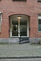
This is a category about rijksmonument number 18558
|
| Address |
|
Media in category "Martinikerkhof 11 (Groningen)"
The following 12 files are in this category, out of 12 total.
-

-

-

-

-

-
 Ingang van pand tegenover parkeergarage - Groningen - 20414349 - RCE.jpg 798 × 1,200; 207 KB
-
 Ingangspartij - Groningen - 20414360 - RCE.jpg 798 × 1,200; 260 KB
-
 Martinikerkhof11 Groningen1.jpg 2,736 × 3,648; 1.12 MB
-
 Martinikerkhof11 Groningen2.jpg 3,648 × 2,736; 1.29 MB
-

-
 Zicht op pand tegenover parkeergarage - Groningen - 20414347 - RCE.jpg 1,200 × 798; 204 KB
-
 Zicht op pand tegenover parkeergarage - Groningen - 20414348 - RCE.jpg 1,200 × 798; 181 KB


