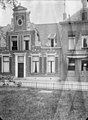
Category:Martinikerkhof 24 (Groningen)
| Object location | | View all coordinates using: OpenStreetMap |
|---|
building in Groningen, Netherlands  | |||||
| Upload media | |||||
| Instance of | |||||
|---|---|---|---|---|---|
| Location | Groningen, Netherlands | ||||
| Street address |
| ||||
| Heritage designation |
| ||||
 | |||||
|
This is a category about rijksmonument number 18563
|
| Address |
|
Media in category "Martinikerkhof 24 (Groningen)"
The following 6 files are in this category, out of 6 total.
-
 Gevel - Groningen - 20094032 - RCE.jpg 788 × 1,200; 187 KB
-
 Interieur - Groningen - 20094035 - RCE.jpg 868 × 1,200; 253 KB
-
 Martinikerkhof24 Groningen.jpg 2,736 × 3,648; 792 KB
-
 Muur - Groningen - 20094033 - RCE.jpg 1,200 × 788; 294 KB
-
 Voorgevel - Groningen - 20094036 - RCE.jpg 878 × 1,200; 319 KB
-
 Voorgevels - Groningen - 20094034 - RCE.jpg 1,200 × 812; 250 KB


