Category:Matamata-Piako District
territorial authority in New Zealand's Waikato region  | |||||
| Upload media | |||||
| Instance of | |||||
|---|---|---|---|---|---|
| Location | Waikato, New Zealand | ||||
| Population |
| ||||
| Area |
| ||||
 | |||||
Subcategories
This category has the following 9 subcategories, out of 9 total.
Media in category "Matamata-Piako District"
The following 9 files are in this category, out of 9 total.
-
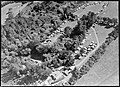 Crystal Springs.jpg 4,776 × 3,480; 3.99 MB
-
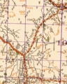 Kiwitahi on 1944 map.png 1,074 × 1,342; 2.84 MB
-
 Matamata-Piako DC.PNG 251 × 376; 23 KB
-
 Matamata-Piako Territorial Authority.png 246 × 352; 5 KB
-
 Okauia (Opal) Springs.jpg 3,050 × 2,134; 2.93 MB
-
 Okauia bridge in 1908.jpg 1,641 × 1,418; 1.29 MB
-
 Okauia Creamery in 1909.jpg 1,000 × 557; 252 KB
-
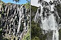 Wairere Falls in April 2010 and May 2023.jpg 2,391 × 1,564; 1.62 MB
-
 Waterhouse Lake Front.jpg 3,264 × 2,448; 4.96 MB


_Springs.jpg)


