Category:Matoya Bay
   | |||||
| Upload media | |||||
| Instance of |
| ||||
|---|---|---|---|---|---|
| Named after |
| ||||
| Location | |||||
| Length |
| ||||
| Coastline |
| ||||
| Area |
| ||||
 | |||||
English: Category for Matoya Bay (Matoya-wan) in Mie Prefecture, Japan
日本語: 三重県・的矢湾に関するカテゴリ
Subcategories
This category has the following 5 subcategories, out of 5 total.
Media in category "Matoya Bay"
The following 12 files are in this category, out of 12 total.
-
 Aerial photograph of Anori district Shima City.jpg 2,501 × 1,873; 1.58 MB
-
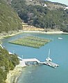
 Anori Gyoko.jpg 1,280 × 960; 403 KB
-
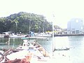
 Matoya Bay 01.jpg 288 × 352; 24 KB
-
 Matoya Bay Aerial photograph taken in 2008.jpg 9,651 × 3,258; 9.41 MB
-
 Matoya Bay Aerial photograph.1975.jpg 11,900 × 3,384; 41.9 MB
-
 Matoya Bay and Shima-spain-mura.JPG 5,184 × 2,560; 3.76 MB
-
 Matoya Bay Bridge s3.JPG 5,184 × 3,200; 6.8 MB
-
 Matoya Bay s2.JPG 5,184 × 3,456; 7.7 MB
-
 Matoya Bay.JPG 5,184 × 3,000; 6.73 MB
-
 Matoya-maru 01.JPG 768 × 347; 47 KB
-
 The map of Matoya Bay.GIF 655 × 469; 13 KB
-
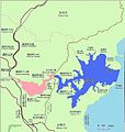 The map of Matoya Bay.jpg 826 × 868; 91 KB


