Category:Matsuura, Nagasaki

city in Nagasaki Prefecture, Japan    | |||||
| Upload media | |||||
| Instance of | |||||
|---|---|---|---|---|---|
| Location | Nagasaki Prefecture, Japan | ||||
| Legal form |
| ||||
| Inception |
| ||||
| Population |
| ||||
| Area |
| ||||
| Replaces |
| ||||
| official website | |||||
 | |||||
Subcategories
This category has the following 6 subcategories, out of 6 total.
Media in category "Matsuura, Nagasaki"
The following 66 files are in this category, out of 66 total.
-
 Aoshima Island and Japan National Route 204 near Matsuura Station.jpg 3,988 × 2,991; 3.16 MB
-
 Cape Kashiwa and Japan National Route 204.jpg 4,032 × 3,024; 3.82 MB
-
 Construction site of Nishi-Kyushu Expressway near Matsuura Station.jpg 4,032 × 3,024; 2.07 MB
-
 E35NishikyushuEXP-TsukinokawaIC.jpg 2,048 × 1,152; 1.54 MB
-
 Emblem of Matsuura, Nagasaki (1955–2006).svg 354 × 354; 4 KB
-
 Emblem of Matsuura, Nagasaki.svg 380 × 382; 4 KB
-
 Flag of Former Matsuura Nagasaki.png 567 × 349; 6 KB
-
 Flag of Matsuura, Nagasaki.jpg 462 × 320; 16 KB
-
 Flag of Matsuura, Nagasaki.svg 324 × 216; 4 KB
-
 Former Matsuura Nagasaki chapter.gif 270 × 260; 5 KB
-
 Imabuku Port from train near Takashimaguchi Station 1.jpg 4,032 × 3,024; 2.94 MB
-
 Imabuku Port from train near Takashimaguchi Station 2.jpg 3,986 × 2,989; 2.04 MB
-
 Imari Bay and Takashima Island from train near Maehama Station 3.jpg 3,995 × 2,996; 2.13 MB
-
 Imari Bay and Takashima Island from train near Maehama Station 4.jpg 4,032 × 3,024; 2.42 MB
-
 Imari Bay and Takashima Island from train near Maehama Station 5.jpg 4,032 × 3,024; 2.33 MB
-
 Imari Bay from train near Maehama Station 2.jpg 3,980 × 2,985; 2.54 MB
-
 Imari Bay from train near Maehama Station 3.jpg 4,013 × 3,010; 2.59 MB
-
 Imari Bay from train near Maehama Station.jpg 4,032 × 3,024; 3.12 MB
-
 Japan National Route 204 and Madarashima Island from train near Higashi-Tabira Station.jpg 3,958 × 2,968; 3.74 MB
-
 Japan National Route 204 near Matsuura Station 2.jpg 4,032 × 3,024; 2.71 MB
-
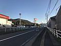
 Japan National Route 204 near Matsuura Station.jpg 4,017 × 3,013; 2.67 MB
-
 Manhole cover of Matsuura, Nagasaki 2.jpg 3,943 × 2,957; 6.36 MB
-
 Manhole cover of Matsuura, Nagasaki 3.jpg 3,871 × 2,903; 6.83 MB
-
 Manhole cover of Matsuura, Nagasaki.jpg 3,972 × 2,979; 5.49 MB
-
 Map Matsuura en.png 1,181 × 701; 37 KB
-
 Matsura bridge.jpg 1,600 × 1,200; 673 KB
-
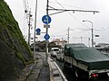
 Matsuura BusCenter.jpg 1,280 × 960; 278 KB
-
 Matsuura city center area Aerial photograph.2012.jpg 6,662 × 4,997; 10.08 MB
-
 Matsuura City Cultural Hall 20190103.jpg 4,032 × 3,024; 3.46 MB
-
 Matsuura City Fire Department.jpg 3,614 × 2,409; 1.4 MB
-
 Matsuura City Martial Arts Arena 20190103.jpg 4,032 × 3,024; 4.34 MB
-
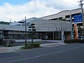
 Matsuura cityhall.jpg 1,280 × 960; 222 KB
-
 Matsuura Fureai Plaza 20190103.jpg 3,989 × 2,992; 3.34 MB
-
 Matsuura in Nagasaki Prefecture Ja.svg 543 × 499; 15 KB
-
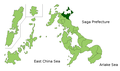 Matsuura in Nagasaki Prefecture.png 1,181 × 701; 38 KB
-
 Matsuura Nagasaki chapter.JPG 250 × 251; 14 KB
-
 Matsuura postoffice.jpg 1,280 × 960; 302 KB
-
 Matsuura Power Station from train near Matsuura-Hatsudensho-mae Station.jpg 3,986 × 2,990; 3.9 MB
-

-

-
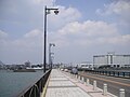
 Matsuura-Ohashi Bridge from east side.jpg 4,032 × 3,024; 2.9 MB
-
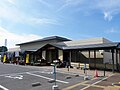 Michinoeki matsuurauminofurusatokan.jpg 1,280 × 960; 231 KB
-
 Mount Furosan from overpass on west side of Matsuura Station.jpg 4,032 × 3,024; 2.98 MB
-
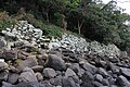 Nigenoura Genko Borui.JPG 5,184 × 3,456; 9.89 MB
-
 NR040end-shisa.jpg 640 × 480; 68 KB
-
 NR144end.jpg 98 × 282; 22 KB
-
 Population distribution of Matsuura, Nagasaki, Japan.svg 512 × 256; 22 KB
-
 Ruins of Kajiya Castle.jpg 2,200 × 1,650; 589 KB
-
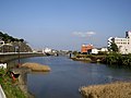
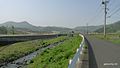
 Shisagawa River from train near Matsuura Station.jpg 4,032 × 3,024; 3.52 MB
-
 Shisagawa0812.jpg 1,200 × 900; 154 KB
-
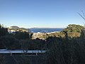 Takashima Island and Matsuura Port from train near Mikuriya Station.jpg 4,032 × 3,024; 2.97 MB
-
 Takashima Island from train near Matsuura-Hatsudensho-mae Station.jpg 4,032 × 3,024; 3.03 MB
-
 Tatsuogawa River and Tatsuobashi Bridge from train near Mikuriya Station.jpg 3,995 × 2,996; 3.16 MB
-
 Tsukinokawagawa River from train near Tsukinokawa Station.jpg 3,966 × 2,974; 2.51 MB
-
 View from train between Nishi-Koba Station and Mikuriya Station.jpg 4,032 × 3,024; 4.08 MB
-
 View of Matsuura Railway from overpass on west side of Matsuura Station.jpg 3,999 × 2,999; 3.57 MB
-
 View of Mount Furosan near Matsuura Station.jpg 4,032 × 3,024; 2.77 MB
-
 View of Takashima Island and Cape Kashiwa from Japan National Route 204.jpg 4,032 × 3,024; 3.34 MB
-
 View of Takashima Island from Japan National Route 204 2.jpg 3,996 × 2,997; 3.24 MB
-
 View of Takashima Island from Japan National Route 204.jpg 4,010 × 3,008; 3.13 MB
-
 一条の滝 - panoramio.jpg 1,806 × 1,200; 812 KB
-
 今福町 - panoramio.jpg 1,600 × 900; 229 KB
-
 御厨今福街道入口 - panoramio.jpg 1,600 × 901; 374 KB
-
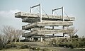 星鹿城山展望台 松浦市 Jan 4, 2020.jpg 1,920 × 1,148; 1.39 MB
-
 松浦市野球場 正面.jpg 5,504 × 3,096; 4.95 MB
-
 龍王の滝 - panoramio.jpg 1,806 × 1,200; 846 KB


.svg)


