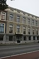
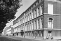
Category:Mauritskade 11, The Hague
| Object location | | View all coordinates using: OpenStreetMap |
|---|
house in The Hague, Netherlands  | |||||
| Upload media | |||||
| Instance of | |||||
|---|---|---|---|---|---|
| Location | The Hague, South Holland, Netherlands | ||||
| Street address |
| ||||
| Located on street | |||||
| Heritage designation |
| ||||
 | |||||
|
This is a category about rijksmonument number 17763
|
| Address |
|
Media in category "Mauritskade 11, The Hague"
The following 3 files are in this category, out of 3 total.
-
 Den Haag - Mauritskade 11.JPG 3,056 × 4,592; 3.43 MB
-
 Den Haag - Mauritskade 9 en 11.JPG 4,592 × 3,056; 4.28 MB
-
 Overzicht - 's-Gravenhage - 20089174 - RCE.jpg 1,200 × 808; 201 KB

