Category:May 2010 in Oxfordshire
Deutsch: Bilder, die im Mai 2010 in Oxfordshire aufgenommen worden sind. Bitte beachten Sie, dass dies weder das Datum des Uploads noch das Datum des Scannens eines Fotos ist.
English: Images/pictures taken in Oxfordshire during May 2010. Note this is not the date of the upload, nor the date a photo was scanned.
Español: Fotografías o imágenes tomadas en Oxfordshire durante mayo 2010. No es la fecha de subida ni escaneo, sino la fecha en que las fotografías o imágenes se crearon.
Esperanto: Bildoj faritaj en Oxfordshire en majo 2010. Tio ne estas la dato, kiam la bildoj estis alŝutitaj aŭ skanitaj.
Français : Photographies ou images prises en Oxfordshire durant mai 2010. Ce n'est pas la date du téléchargement ou du scan.
Galego: Fotografías ou imaxes tomadas en Oxfordshire durante maio 2010. Non é a data de subida nin escaneamento, senón a data na que se crearon as fotografías ou imaxes.
Italiano: Fotografie o immagini scattate a Oxfordshire nel maggio 2010. Nota bene: la data non si riferisce né a quella di upload né a quella in cui la foto è stata digitalizzata.
Norsk bokmål: Bilder tatt i Oxfordshire i løpet av mai 2010. Merk at dette ikke er datoen for opplasting, eller når et bilde har blitt skannet.
Norsk nynorsk: Bilete teke i Oxfordshire i løpet av mai 2010. Merk at dette ikkje er datoen for opplasting, eller når eit bilete har vorte skanna.
Русский: Изображения, сделанные в Oxfordshire в течение май 2010 (не дата загрузки изображения).
Українська: Зображення, зроблені в Oxfordshire протягом травень 2010. Зауважте, що це не дата завантаження чи дата сканування фотографії.
| May 2009 | ← | May 2010 | → | May 2011 | |||||||
| Jan | Feb | Mar | Apr | May | Jun | Jul | Aug | Sep | Oct | Nov | Dec |
| 41 | 39 | 33 | 40 | 61 | 22 | 25 | 54 | 18 | 7 | 6 | 14 |
|---|---|---|---|---|---|---|---|---|---|---|---|
Media in category "May 2010 in Oxfordshire"
The following 61 files are in this category, out of 61 total.
-
 "Churn" at Cleeve Lock - geograph.org.uk - 1889657.jpg 1,796 × 1,502; 385 KB
-
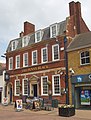 "The Penny Black" public house, Sheep Street, Bicester - geograph.org.uk - 1846294.jpg 1,956 × 2,572; 1.67 MB
-
 1450 Didcot (1).jpg 4,422 × 2,442; 8.93 MB
-
 1450 Didcot (2).jpg 3,744 × 2,274; 6.11 MB
-
 1450 Didcot.jpg 3,198 × 2,634; 6.24 MB
-
 Cherwell Valley Services, M40 - geograph.org.uk - 1859583.jpg 3,488 × 2,616; 2.13 MB
-
-
 Tented Services - geograph.org.uk - 1973014.jpg 640 × 480; 160 KB
-
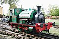
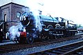 5029 Didcot Railway Centre - 30145399282.jpg 3,900 × 2,600; 5.74 MB
-
 5029 Didcot Railway Centre - 30225857406.jpg 3,597 × 2,400; 5.56 MB
-
 7827 Didcot Railway Centre - 6825276939.jpg 597 × 400; 80 KB
-
 9460 Didcot Railway Centre - 6825275439.jpg 597 × 400; 250 KB
-
 9460 Didcot Railway Centre.jpg 597 × 400; 201 KB
-
 An eight on the Thames - geograph.org.uk - 1907739.jpg 1,500 × 971; 181 KB
-
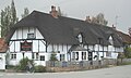
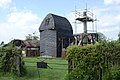
 Arncott Thatch.JPG 2,910 × 1,940; 1.62 MB
-
 Arncott Green Lane.JPG 3,000 × 1,800; 682 KB
-
 Arncott Green.JPG 3,000 × 1,800; 551 KB
-
 Arncott Methodist.JPG 3,000 × 1,800; 2.38 MB
-
 Ashdown House and its south lodge, Lambourn - geograph.org.uk - 1874182.jpg 1,600 × 1,200; 916 KB
-
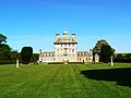 Ashdown House, Lambourn, from Western Avenue - geograph.org.uk - 1874220.jpg 1,600 × 1,200; 905 KB
-
 Benson Lock - geograph.org.uk - 1960076.jpg 1,500 × 989; 231 KB
-
 Blue plaque on the Almshouses - geograph.org.uk - 1885632.jpg 600 × 800; 145 KB
-
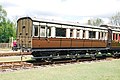
 BR Mk.I BSK No.W35470 (6822559763).jpg 597 × 400; 90 KB
-
 BR Mk.I POS No.80345 (6822559985).jpg 597 × 400; 93 KB
-
 BR Mk.IIIa SLEP No.10509 (6822560475).jpg 597 × 400; 90 KB
-
 Brightwell RedLion.JPG 2,700 × 1,620; 469 KB
-
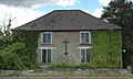
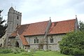
 Brightwell StAgatha exterior.JPG 2,940 × 1,960; 669 KB
-
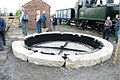 Broad Gauge turntable at Didcot. (6613094553).jpg 597 × 400; 126 KB
-
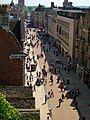
 Broad Street, Banbury - geograph.org.uk - 6117157.jpg 3,456 × 2,592; 3.67 MB
-
 Chinnor 2010.jpg 1,024 × 683; 186 KB
-
 City Sightseeing bus in Oxford, England 13.jpg 2,461 × 1,846; 1.56 MB
-
 City Sightseeing bus in Oxford, England 14 - Parks Road.jpg 3,072 × 2,304; 2.01 MB
-
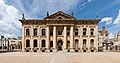 Clarendon Building, Oxford, England - May 2010.jpg 7,181 × 3,792; 8.31 MB
-
 Eagles Close Almshouses - geograph.org.uk - 1885625.jpg 1,024 × 768; 179 KB
-
 Folly Bridge View of downstream River Thames, Oxford - May 2010.jpg 12,421 × 3,998; 16.69 MB
-
 Godstow Abbey - geograph.org.uk - 1907729.jpg 1,500 × 1,000; 244 KB
-
 Godstow Abbey - geograph.org.uk - 1910945.jpg 1,500 × 992; 287 KB
-
 GWR Dean 31 6-wheel Family Saloon No.2511 (6766965631).jpg 597 × 400; 97 KB
-
 GWR Gooch Second Class broad gauge coach (6824560573).jpg 597 × 400; 136 KB
-
 GWR175 Didcot 1 (4582181714).jpg 4,707 × 2,127; 4.9 MB
-
 GWR175 Didcot 2 (4582177986).jpg 4,683 × 2,989; 7.4 MB
-
 Headington StAndrews exterior.JPG 2,925 × 1,950; 675 KB
-

-
 Hugh llewelyn ? (6824562499).jpg 597 × 400; 102 KB
-
 Keble College Oxford University Panorama - May 2010.jpg 8,000 × 2,347; 7.83 MB
-
 LetcombeRegis StAndrew.JPG 2,850 × 1,900; 695 KB
-
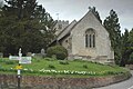
 LittleWittenham StPeter exterior.JPG 2,940 × 1,960; 727 KB
-
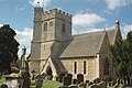
 NorthMoreton AllSaints exterior.JPG 3,000 × 1,800; 536 KB
-
 OS Flush Bracket on Thame Church - geograph.org.uk - 1847843.jpg 1,200 × 1,600; 745 KB
-
 Oxford High Street 01.jpg 1,920 × 2,560; 1.42 MB
-
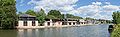 Oxford University College Boat Houses Crop, England - May 2010.jpg 5,520 × 1,707; 3.45 MB
-
 Oxford University College Boat Houses, England - May 2010.jpg 5,520 × 3,015; 5.43 MB
-
 Part timbered house in East Hagbourne - geograph.org.uk - 1887993.jpg 1,500 × 1,000; 224 KB
-
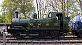
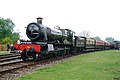
 Robert Stephenson & Hawthorn No.7544 (5656781313).jpg 3,872 × 2,592; 1.81 MB
-
 Robert Stephenson & Hawthorn No.7544 (5656782715).jpg 3,872 × 2,592; 1.75 MB
-
 Rotherfield Greys, Maltsters Arms.JPG 2,667 × 1,665; 1.78 MB
-
 Rowers on Wolvercote Millstream - geograph.org.uk - 1897240.jpg 1,500 × 1,000; 278 KB
-
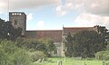
 Thame Church - geograph.org.uk - 1847834.jpg 1,600 × 1,200; 297 KB
-
 Thatched cottage and garden in East Hagbourne - geograph.org.uk - 1888011.jpg 1,500 × 1,000; 328 KB
-
 The Fleur De Lys in East Hagbourne - geograph.org.uk - 1888019.jpg 1,500 × 977; 210 KB
-
 The Miller Of Mansfield in Goring-On-Thames - geograph.org.uk - 1881309.jpg 1,500 × 968; 238 KB


.jpg)
.jpg)


.jpg)
.jpg)
.jpg)


.jpg)


.jpg)
.jpg)
.jpg)
.jpg)


.jpg)


.jpg)
.jpg)


