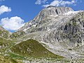
Category:Medelserhütte
| Object location | | View all coordinates using: OpenStreetMap |
|---|
mountain hut  | |||||
| Upload media | |||||
| Instance of | |||||
|---|---|---|---|---|---|
| Location | Grisons, Switzerland | ||||
| Owned by |
| ||||
| Inception |
| ||||
| Mountain range |
| ||||
| Elevation above sea level |
| ||||
| official website | |||||
 | |||||
Media in category "Medelserhütte"
The following 20 files are in this category, out of 20 total.
-
 Fil Liung Fuorcla da Lavaz.jpg 4,000 × 3,000; 4.78 MB
-
 Fil Liung von oberhalb Alp Cuolmet.jpg 4,000 × 3,000; 4.85 MB
-
 Fuorcla la Lavaz Stavelatsch.jpg 4,000 × 3,000; 4.56 MB
-
 Gastraum Medelserhütte 2021.jpg 4,000 × 3,000; 4.48 MB
-
 Hüttenschild Medelserhütte.jpg 4,000 × 3,000; 4.83 MB
-
 Medelserhuette Schlafraum.jpg 2,112 × 2,816; 592 KB
-
 Medelserhuette Speiseraum.jpg 2,816 × 2,112; 567 KB
-
 Medelserhuette Stube.jpg 2,816 × 2,112; 729 KB
-
 Medelserhuette wappen.jpg 2,816 × 2,112; 1.29 MB
-
 Medelserhuette wegweiser.jpg 2,112 × 2,816; 948 KB
-
 Medelserhütte 2021a.jpg 4,000 × 3,000; 4.97 MB
-
 Medelserhütte 2021b.jpg 4,000 × 3,000; 4.97 MB
-
 Medelserhütte 2021c.jpg 4,000 × 3,000; 4.69 MB
-
 Medelserhütte 2524m.jpg 2,816 × 2,112; 915 KB
-
 Medelserhütte Alp Lavaz.jpg 4,000 × 3,000; 5.21 MB
-
 Medelserhütte von oberhalb Alp Cuolmet.jpg 4,000 × 3,000; 4.68 MB
-
 Medelserhütte von Westen 2021.jpg 4,000 × 3,000; 4.76 MB
-
 Medelserhütte von Westen.jpg 4,000 × 3,000; 4.97 MB
-
 Wegweiser Medelserhütte 2021a.jpg 3,000 × 4,000; 4.03 MB
-
 Westlicher Aufstiegsweg zur Camona da Medel. Glatscher da Medel 2021d.jpg 4,000 × 3,000; 4.68 MB


