Category:Melbury Bubb
English: Melbury Bubb is a hamlet in north west Dorset, England, situated on a chalk hill seven miles south of Sherborne. It is just off the road between Dorchester and Yeovil in Somerset. The village has a population of 78 .
hamlet and civil parish in Dorset, England, United Kingdom  | |||||
| Upload media | |||||
| Instance of | |||||
|---|---|---|---|---|---|
| Location |
| ||||
 | |||||
Subcategories
This category has the following 2 subcategories, out of 2 total.
E
- Evershot Tunnel (2 F)
S
Media in category "Melbury Bubb"
The following 50 files are in this category, out of 50 total.
-
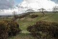 Alder Hill - geograph.org.uk - 5712227.jpg 640 × 427; 68 KB
-
 Batcombe Hill - geograph.org.uk - 912239.jpg 640 × 426; 57 KB
-
 Cottage twixt Holywell and Redford - geograph.org.uk - 405804.jpg 640 × 480; 139 KB
-
 Dorset Countryside in Snow - geograph.org.uk - 1148390.jpg 640 × 428; 40 KB
-
 Farmland at Holywell - geograph.org.uk - 794215.jpg 640 × 426; 83 KB
-
 Farmland at Woolcombe Farm - geograph.org.uk - 794225.jpg 640 × 426; 54 KB
-

-

-
 Flush Bracket, Holywell Bridge - geograph.org.uk - 4446446.jpg 480 × 640; 106 KB
-
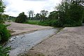 Ford at Woolcombe - geograph.org.uk - 794251.jpg 640 × 426; 90 KB
-
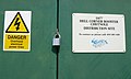 Hell Corner Booster - geograph.org.uk - 794307.jpg 640 × 383; 38 KB
-
 Higher Woolcombe Farm and Pond - geograph.org.uk - 5712228.jpg 640 × 427; 38 KB
-

-
 Lane at Hell Corner (no through road) - geograph.org.uk - 2347051.jpg 1,280 × 960; 467 KB
-

-

-
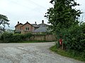
 Melbury Bubb Manor House - geograph.org.uk - 838664.jpg 640 × 392; 309 KB
-

-
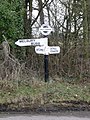 Melbury Bubb, finger-post at Hell Corner - geograph.org.uk - 2244525.jpg 480 × 640; 129 KB
-
 Melbury Bubb, postbox № DT2 106 - geograph.org.uk - 2244534.jpg 480 × 640; 131 KB
-
 Oak Tree near Woolcombe farm - geograph.org.uk - 794236.jpg 640 × 426; 90 KB
-
 Ordnance Survey Flush Bracket (225) - geograph.org.uk - 4935541.jpg 476 × 640; 114 KB
-
 Ordnance Survey Flush Bracket (226) - geograph.org.uk - 4935537.jpg 533 × 640; 71 KB
-
 Rail Cutting north of Holywell - geograph.org.uk - 794210.jpg 640 × 426; 111 KB
-

-

-
 Railway Bridge near Redford - geograph.org.uk - 794228.jpg 426 × 640; 72 KB
-
 Railway Bridge near Redford - geograph.org.uk - 794243.jpg 640 × 426; 119 KB
-
 Redford Farm, Junction with post box - geograph.org.uk - 1848264.jpg 800 × 535; 461 KB
-
 Road to Woolcombe Farm - geograph.org.uk - 794221.jpg 640 × 426; 87 KB
-
 Rush hour in Melbury Bubb - geograph.org.uk - 3123649.jpg 640 × 480; 94 KB
-
 The House at Hell Corner - geograph.org.uk - 5120186.jpg 640 × 480; 97 KB
-
 Too close to be coincidence - geograph.org.uk - 3123601.jpg 640 × 480; 135 KB
-
 Tractor at Hell Corner - geograph.org.uk - 794290.jpg 640 × 426; 87 KB
-
 Trigpoint, Bubb Down Hill - geograph.org.uk - 4317870.jpg 640 × 427; 61 KB
-
 View towards Melbury Bubb - geograph.org.uk - 794903.jpg 640 × 447; 97 KB
-
 Woolcombe Ford - geograph.org.uk - 4874281.jpg 1,600 × 1,067; 1.83 MB
-
 Deer park at Melbury Sampford - geograph.org.uk - 108369.jpg 640 × 431; 223 KB
-
 Drive End Farm - geograph.org.uk - 557123.jpg 640 × 480; 97 KB
-
 Farm track leading to Hazel Farm - geograph.org.uk - 642621.jpg 640 × 480; 94 KB
-
 Field behind the Rest and Welcome Inn - geograph.org.uk - 429105.jpg 640 × 477; 86 KB
-

-
 Fields looking towards Holt Farms - geograph.org.uk - 557131.jpg 640 × 480; 104 KB
-
 Hell Corner Signpost - geograph.org.uk - 405828.jpg 480 × 640; 175 KB
-
 Layby on the A37 near Evershot - geograph.org.uk - 691449.jpg 640 × 480; 72 KB
-
 Lodge at Entrance to Melbury Park - geograph.org.uk - 691435.jpg 640 × 480; 88 KB
-
 Old railway wagon - geograph.org.uk - 438338.jpg 640 × 477; 88 KB
-

-
 Shade for the sheep in Melbury Park - geograph.org.uk - 438396.jpg 640 × 477; 145 KB
-
 The House at Hell Corner - geograph.org.uk - 405823.jpg 640 × 480; 129 KB


_-_geograph.org.uk_-_2347051.jpg)


_-_geograph.org.uk_-_4935541.jpg)
_-_geograph.org.uk_-_4935537.jpg)

_looking_north_from_Melbury_Bubb_-_geograph.org.uk_-_2347043.jpg)
_looking_south_from_Melbury_Bubb_-_geograph.org.uk_-_2347046.jpg)


