Category:Mercer County, West Virginia in the 2000s
Media in category "Mercer County, West Virginia in the 2000s"
The following 61 files are in this category, out of 61 total.
-
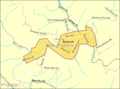
 Athens WV 2009 reference map.png 575 × 425; 26 KB
-

-
 Bluefield WV 2000 Census reference map.png 575 × 425; 49 KB
-
 Bluefield, West Virginia.jpg 2,388 × 1,648; 2.66 MB
-
 Bluefield-WV-chicory.jpg 387 × 516; 140 KB
-
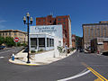 Bluefield-WV-downtown.jpg 515 × 386; 142 KB
-
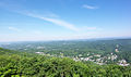 Bluefield-WV-overlook.jpg 515 × 305; 118 KB
-
 Bluestone Wildlife Management Area - Sign-square.jpg 2,592 × 2,592; 1.43 MB
-
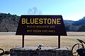 Bluestone Wildlife Management Area - Sign.jpg 3,872 × 2,592; 2.17 MB
-
 Bramwell WestVirginia main street.jpg 1,536 × 1,012; 761 KB
-
 Bramwell WV 2009 reference map.png 575 × 425; 25 KB
-
 Camp Creek State Park-Shay Locomotive Bell-square.jpg 1,929 × 1,928; 1.9 MB
-
 Camp Creek State Park-Shay Locomotive Bell.jpg 2,576 × 1,932; 2.85 MB
-
 Camp creek waterfall.JPG 4,000 × 3,000; 3.15 MB
-
 Camp-creek - West Virginia - ForestWander.jpg 1,209 × 806; 508 KB
-
 Camp-creek-waterfalls - West Virginia - ForestWander.jpg 1,209 × 806; 971 KB
-
 Camp-creek-waterfalls-10 - West Virginia - ForestWander.jpg 1,209 × 806; 268 KB
-
 Camp-creek-waterfalls-2 - West Virginia - ForestWander.jpg 1,209 × 806; 1.15 MB
-
 Camp-creek-waterfalls-2.jpg 1,209 × 806; 1.14 MB
-
 Camp-creek-waterfalls-3 - West Virginia - ForestWander.jpg 1,209 × 806; 352 KB
-
 Camp-creek-waterfalls-4 - West Virginia - ForestWander.jpg 1,209 × 806; 383 KB
-
 Camp-creek-waterfalls-5 - West Virginia - ForestWander.jpg 1,209 × 806; 446 KB
-
 Camp-creek-waterfalls-6 - West Virginia - ForestWander.jpg 1,209 × 806; 507 KB
-
 Camp-creek-waterfalls-7 - West Virginia - ForestWander.jpg 1,209 × 806; 386 KB
-
 Camp-creek-waterfalls-8 - West Virginia - ForestWander.jpg 1,209 × 806; 300 KB
-
 Camp-creek-waterfalls-9 - West Virginia - ForestWander.jpg 1,209 × 806; 351 KB
-
 Camp-creek-waterfalls-spring - West Virginia - ForestWander.jpg 1,209 × 806; 359 KB
-
 Camp-creek-waterfalls-trees-spring - West Virginia - ForestWander.jpg 1,209 × 806; 361 KB
-
 Camp-creek-waterfalls.jpg 1,209 × 806; 963 KB
-
 Concord University entrance from Vermillion St fall.JPG 1,600 × 1,200; 1.25 MB
-
 Concord University Library.jpg 1,600 × 1,200; 929 KB
-
 Concord University Marsh Hall Bell Tower.jpg 1,200 × 1,600; 977 KB
-
 Concord University Mountain Lion.jpg 2,160 × 1,500; 2.92 MB
-
 Concord University Student Center.jpg 2,540 × 1,240; 3.16 MB
-
 ConcordUniv5Dec2009.jpg 640 × 480; 34 KB
-
 ConcordUniversity Entrance Sign.jpg 2,592 × 1,944; 1.82 MB
-
 ConcordUniversityArtBuilding.jpg 2,592 × 1,944; 1.54 MB
-
 ConcordUniversityFootballFieldGame.jpg 2,592 × 1,944; 1.74 MB
-
 ConcordUniversityFrontSign.jpg 4,000 × 3,000; 3.74 MB
-
 ConcordUniversityHistorySign.jpg 4,000 × 3,000; 3.24 MB
-
 ConcordUniversityNorthAndSouthTowers.jpg 2,592 × 1,944; 1.63 MB
-
 ConcordUniversityNorthEnd.jpg 4,000 × 3,000; 3.49 MB
-
 ConcordUniversityScienceBuilding.jpg 4,000 × 3,000; 3.92 MB
-
 ConcordUniversityScienceHallEntrance.jpg 2,592 × 1,944; 1.96 MB
-
 ConcordUniversitySouthEnd.jpg 4,000 × 3,000; 3.64 MB
-
 East River Mountain Tunnel, Wv - panoramio.jpg 3,072 × 2,304; 496 KB
-
 East River Mt Tunnel.JPG 1,080 × 425; 117 KB
-
 Entrance to the East River Mountain Tunnel, Virginia side.jpg 3,264 × 1,852; 4.08 MB
-
 Matoaka, West Virginia.jpg 658 × 522; 151 KB
-
 Mercer County Courthouse West Virginia.jpg 2,856 × 1,811; 1.11 MB
-
 Nick Rayhall Tech Center New Front.JPG 1,600 × 850; 914 KB
-
 Nick Rayhall Tech Center Sign.JPG 1,024 × 768; 259 KB
-
 Pinnacle Rock State Park.jpg 2,048 × 1,451; 890 KB
-
 Pipestem Resort State Park-Lookout Tower.jpg 2,576 × 1,932; 1.63 MB
-
 Princeton West Virginia.jpg 2,856 × 1,490; 1.08 MB
-
 Princeton-WV-TIC.jpg 542 × 293; 119 KB
-
 Rail Road Bridge over Exp Way-77, WV - panoramio.jpg 3,072 × 2,304; 404 KB
-

-
 US-WV - Ada - Sign - North America - Truck - Road Trip - The South (4891424115).jpg 2,601 × 1,942; 4.98 MB
-
 USA Mercer County, West Virginia age pyramid.svg 520 × 600; 7 KB
-
 West Virginia Welcome Center Princeton I-77 US-460.jpg 2,590 × 1,340; 2.63 MB

_(Mercer_County,_West_Virginia,_USA)_2_(17062900988).jpg)


.jpg)
.jpg)

