Category:Mingulay
island in the south of the Outer Hebrides, Scotland, UK   | |||||
| Upload media | |||||
| Instance of | |||||
|---|---|---|---|---|---|
| Part of |
| ||||
| Location |
| ||||
| Located in or next to body of water | |||||
| Owned by | |||||
| Operator | |||||
| Width |
| ||||
| Length |
| ||||
| Population |
| ||||
| Area |
| ||||
| official website | |||||
 | |||||
Subcategories
This category has the following 2 subcategories, out of 2 total.
C
- Càrnan (3 F)
M
- Macphee's Hill (2 F)
Media in category "Mingulay"
The following 111 files are in this category, out of 111 total.
-
 A deep geo splits Mingulay's western rampart - geograph.org.uk - 3534148.jpg 1,024 × 648; 169 KB
-
 A gentler side of Mingulay - geograph.org.uk - 3536582.jpg 1,024 × 682; 105 KB
-
 A long way down - geograph.org.uk - 2062514.jpg 2,448 × 3,264; 1.93 MB
-
 After passing under the natural arch - geograph.org.uk - 1293553.jpg 640 × 480; 64 KB
-
 Bagh na h-Aoineig - geograph.org.uk - 2062505.jpg 2,448 × 3,264; 2.16 MB
-
 Bagh Shuna Dubh, Mingulay - geograph.org.uk - 228978.jpg 427 × 640; 69 KB
-
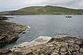 Barra Head Jetty.jpg 640 × 427; 88 KB
-
 Barra Head Lighthouse.jpg 640 × 427; 55 KB
-
 Berneray and Mingulay from the air - geograph.org.uk - 5376402.jpg 3,024 × 2,274; 2.56 MB
-
 Bird cliffs on west side of Mingulay - geograph.org.uk - 119204.jpg 480 × 640; 114 KB
-
 Birdwatching on the Mingulay cliffs - geograph.org.uk - 5275427.jpg 1,600 × 1,067; 607 KB
-
 Bual na Creige, Mingulay - geograph.org.uk - 1032893.jpg 427 × 640; 74 KB
-
 Bual na Creige, Mingulay - geograph.org.uk - 1032895.jpg 427 × 640; 85 KB
-
 Bàgh Mhiùghlaigh and site of village - geograph.org.uk - 1290935.jpg 640 × 480; 71 KB
-
 Carte Mingulay.png 378 × 272; 41 KB
-
 Cave on the islet of Lianamul - geograph.org.uk - 2062452.jpg 2,448 × 3,264; 2.05 MB
-
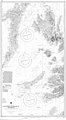 Chart 3674 Southern Approaches to the Minch Scotland.jpg 3,987 × 7,238; 4.72 MB
-
 Cliffs and caves on the Mingulay coast - geograph.org.uk - 2062540.jpg 2,422 × 2,641; 1.49 MB
-
 Cliffs at Rubha Domhain - geograph.org.uk - 2063898.jpg 2,448 × 3,264; 1.38 MB
-
 Cliffs of Mingulay - geograph.org.uk - 2062446.jpg 2,422 × 2,177; 956 KB
-
 Cliffs of Mingulay - geograph.org.uk - 5275419.jpg 1,600 × 1,067; 568 KB
-
 Convoluted coastline - geograph.org.uk - 1290901.jpg 480 × 640; 114 KB
-
 Càrnan Summit Trig, Mingulay-Miùghlaigh - geograph.org.uk - 3980147.jpg 2,560 × 1,920; 2.41 MB
-
 Exposed rock at Rubha an Droma - geograph.org.uk - 1032897.jpg 640 × 427; 115 KB
-
 Flodday - geograph.org.uk - 83696.jpg 640 × 428; 42 KB
-
 Gearuim Mor - geograph.org.uk - 737383.jpg 480 × 640; 91 KB
-
 Geodhachan - geograph.org.uk - 2062564.jpg 1,632 × 2,176; 744 KB
-
 Great Skuas on Mingulay - geograph.org.uk - 3534748.jpg 1,600 × 1,144; 191 KB
-
 Guarsaigh Mòr-Geograph-3536545-by-Alan-Reid.jpg 1,024 × 682; 182 KB
-
 Guarsay Beag on Mingulay - geograph.org.uk - 3534724.jpg 1,024 × 682; 107 KB
-
 Gèarum Beag a rock islet off Mingulay - geograph.org.uk - 3536576.jpg 1,024 × 682; 138 KB
-
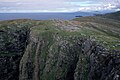
 High ground at the north end of Mingulay - geograph.org.uk - 3534709.jpg 1,024 × 675; 134 KB
-

-
 Kayaking around Mingulay - geograph.org.uk - 1496896.jpg 640 × 423; 58 KB
-
 Looking south to Mingulay - geograph.org.uk - 826421.jpg 640 × 426; 69 KB
-
 Macphee's Hill, Mingulay - geograph.org.uk - 229087.jpg 640 × 427; 65 KB
-
 Mingulay - A narrow gap - geograph.org.uk - 2063906.jpg 2,448 × 3,264; 1.36 MB
-
 Mingulay - Abandoned village - entrance to former dwelling (geograph 6888618).jpg 1,365 × 1,000; 1.2 MB
-
 Mingulay - Abandoned village from the beach (geograph 6890285).jpg 2,057 × 1,000; 1.62 MB
-
 Mingulay - former chapel (geograph 6888924).jpg 1,333 × 1,000; 1.32 MB
-
 Mingulay - former entrance to dwelling (geograph 6888621).jpg 1,000 × 1,333; 1.01 MB
-
 Mingulay - Former school (geograph 6891868).jpg 1,257 × 1,000; 1.27 MB
-
 Mingulay - former school, now NTS base (geograph 6891864).jpg 1,356 × 1,000; 1.35 MB
-
 Mingulay - geograph.org.uk - 233502.jpg 640 × 339; 114 KB
-
 Mingulay - Ruined houses and chapel above the main village (geograph 6891859).jpg 1,333 × 1,000; 1.15 MB
-
 Mingulay - sand-filled ruined house (geograph 6888916).jpg 1,360 × 1,000; 1.15 MB
-
 Mingulay - The abandoned village (geograph 6890287).jpg 1,095 × 1,000; 940 KB
-
 Mingulay Bay - geograph.org.uk - 1032875.jpg 640 × 427; 56 KB
-
 Mingulay Bay - geograph.org.uk - 1032888.jpg 640 × 427; 68 KB
-
 Mingulay Bay - geograph.org.uk - 200361.jpg 640 × 480; 78 KB
-
 Mingulay birds (Paul Store).jpg 640 × 427; 71 KB
-
 Mingulay cliffs - geograph.org.uk - 1032890.jpg 427 × 640; 98 KB
-
 Mingulay graveyard - geograph.org.uk - 2063833.jpg 2,448 × 3,264; 2.3 MB
-
 Mingulay hilltops - geograph.org.uk - 2062510.jpg 3,264 × 2,448; 1.86 MB
-
 Mingulay main settlement from the North - geograph.org.uk - 26394.jpg 640 × 427; 113 KB
-
 Mingulay main settlement from the North.jpg 638 × 424; 381 KB
-
 Mingulay OH.svg 1,083 × 1,424; 2.36 MB
-
 Mingulay Old Mill (Bob Jones).jpg 640 × 427; 106 KB
-
 Mingulay sands (Russel Wills).jpg 640 × 480; 105 KB
-
 Mingulay village.jpg 3,296 × 2,112; 1.24 MB
-
 Na Gilleachan Rudha - geograph.org.uk - 3536535.jpg 1,024 × 658; 109 KB
-
 Natural arch from above - geograph.org.uk - 1290894.jpg 480 × 640; 144 KB
-
 Natural arch Mingulay - geograph.org.uk - 233501.jpg 386 × 640; 71 KB
-
 Natural arch, Gunamul - geograph.org.uk - 2062556.jpg 2,448 × 3,264; 1.25 MB
-
 Natural arch, Mingulay - geograph.org.uk - 228967.jpg 427 × 640; 102 KB
-
 Old fence on Mingulay - geograph.org.uk - 1032892.jpg 427 × 640; 95 KB
-
 Old fields on Mingulay - geograph.org.uk - 2063801.jpg 3,264 × 2,448; 1.73 MB
-
 Old house and enclosure - geograph.org.uk - 2063866.jpg 3,264 × 2,448; 2.29 MB
-
 Old lazy beds - geograph.org.uk - 761542.jpg 640 × 423; 65 KB
-
 Old School house Mingulay.jpg 640 × 427; 107 KB
-
 Old schoolhouse, Mingulay - geograph.org.uk - 2063880.jpg 3,221 × 1,632; 1.15 MB
-
 Ordnance Survey One-Inch Sheet 32 Barra, Published 1959.jpg 8,251 × 9,865; 5.33 MB
-
 Ordnance Survey One-Inch Sheet 33 Barra & Mingulay, Published 1947.jpg 12,221 × 9,659; 7.81 MB
-
 Passage beside Arnamuil and Mingulay - geograph.org.uk - 5275390.jpg 1,600 × 1,067; 622 KB
-
 Passage between Arnamuil and Gunamuil - geograph.org.uk - 5275410.jpg 1,600 × 1,067; 582 KB
-
 Population Mingulay crop.png 1,075 × 315; 28 KB
-
 Priest's House and village bay - geograph.org.uk - 2063789.jpg 2,176 × 1,632; 698 KB
-
 Ready to leave - geograph.org.uk - 2063852.jpg 2,448 × 3,264; 1.27 MB
-
 Red Boy stac, west coast of Mingulay - geograph.org.uk - 200350.jpg 640 × 480; 68 KB
-
 Rubh' a' Charnain, Mingulay - geograph.org.uk - 200369.jpg 640 × 480; 72 KB
-
 Rubha Heacla - geograph.org.uk - 2062567.jpg 3,229 × 1,632; 1,023 KB
-
 Rubha Heacla - geograph.org.uk - 3536587.jpg 1,024 × 682; 111 KB
-
 Ruined Building on Mingulay (Bob Jones).jpg 640 × 427; 79 KB
-
 Ruins of the Chapel House, Mingulay - geograph.org.uk - 2063781.jpg 2,448 × 3,264; 1.73 MB
-
 Sand dunes invade old dwelling - geograph.org.uk - 1032887.jpg 640 × 427; 93 KB
-

-
 Schoolhouse on Mingulay - geograph.org.uk - 761874.jpg 640 × 395; 59 KB
-
 South from Vatersay to Sundray, Pabbay, Mingulay - panoramio.jpg 3,008 × 2,000; 2.63 MB
-
 Southern Mingulay - geograph.org.uk - 233503.jpg 640 × 350; 87 KB
-
 Southern Mingulay - geograph.org.uk - 233504.jpg 640 × 453; 103 KB
-
 Sròn an Dùin - geograph.org.uk - 3536570.jpg 1,024 × 652; 122 KB
-
 Sròn an Dùin, Mingulay - geograph.org.uk - 1033015.jpg 640 × 427; 81 KB
-
 Sròn an Dùin, Mingulay - geograph.org.uk - 1033022.jpg 640 × 427; 75 KB
-
 Summit cairn on Càrnan - geograph.org.uk - 1290879.jpg 640 × 438; 73 KB
-
 Summit of Carnan, Mingulay - geograph.org.uk - 200371.jpg 640 × 480; 89 KB
-
 The channel between Mingulay and Arnamul - geograph.org.uk - 2062551.jpg 2,422 × 2,427; 1.36 MB
-
 The Hoe, Pabbay, Outer Hebrides - geograph.org.uk - 206295.jpg 640 × 419; 50 KB
-
 The ridge to the NW of Mcphees Hill - geograph.org.uk - 26401.jpg 640 × 427; 64 KB
-
 The Schoolhouse Mingulay - geograph.org.uk - 1293577.jpg 640 × 392; 56 KB
-
 The Village and Church, Mingulay - geograph.org.uk - 3072432.jpg 640 × 427; 39 KB
-
 The Western cliffs of Mingulay - geograph.org.uk - 3534129.jpg 1,024 × 682; 150 KB
-
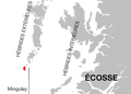
 UK Mingulay.PNG 648 × 584; 19 KB
-
 View south from Heaval.jpg 640 × 480; 66 KB
-
 Village ruins on Mingulay - geograph.org.uk - 2063826.jpg 2,422 × 2,177; 1.27 MB
-
 Village ruins, Mingulay - geograph.org.uk - 2063817.jpg 3,264 × 2,448; 2.08 MB
-
 Wanderings of a naturalist (1921) (14747256811).jpg 1,848 × 1,370; 1.09 MB
-
 West coast of Mingulay - geograph.org.uk - 1033017.jpg 640 × 427; 65 KB
-
 Western Cliffs of Mingulay - geograph.org.uk - 200357.jpg 640 × 480; 72 KB
-
 Western cliffs of Mingulay.jpg 639 × 476; 240 KB
-
 Mingulay looking north - geograph.org.uk - 505883.jpg 438 × 311; 57 KB
-
 View from the boat - geograph.org.uk - 26405.jpg 640 × 427; 97 KB


.jpg)
.jpg)
.jpg)
.jpg)
.jpg)
.jpg)

.jpg)
.jpg)
.jpg)


.jpg)


.jpg)
.jpg)


.jpg)


_(14747256811).jpg)


