Category:Mont Tournier
| Object location | | View all coordinates using: OpenStreetMap |
|---|
mountain in France  | |||||
| Upload media | |||||
| Instance of | |||||
|---|---|---|---|---|---|
| Location | Savoie, Auvergne-Rhône-Alpes, Metropolitan France, France | ||||
| Mountain range | |||||
| Elevation above sea level |
| ||||
 | |||||
Media in category "Mont Tournier"
The following 5 files are in this category, out of 5 total.
-
 Croix de La Dronière - Saint-Maurice-de-Rotherens.jpg 1,920 × 2,560; 2.04 MB
-
 La Broche 733 m la Tour depuis le Rafour.jpg 4,032 × 2,016; 3.06 MB
-
 La Pierre Vire - Saint-Maurice-de-Rotherens.jpg 2,560 × 1,920; 2.27 MB
-
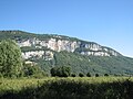 Mont Tournier.jpg 2,816 × 2,112; 3.25 MB
-
 Éclaircies dans les environs de St-Béron (mars 2024).JPG 3,120 × 2,352; 2.88 MB


.JPG)