Category:Morfil
|
Morfil has an entry on OpenStreetMap (show). |
island of Senegal | |||||
| Upload media | |||||
| Instance of | |||||
|---|---|---|---|---|---|
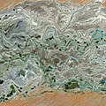
| Location | Podor Department, Saint-Louis, Senegal | ||||
| Located in or next to body of water | |||||
| Capital | |||||
| Area |
| ||||
| Drainage basin | |||||
 | |||||
Subcategories
This category has the following 3 subcategories, out of 3 total.
Media in category "Morfil"
The following 2 files are in this category, out of 2 total.
-
 Morfil.jpg 768 × 434; 111 KB
-
 Senegal River SPOT 1132.jpg 6,000 × 6,000; 39.51 MB

