Category:Moston, Greater Manchester
district of Manchester, England  | |||||
| Upload media | |||||
| Instance of | |||||
|---|---|---|---|---|---|
| Location | Manchester, Greater Manchester, North West England, England | ||||
| Different from | |||||
 | |||||
English: Moston is situated in the Manchester City Council ward of Moston in the City of Manchester
Subcategories
This category has the following 6 subcategories, out of 6 total.
B
- Broadhurst Park (31 F)
M
- Manchester Marl (1 F)
- Moston Brook (49 F)
- Moston railway station (14 F)
Media in category "Moston, Greater Manchester"
The following 54 files are in this category, out of 54 total.
-
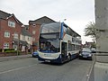 19087 - MX56FUF.jpg 4,608 × 3,456; 6.25 MB
-
 244 Lightbowne Road, Manchester - geograph.org.uk - 2536227.jpg 4,000 × 3,000; 1.58 MB
-
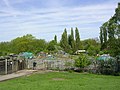 Allotments, near Moston Manchester. - geograph.org.uk - 12766.jpg 640 × 480; 133 KB
-
 An overgrown footpath - geograph.org.uk - 1901994.jpg 3,872 × 2,592; 4.37 MB
-
 Blandford Drive, New Moston - panoramio.jpg 3,072 × 2,304; 1.82 MB
-
 Blue Bell Hotel - geograph.org.uk - 5324314.jpg 4,657 × 2,847; 1.44 MB
-
 Boar Green Close - geograph.org.uk - 5255779.jpg 1,000 × 750; 586 KB
-
 Borland Avenue, New Moston - panoramio.jpg 2,048 × 1,536; 956 KB
-
 Broadway, New Moston - panoramio (1).jpg 4,000 × 3,000; 4.96 MB
-
 Broadway, New Moston - panoramio (2).jpg 4,000 × 3,000; 5.07 MB
-
 Broadway, New Moston - panoramio.jpg 3,072 × 2,304; 1.81 MB
-
 Bus stop on Moston Lane - geograph.org.uk - 5919952.jpg 640 × 480; 98 KB
-
 Cafe Supreme - geograph.org.uk - 4737942.jpg 4,693 × 2,279; 2.05 MB
-
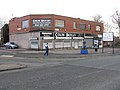
 Convenience store on Moston Lane - geograph.org.uk - 5919880.jpg 640 × 420; 58 KB
-
 Cows grazing - geograph.org.uk - 5486000.jpg 1,280 × 958; 929 KB
-
 Edward VII postbox on Kenyon Lane, Moston, M40 - geograph.org.uk - 5921912.jpg 2,431 × 4,366; 2.74 MB
-
 Entrance to Hanson Gardens - A New Housing Development - geograph.org.uk - 3044131.jpg 4,288 × 3,216; 3.56 MB
-
 Former chemist's, Broadway - geograph.org.uk - 2239311.jpg 2,592 × 1,944; 2.46 MB
-
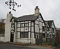
 Former Museum Inn, Moston - geograph.org.uk - 5919893.jpg 640 × 480; 80 KB
-
 Gullane Close, New Moston - geograph.org.uk - 5255789.jpg 1,000 × 750; 544 KB
-
 Heppleton Road, New Moston - panoramio.jpg 4,000 × 3,000; 4.99 MB
-
 Hough Hall Moston.jpg 3,430 × 2,785; 3.37 MB
-
 Hough Hall, Moston, Manchester - geograph.org.uk - 3898212.jpg 3,255 × 2,864; 4.01 MB
-
 Houses on Halliford Road - panoramio.jpg 3,072 × 2,304; 1.81 MB
-
 Joyce Street, Moston, Manchester - geograph.org.uk - 3913590.jpg 4,000 × 3,000; 1.68 MB
-
 Kenyon Lane, Moston - panoramio.jpg 4,000 × 3,000; 4.58 MB
-
 Kenyon Lane, Moston, M40 - geograph.org.uk - 5921913.jpg 4,441 × 2,831; 2.51 MB
-
 Lightbowne Road - Moston - geograph.org.uk - 3044147.jpg 4,288 × 3,216; 3.76 MB
-
 Looking north on Arran Street - geograph.org.uk - 5919888.jpg 640 × 480; 75 KB
-
 Looking west on Moston Lane - geograph.org.uk - 5919883.jpg 640 × 480; 72 KB
-
 Manchester- Broadway Leisure Centre (geograph 2239293).jpg 2,592 × 1,944; 1.9 MB
-
 MHS, New Moston - panoramio.jpg 4,000 × 3,000; 5.37 MB
-
 Moston Cemetery - geograph.org.uk - 1902168.jpg 3,872 × 2,592; 5.35 MB
-
 Moston Cemetery - geograph.org.uk - 4737940.jpg 5,006 × 3,446; 1.77 MB
-
 Moston Cemetery - geograph.org.uk - 5919949.jpg 640 × 480; 136 KB
-
 Myerscroft Close, New Moston - geograph.org.uk - 5409186.jpg 640 × 480; 85 KB
-

-
 Nuthurst Road, New Moston - geograph.org.uk - 5409184.jpg 640 × 481; 75 KB
-
 Off-licence on The Fairway - geograph.org.uk - 5255785.jpg 1,000 × 750; 502 KB
-
 Oscar Street, Moston - panoramio.jpg 3,072 × 2,304; 1.84 MB
-
 Railway bridge over St Mary's Road - geograph.org.uk - 5919873.jpg 640 × 416; 68 KB
-
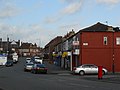
 Shops on Kenyon Lane - geograph.org.uk - 5919878.jpg 640 × 476; 62 KB
-
 Sign for the Blue Bell Hotel, Moston - geograph.org.uk - 5919901.jpg 489 × 640; 84 KB
-

-
 St Mary's Road, Moston - geograph.org.uk - 5409183.jpg 640 × 479; 66 KB
-
 St. Mary's Road, Moston - geograph.org.uk - 3913599.jpg 4,000 × 3,000; 1.17 MB
-
 The Blue Bell Hotel, Moston - geograph.org.uk - 5919898.jpg 640 × 480; 75 KB
-
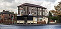
 The Broadway Hotel - geograph.org.uk - 2239398.jpg 2,592 × 1,944; 2.02 MB
-
 The former Dean Brook Inn - geograph.org.uk - 5919876.jpg 640 × 456; 48 KB
-

-
 Thorpebrook Road, Moston - panoramio.jpg 3,072 × 2,304; 1.67 MB
-
 Tomlinson Street, New Moston.jpg 4,608 × 3,456; 6.13 MB
-
 Wildcroft Avenue, Moston - panoramio.jpg 4,000 × 3,000; 5.06 MB
-
 Worsley Avenue, Moston - panoramio.jpg 4,000 × 3,000; 4.91 MB


.jpg)
.jpg)


.jpg)


