Category:Mount Baker
stratovolcano in Washington State, United States   | |||||
| Upload media | |||||
| Instance of | |||||
|---|---|---|---|---|---|
| Part of | |||||
| Named after |
| ||||
| Made from material | |||||
| Located in protected area | |||||
| Location | Whatcom County, Washington, Pacific Northwest, Washington, Pacific States Region | ||||
| Mountain range | |||||
| Topographic prominence |
| ||||
| Topographic isolation |
| ||||
| Elevation above sea level |
| ||||
| Different from | |||||
 | |||||
Subcategories
This category has the following 18 subcategories, out of 18 total.
+
- Mount Baker in art (17 F)
- Panoramics of Mount Baker (10 F)
- Remote views of Mount Baker (34 F)
A
- Artist Point (Washington) (100 F)
B
G
M
S
- Schriebers Meadow Cone (1 F)
- Sherman Crater (5 F)
Media in category "Mount Baker"
The following 200 files are in this category, out of 209 total.
(previous page) (next page)-
 - panoramio (4071).jpg 1,152 × 864; 1.2 MB
-
 7487 copy Sherman Crater from Grant Peak 8-1-04.jpg 572 × 428; 65 KB
-
 A sea of clouds over the Lower Mainland.jpg 4,290 × 2,860; 1.49 MB
-

-
 Along the Ptarmigan Ridge trail…Mt Baker…amazing autumn foliage (8124199305).jpg 2,121 × 1,414; 3.31 MB
-
 Argus - A.Y.P. ed. - Page 35.jpg 5,510 × 4,229; 6.14 MB
-
 Argus - A.Y.P. ed. - Page 42.jpg 4,275 × 5,580; 8.77 MB
-
 Baker Lake from Mount Baker.jpeg 1,322 × 876; 448 KB
-
 Baker81 gas sampling fumarole mount baker 1981 med.jpg 600 × 400; 58 KB
-
 Ballard 07755.JPG 2,107 × 1,580; 522 KB
-

-
-

-
 Beam of Light (2844087031).jpg 1,024 × 683; 550 KB
-
 Bellingham Washington facing west.jpg 1,242 × 909; 810 KB
-
 Bellingham-Mount-Baker.jpg 5,184 × 3,456; 4.41 MB
-
 Black Buttes Lincoln and Colfax.jpg 910 × 572; 328 KB
-
 Black Buttes of Mount Baker.jpeg 1,353 × 894; 808 KB
-
 Bob and Karl descending - Flickr - brewbooks.jpg 3,198 × 2,462; 893 KB
-
 Burnaby bc.jpg 2,543 × 1,267; 667 KB
-
 Citroen near Mt. Baker ca. 1970.jpg 2,725 × 1,633; 1.48 MB
-
 Close Up View of Mt Baker, Mt Baker Snoqualmie National Forest (31270802944).jpg 4,288 × 2,848; 513 KB
-
 Clouds (2844921832).jpg 1,024 × 683; 423 KB
-
 Clouds and Light (2844156041).jpg 1,024 × 505; 339 KB
-
 Conifers with Mount Baker in distance (b1396bc1-0c87-4b64-b1ae-230083ff3b6f).tif 4,693 × 4,612; 42.51 MB
-
 Deception Pass, Whidbey Island 2.jpg 3,264 × 2,448; 2.92 MB
-
 Die Gartenlaube (1885) 618.jpg 3,103 × 4,126; 1.74 MB
-

-

-
 Glacial lake in front of Table Mountain.jpg 3,264 × 2,448; 3.74 MB
-

-
 Glorious Day (2844089373).jpg 1,024 × 585; 577 KB
-

-
 Heliotrope Ridge (15361074733).jpg 4,896 × 3,672; 8.11 MB
-
 Heliotrope Ridge (15793308188).jpg 4,896 × 3,672; 8.12 MB
-
 High Camp (2844990130).jpg 683 × 1,024; 726 KB
-

-

-
 ISS008-E-15493 lrg.jpg 1,000 × 663; 355 KB
-
 Koma Kulshan Project map.jpg 755 × 589; 229 KB
-
 Kulshan Stratovolcano© - Mount Baker Stratovolcano©.jpg 4,320 × 960; 1.21 MB
-

-

-
 Mazamas on Mt. Baker snow fields with The Sisters (Cascades) in the background (3229145499).jpg 5,664 × 4,549; 11.35 MB
-
 Measuring glacial mass balance on Easton Glacier, Washington.jpg 3,456 × 4,608; 2.36 MB
-
 Milky Way at Mt Baker, Mt Baker Snoqualmie National Forest (32068735616).jpg 3,456 × 5,184; 15.25 MB
-
 Moonrise at Mt Baker, Mt Baker Snoqualmie National Forest (24853488064).jpg 4,149 × 2,730; 559 KB
-
 Moonrise over Boulder Ridge on Mt Baker, Mt Baker Snoqualmie National Forest (32069356816).jpg 5,184 × 3,456; 13.54 MB
-
 Mount Baker (104936847).jpg 2,272 × 1,704; 1.74 MB
-
 Mount Baker (iss069e060816).jpg 5,568 × 3,712; 2.8 MB
-
 Mount Baker - Heather Meadows Visitor Center 01.jpg 6,000 × 4,000; 11.44 MB
-
 Mount Baker - Heather Meadows Visitor Center 02.jpg 6,000 × 4,000; 11.39 MB
-
 Mount Baker across lake (2804dac0-85fe-4ba0-aa33-a03dcb03f033).tif 5,989 × 4,746; 162.64 MB
-
 Mount Baker across lake (92510c39-a4d3-4a50-b1b5-57fed30f5c48).tif 1,499 × 2,911; 14.06 MB
-
 Mount Baker across lake (acb816df-34ce-4d6c-8d5d-b691b0419449).tif 5,961 × 4,859; 211.5 MB
-
 Mount Baker across lake (c0ad4ce4-c41d-4bb8-994f-587de0b914c6).tif 1,325 × 1,329; 5.91 MB
-
 Mount Baker alpine lake (20083033158).jpg 3,264 × 1,840; 2.47 MB
-

-
 Mount Baker and part of Ptarmigan Ridge (a458a0b4-8bf2-4df5-9567-093126c4ca3a).tif 8,318 × 6,547; 311.61 MB
-
 Mount Baker and road (beba79d8-bef5-48ca-b44b-8845844a7293).tif 2,833 × 2,254; 10.88 MB
-
 Mount Baker foothills (19648362474).jpg 3,264 × 1,840; 2.5 MB
-
 Mount Baker from Bellhouse Provincial Park, BC.jpg 4,320 × 3,240; 2.62 MB
-
 Mount Baker from Heather Meadows, Mt Baker Snoqualmie National Forest (31736788800).jpg 1,880 × 2,816; 660 KB
-
 Mount Baker from Hovander Homestead Park 01.jpg 6,000 × 4,000; 8.58 MB
-
 Mount Baker from Hovander Homestead Park 02.jpg 6,000 × 4,000; 9.18 MB
-
 Mount Baker from Hovander Homestead Park 03.jpg 6,000 × 4,000; 9.44 MB
-
 Mount Baker from inside Green's Corner (8610853619).jpg 2,304 × 1,728; 989 KB
-

-

-
 Mount Baker from Oak Bay, British Columbia (HS85-10-14463) original.tif 3,975 × 3,463; 40.02 MB
-
 Mount Baker from Oak Bay, British Columbia (HS85-10-14463).jpg 2,468 × 1,920; 4.92 MB
-
 Mount baker from point roberts.jpg 3,072 × 2,048; 5.97 MB
-
 Mount Baker from Point Whitehorn area (34690138182).jpg 2,304 × 1,728; 1.14 MB
-
 Mount Baker from Sauk Mountain, 1956.jpg 1,200 × 812; 102 KB
-
 Mount Baker from Shuksan.jpg 1,127 × 737; 672 KB
-
 Mount Baker from uvic (8365449671).jpg 612 × 612; 127 KB
-
 Mount Baker hazard map-en.svg 4,712 × 3,376; 4.24 MB
-
 Mount Baker hike 01.jpg 6,000 × 4,000; 10.22 MB
-
 Mount Baker hike 02.jpg 6,000 × 4,000; 11.26 MB
-
 Mount Baker hike 03.jpg 6,000 × 4,000; 10.98 MB
-
 Mount Baker hike 04.jpg 6,000 × 4,000; 12.19 MB
-
 Mount Baker hike 05.jpg 6,000 × 4,000; 12.41 MB
-
 Mount Baker Kulshan Glaciers 01 Lidar (52593993526).jpg 10,800 × 10,800; 58.25 MB
-
 Mount Baker Kulshan Glaciers 02 Photo Lidar blend (52594511553).jpg 10,800 × 10,800; 61.01 MB
-
 Mount Baker Kulshan Glaciers 03 Photo (52594511333).jpg 10,800 × 10,800; 67.08 MB
-

-
 Mount Baker reflected in tarn 1991.jpg 827 × 1,076; 660 KB
-
 Mount Baker seen from Keep Kool Butte.jpeg 1,392 × 887; 629 KB
-

-
 Mount Baker Sunrise (4257299687).jpg 4,272 × 2,848; 7.58 MB
-

-
 Mount Baker's Colfax Peak.jpg 2,045 × 1,183; 650 KB
-
 Mount Baker, heather meadows, Coleman Ridge (178d8d7f-19ec-4d8d-ba06-a3d0385620d4).tif 5,974 × 4,803; 164.18 MB
-

-
 Mount Baker, meadow and forest (a1aa3f27-fd10-4421-9bd7-fd240de95241).tif 2,829 × 2,230; 11.02 MB
-
 Mount Baker, meadow and forest (c8c5e6da-db27-4ed8-b6d1-b48d096e690f).tif 2,823 × 2,206; 13.76 MB
-
 Mount Baker, meadow and forest (e8797cbd-6128-44e6-a4fb-a58791e202bc).tif 2,828 × 2,240; 9.85 MB
-
 Mount Baker, the peak (20244803106).jpg 3,264 × 1,840; 2.36 MB
-

-

-
-

-

-

-
-

-

-

-

-

-

-
 Mount Vernon, WA - Little Mountain Park - North Viewpoint - panorama 01.jpg 5,741 × 2,450; 9.18 MB
-
 Mount Vernon, WA - Little Mountain Park - North Viewpoint - view toward Mount Baker 01.jpg 6,000 × 4,000; 12.98 MB
-
 Mountain and Valley.jpg 3,087 × 2,048; 4.61 MB
-
 Mountain lake with Mount Baker in distance (9e1c9cfa-8fb1-48f4-bec4-b54a1c68d37b).tif 1,329 × 1,326; 3.1 MB
-

-
-
-
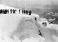
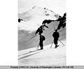
 Mountaineers on Mount Baker, Washington, ca 1925 (WASTATE 1199).jpg 768 × 461; 50 KB
-
-

-
-

-
 MountBaker.jpg 1,512 × 2,016; 1.29 MB
-
 MountBakerfromElkMountain.jpg 3,648 × 2,736; 2.23 MB
-
 Mt Baker & Kilikitat P6180089.jpg 1,600 × 1,200; 580 KB
-
 Mt Baker (3286m) from Austin Pass area - (28758691665).jpg 4,730 × 3,202; 11.32 MB
-
 Mt Baker (Admiralty Point).jpg 1,676 × 990; 1.57 MB
-
 Mt Baker (WASTATE 1636).jpeg 1,000 × 681; 113 KB
-
-

-
 Mt Baker at 130 mm-2.jpg (8124201169).jpg 1,650 × 1,818; 2.03 MB
-
 Mt Baker at Sunset, Mt Baker Snoqualmie National Forest (31297590453).jpg 5,184 × 3,456; 12.2 MB
-
 Mt Baker from Artist Point, Mt Baker Snoqualmie National Forest (24857323393).jpg 2,000 × 1,333; 1.47 MB
-
 Mt Baker from Base of Boulder Ridge, Mt Baker Snoqualmie National Forest (32108509895).jpg 5,184 × 3,456; 11.6 MB
-
 Mt Baker from Burnaby.JPG 2,042 × 1,304; 288 KB
-
 Mt Baker from Ptarmigan Ridge-2.jpg (8124200845).jpg 2,691 × 1,114; 2.43 MB
-

-
-
 Mt Baker Ski Area Chair 5 and Gabl's run.jpg 4,608 × 3,456; 5.12 MB
-
 Mt Baker Summit, Mt Baker Snoqualmie National Forest (31989444941).jpg 5,184 × 3,456; 9.59 MB
-
 Mt Baker Sunset - panoramio.jpg 1,072 × 433; 169 KB
-
 Mt. Baker, Summer 1951 (6478856879).jpg 1,592 × 2,000; 529 KB
-
 Mt.Baker - panoramio.jpg 2,448 × 3,264; 3.01 MB
-
 Mtbaker.jpg 532 × 347; 82 KB
-
 No Name Glacier, west slope of Mount Baker, 1913 (WASTATE 2028).jpeg 768 × 464; 30 KB
-
 Park Butte, Mount Baker NRA.jpg 4,032 × 2,268; 4.01 MB
-
 Polygonia gracilis 3396.JPG 800 × 600; 268 KB
-
 Port Townsend - view from corner of Root & Jackson Streets 02.jpg 4,288 × 2,848; 5 MB
-
 Puget Sound and western Washington; cities-towns-scenery (1912) (14595551359).jpg 3,072 × 1,982; 1.03 MB
-
 Pylon at Hannegan Road near Bellingham, Washington US 2017 A.jpg 2,308 × 1,731; 1.51 MB
-
-
-
 San Juan Island - View from Fourth of July Beach 01.jpg 5,940 × 3,875; 8.69 MB
-
Scenic view from the shore of Baker Lake.ogv 39 s, 720 × 480; 14.37 MB
-
 Schriebers Meadow Cone.jpg 900 × 673; 102 KB
-

-

-
 Shuksan (2844156659).jpg 1,024 × 471; 310 KB
-

-
 Ski slope near Gargoyle Ridge region (4342022348).jpg 723 × 530; 105 KB
-
 Skier on Coleman Glacier, Mount Baker (4322470399).jpg 713 × 516; 115 KB
-
-
 Skyline Sunrise (3186770932).jpg 1,024 × 682; 421 KB
-
 Souvenir Folder of Bellingham, Washington, Mt BAker (NBY 3340).jpg 923 × 616; 137 KB
-
 Sunrise at Mt Baker, Mt Baker Snoqualmie National Forest (31297644193).jpg 5,184 × 3,185; 9.62 MB
-
 Sunrise by Mt Baker, Mt Baker Snoqualmie National Forest (31297568773).jpg 5,184 × 3,456; 11.83 MB
-
 Sunrise on Mount Baker (HS85-10-12228) original.tif 4,125 × 3,476; 41.66 MB
-
 Sunrise on Mount Baker (HS85-10-12228).jpg 2,640 × 2,120; 5.65 MB
-
 Sunset and farm scene north of Custer, WA. (9209715953).jpg 2,304 × 1,728; 952 KB
-
-
 The American annual of photography (1914) (14594144479).jpg 1,352 × 2,006; 727 KB
-
 The natural history of Washington territory (Plate LXX) (7493996286).jpg 1,627 × 1,200; 442 KB
-
 Traffic revision ahead (33053806010).jpg 2,304 × 1,728; 967 KB
-

-

-

-

-

-

-
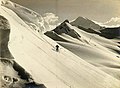
 Two skiers on Mount Baker (511310491).jpg 765 × 630; 135 KB
-
 Untitled - panoramio - Matt Adkins (13).jpg 3,264 × 2,448; 1.69 MB
-
 Untitled - panoramio - Matt Adkins (14).jpg 3,264 × 2,448; 1.63 MB
-
 Untitled - panoramio - Matt Adkins (15).jpg 3,264 × 2,448; 1.58 MB
-
 Vancouver skyline (49108244853).jpg 7,725 × 5,087; 48.88 MB
-
 Vancouver skyline (49108621481).jpg 7,866 × 5,244; 49.1 MB
-
 Vancouver skyline (49108677006).jpg 7,132 × 4,755; 37.19 MB
-
 Vancouver skyline (49108695451).jpg 7,201 × 4,801; 25.71 MB
-
 Vancouver skyline (49108741711).jpg 5,117 × 5,125; 28.41 MB
-
 Vancouver skyline (49108759476).jpg 5,238 × 3,449; 21.96 MB
-
 Vancouver skyline (49108878382).jpg 10,312 × 6,843; 56.47 MB
-
 Vancouver skyline (49108893742).jpg 7,777 × 4,626; 35.9 MB
-
 Vancouver skyline (49108909647).jpg 7,739 × 4,790; 30.74 MB
-
 Vancouver skyline (49108917332).jpg 8,068 × 5,182; 30.47 MB
-
 Vancouver skyline (49108955522).jpg 6,636 × 4,370; 25.17 MB
-
 Vancouver skyline and Mount Baker (49108226623).jpg 7,570 × 5,047; 30.84 MB
-
 Vancouver skyline and Mount Baker (49108604576).jpg 8,674 × 5,003; 45.83 MB
-
 Vancouver skyline and Mount Baker (49108712356).jpg 7,327 × 4,885; 37.71 MB
-
 Vancouver skyline and Mount Baker (49108843947).jpg 8,688 × 5,792; 47.39 MB
-
 View from Cypress Mountain, 1974 05.jpg 3,294 × 2,230; 1.47 MB
.jpg)


.jpg)


.jpeg)
.jpeg)
.jpg)


.jpg)
.jpg)
.jpg)

_618.jpg)
.jpeg)
.jpg)

.jpeg)
.jpg)
.jpeg)
.jpg)
.jpg)
.jpg)
.jpeg)
.jpeg)


_viewing_Mount_Baker,_1909_(WASTATE_2038).jpeg)
_in_the_background_(3229145499).jpg)

.jpg)
.jpg)
.jpg)
.jpg)
.jpg)


.jpg)
.jpeg)
.jpg)

.jpg)


.jpg)
.jpeg)
.jpg)

.jpg)


.jpg)


.jpg)
.jpg)
.jpg)
.jpg)


.jpeg)
.jpg)
.jpeg)

.jpg)


.jpeg)
.jpeg)
.jpeg)
.jpg)
.jpeg)
.jpeg)
.jpeg)
.jpeg)


_from_Austin_Pass_area_-_(28758691665).jpg)
.jpg)
.jpeg)
.jpeg)
.jpg)
.jpg)
.jpg)
.jpg)

.jpg)
.jpg)

.jpg)
.jpg)


.jpeg)


_(14595551359).jpg)

_(14757573604).jpg)


.jpg)
.jpg)
.jpg)
.jpeg)
.jpg)
.jpg)
.jpg)
.jpg)
.jpg)
.jpg)
.jpg)
.jpg)
.jpg)
.jpeg)
_(14594144479).jpg)
_(7493996286).jpg)
.jpg)
_in_Washington,_seemingly_close_behind_the_City_of_Vancouver_with_a_270_mm_lens_-_(19542485785).jpg)
.jpg)
.jpeg)
.jpeg)
.jpg)
.jpg)
.jpg)
.jpg)
.jpg)
.jpg)
.jpg)
.jpg)
.jpg)
.jpg)
.jpg)
.jpg)
.jpg)
.jpg)
.jpg)
.jpg)
.jpg)
.jpg)
.jpg)
.jpg)
.jpg)

.jpeg)
.jpeg)
.jpg)
.jpg)