Category:Mount Miroku
436-metre mountain on the border between Tajimi, Gifu and Kasugai, Aichi in Japan  | |||||
| Upload media | |||||
| Instance of | |||||
|---|---|---|---|---|---|
| Part of |
| ||||
| Located in protected area | |||||
| Location | |||||
| Topographic prominence |
| ||||
 | |||||
English: Mount Miroku (Miroku-yama), a 436.6m mountain on the border of Gifu prefecture and Aichi prefecture, Japan
Subcategories
This category has the following 3 subcategories, out of 3 total.
Media in category "Mount Miroku"
The following 72 files are in this category, out of 72 total.
-
 Azumaya in Mount Miroku.jpg 2,048 × 1,536; 4.65 MB
-
 Chikusuiike - 4.jpg 2,048 × 1,314; 2.28 MB
-
 Chinese character meaning "4" painted on stone.jpg 4,032 × 3,024; 12.65 MB
-
 Chinese character meaning "9" painted on stone.jpg 2,150 × 1,970; 4.08 MB
-
 Chinese character meaning "Water" painted on stone.jpg 2,048 × 2,048; 6.45 MB
-
 Datum point at the top of Mount Miroku - 1.jpg 2,048 × 1,536; 4.12 MB
-
 Datum point at the top of Mount Miroku - 2.jpg 1,536 × 2,048; 3.08 MB
-
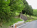
 Entrance gate No.17 of mountain trail of Mount Miroku - 1.jpg 2,048 × 1,536; 5.31 MB
-
 Entrance gate No.17 of mountain trail of Mount Miroku - 2.jpg 2,048 × 1,536; 4.8 MB
-
 Entrance gate No.25 of mountain trail of Mount Miroku.jpg 2,048 × 1,536; 4.5 MB
-
 Entrance of Kasugai Course of Tokai Nature Trail near Utsutsu Pass.jpg 2,048 × 2,048; 5.29 MB
-
 Entrance of mountain trail of Mount Miroku - 2.jpg 2,048 × 1,536; 5.6 MB
-
 Entrance of mountain trail of Mount Miroku.jpg 2,048 × 1,536; 5.78 MB
-
 Fog in forest - 1.jpg 3,024 × 3,024; 10.34 MB
-
 Fog in forest - 2.jpg 3,024 × 4,032; 11.86 MB
-
 Kasugai-sanzan from Observatory in Kasugai Shonen Shizen-no-ie.jpg 3,359 × 1,889; 10.42 MB
-
 Marble in Mount Miroku - 1.jpg 2,048 × 1,536; 5.65 MB
-
 Marble in Mount Miroku - 2.jpg 2,048 × 1,536; 4.21 MB
-
 Marble in Mount Miroku - 3.jpg 2,048 × 1,536; 3.78 MB
-
 Marble in Mount Miroku - 4.jpg 2,048 × 1,537; 3.58 MB
-
 Miyatakiōike - 3.jpg 2,048 × 1,536; 3.15 MB
-
 Mount Miroku and Mount Otani and Owari-hakusan from the top of Hongu.jpg 2,048 × 1,536; 3.92 MB
-
 Mount Miroku and Mount Ōtani from Chikusuiike - 1.jpg 2,048 × 1,152; 1.98 MB
-
 Mount Miroku and Mount Ōtani from Chikusuiike - 2.jpg 2,048 × 1,536; 2.65 MB
-
 Mount Miroku and Mount Ōtani from Chikusuiike - 3.jpg 2,048 × 1,536; 2.71 MB
-
 Mount Miroku from Chikusuiike.jpg 2,048 × 1,536; 3.34 MB
-
 Mount Miroku from Kitatanioike.JPG 5,184 × 3,456; 7.62 MB
-
 Mount Miroku from Miyatakiōike.jpg 1,536 × 2,048; 2.97 MB
-
 Mount Miroku from Mount Hongu.jpg 2,048 × 1,152; 2.75 MB
-
 Mount Nishitakamori and Mount Miroku and Mount Ōtani from Miyatakiōike.jpg 2,048 × 1,152; 2.22 MB
-
 Mountain trail of Mount Miroku - 1.jpg 1,600 × 1,200; 4.25 MB
-
 Mountain trail of Mount Miroku - 2.jpg 1,600 × 1,200; 3.06 MB
-
 Mountain trail of Mount Miroku - 3.jpg 1,600 × 1,200; 3.42 MB
-
 Mountain trail of Mount Miroku - 4.jpg 3,024 × 4,032; 16.42 MB
-
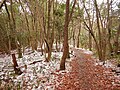
 Mountain trail of Mount Miroku at winter - 1.jpg 4,608 × 3,456; 18.52 MB
-
 Mountain trail of Mount Miroku at winter - 2.jpg 4,608 × 3,456; 18.79 MB
-
 Mountain trail of Mount Miroku at winter - 3.jpg 4,608 × 3,456; 19.02 MB
-
 No.32 direction board of mountain trail of Mount Miroku.jpg 2,048 × 1,536; 5.63 MB
-
 Observatory of Mount Miroku from Miyatakiōike - 1.jpg 2,048 × 1,537; 3.73 MB
-
 Observatory of Mount Miroku from Miyatakiōike - 2.jpg 2,048 × 1,537; 3.64 MB
-
 Observatory on the top of Mount Miroku at winter.jpg 4,608 × 3,456; 14.33 MB
-
 Observatory on top of Mount Miroku - 1.jpg 2,048 × 1,536; 4.22 MB
-
 Observatory on top of Mount Miroku - 2.jpg 2,048 × 1,536; 3.38 MB
-
 Observatory on top of Mount Miroku - 3.jpg 2,048 × 1,536; 3.37 MB
-
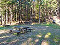 Otani rest station - 1.jpg 2,048 × 1,536; 6.14 MB
-
 Otani rest station - 2.jpg 2,048 × 1,536; 5.21 MB
-
 Panorama view from Observatory in Kasugai Shonen Shizen-no-ie.jpg 16,376 × 3,864; 66.03 MB
-
 Pile showing the boundary between Aichi and Gifu prefectures in Mount Miroku - 1.jpg 2,048 × 1,536; 5.35 MB
-
 Pile showing the boundary between Aichi and Gifu prefectures in Mount Miroku - 2.jpg 1,536 × 2,048; 4.57 MB
-
 Resting place at the top of Mount Miroku - 1.jpg 2,048 × 1,536; 5.49 MB
-
 Resting place at the top of Mount Miroku - 2.jpg 2,048 × 1,536; 4.66 MB
-
 Small shrine at the top of Mount Miroku.jpg 2,048 × 1,536; 4.99 MB
-
 Steep staircase near the top of Mount Miroku.jpg 1,350 × 1,800; 2.95 MB
-
 Top of Mount Miroku - 1.jpg 2,048 × 1,536; 5.17 MB
-
 Top of Mount Miroku - 2.jpg 2,048 × 1,536; 5.29 MB
-
 Top of Mount Miroku - 3.jpg 2,048 × 1,536; 5.16 MB
-
 Top of Mount Miroku - 4.jpg 2,048 × 1,536; 5.37 MB
-
 Top of Mount Miroku - 5.jpg 1,536 × 2,048; 4.99 MB
-
 Ōtani River (Kasugai) - 6.jpg 2,048 × 1,537; 3.59 MB
-
 Ōtani River (Kasugai) - 8.jpg 2,048 × 1,536; 4.14 MB
-
 スズメバチ注意の貼り紙 - 1.jpg 3,024 × 4,032; 9.17 MB
-
 スズメバチ注意の貼り紙 - 2.jpg 3,024 × 4,032; 10.8 MB
-
 スズメバチ注意の貼り紙 - 3.jpg 3,024 × 4,032; 14.14 MB
-
 スズメバチ注意の貼り紙 - 4.jpg 3,024 × 4,032; 13.42 MB
-
 スズメバチ被害防止のため封鎖された弥勒山の登山道 - 1.jpg 4,032 × 3,024; 18.54 MB
-
 スズメバチ被害防止のため封鎖された弥勒山の登山道 - 2.jpg 4,032 × 3,024; 15.41 MB
-
 宮滝大池に反射する春日井三山 - 1.jpg 3,622 × 2,037; 6.42 MB
-
 宮滝大池に反射する春日井三山 - 2.jpg 2,048 × 1,152; 480 KB
-
 宮滝大池に反射する春日井三山 - 3.jpg 4,020 × 3,015; 9.65 MB
-
 弥勒山 from 春日井市廻間町.jpg 2,048 × 1,536; 3.1 MB
-
 杉洞川の源流.jpg 4,608 × 3,456; 19.18 MB
-
 築水の小屋から見た弥勒山と大谷山.jpg 2,048 × 1,536; 3.64 MB


_-_6.jpg)
_-_8.jpg)


