Category:Mountain pass signs in Austria
Media in category "Mountain pass signs in Austria"
The following 68 files are in this category, out of 68 total.
-
 13-Bielerhöhe-S.jpg 4,240 × 2,832; 7.07 MB
-
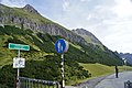
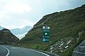
 1773-Flexenpass-N.jpg 6,016 × 3,384; 6.88 MB
-
 1894-Hahntennjoch.jpg 4,240 × 2,832; 4.51 MB
-
 957-Pass Gschütt.jpg 6,016 × 3,384; 3.16 MB
-
 Arlberg Passhöhe 1800 m Austria.jpg 1,888 × 1,479; 434 KB
-
 Bielerhöhe Schild.jpg 2,816 × 2,112; 3.61 MB
-
 Birkfelder Gschaid 06.jpg 3,008 × 2,000; 2.46 MB
-
 Birkfelder Gschaid 12.jpg 1,897 × 2,970; 3.1 MB
-
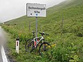
 Buchauer Sattel Passtafel.jpg 3,472 × 4,624; 3.82 MB
-
 Dientner sattel.jpg 640 × 480; 102 KB
-
 Feistritzsattel, Höhentafel.jpg 2,000 × 1,000; 1.06 MB
-
 Fernpass Passhoehe Schild.jpg 1,296 × 1,944; 1.71 MB
-
 Fernpass Schilder.jpg 708 × 446; 183 KB
-
 Fernpasshöhe, het bord van de pas 2012-08-15 11.36.JPG 4,416 × 3,312; 8.84 MB
-
 Filzensattel.jpg 3,072 × 2,304; 2.33 MB
-
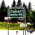 Gaberl 01.jpg 2,418 × 2,406; 5.15 MB
-
 Geiseben 04.jpg 4,928 × 3,264; 8.15 MB
-
 Gerlospass passhoehe blick ost.jpg 1,136 × 852; 383 KB
-
 Gollersattel 02.jpg 6,000 × 4,000; 15.36 MB
-
 Griessenpass, bordje van de pas 2012-08-07 17.55.JPG 3,595 × 2,696; 5.83 MB
-
 Großglockner Hochalpenstraße 21082018 324.jpg 6,000 × 4,000; 8.16 MB
-
 Großglockner Hochalpenstraße 21082018 378.jpg 6,000 × 4,000; 4.63 MB
-
 Hirschbichl 4.jpg 3,456 × 4,608; 3.15 MB
-
 Hochtannberghpass, bordje van de pas 2014-07-26 12.36.jpg 4,416 × 3,312; 16.07 MB
-
 Hochtannbergpass (41240547141).jpg 7,952 × 5,304; 18.61 MB
-
 Iselsbergpass (1204 m ü.A.) Kärnten.jpg 1,500 × 982; 1.06 MB
-
 Katschberghoehe passhoehe schild.jpg 1,944 × 1,296; 1.15 MB
-
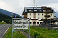
 Klippitztörl Passhöhe 1642 m Seehöhe Bad St.Leonhard, Bezirk Wolfsberg, Kärnten.jpg 4,912 × 2,927; 3.57 MB
-
 Koppenpass.jpg 2,816 × 2,112; 3.66 MB
-
 Kuehtai ostrampe beginn oben.jpg 1,136 × 852; 374 KB
-
 Lahnsattel Jan. 2022.jpg 4,032 × 3,024; 6.24 MB
-
 Lahnsattel Passhöhe.jpg 3,472 × 4,624; 3.65 MB
-
 Lienbachsattel.jpg 640 × 480; 142 KB
-
 Luftpass, Lower Austria.jpg 3,472 × 4,624; 4.88 MB
-
 Niederalpl Passtafel.jpg 3,472 × 4,624; 3.07 MB
-
 Obdacher Sattel.jpg 3,648 × 2,736; 2.82 MB
-
 Orainsattel.jpg 2,816 × 2,112; 3.52 MB
-
 Pass griessen passhoehe blick west.jpg 1,136 × 852; 515 KB
-
 Pass Lueg.jpg 640 × 480; 163 KB
-
 Pass thurn passhoehe blick sued.jpg 1,136 × 852; 342 KB
-
 Passhöhe annaberg.JPG 4,320 × 2,432; 2.76 MB
-
 Passhöhe Josefsberg.JPG 4,320 × 2,432; 2.48 MB
-
 Pavličevo sedlo.JPG 3,281 × 2,736; 3 MB
-
 Pfaffensattel.jpg 2,048 × 1,536; 655 KB
-
 Vizze0.jpg 500 × 375; 66 KB
-
 Preiner gscheid.jpg 2,816 × 2,112; 3.62 MB
-
 Präbichl Passtafel.jpg 3,472 × 4,624; 3.01 MB
-
 Radlpass-6339-1.jpg 5,568 × 3,712; 4.3 MB
-
 Ramssattel Infotafel.jpg 3,472 × 4,624; 3.66 MB
-
 Rechbergpass 01.jpg 4,928 × 3,104; 6.34 MB
-
 Rechbergpass 02.jpg 4,928 × 3,264; 6.42 MB
-
 Schanzsattel 1.jpg 1,905 × 2,860; 3.69 MB
-
 Schanzsattel.jpg 2,816 × 2,112; 3.61 MB
-
 Scharflingerhöhe.jpg 3,168 × 2,376; 3.45 MB
-
 Soelkpass Passhöhe.jpg 2,816 × 2,112; 3.51 MB
-
 Sonnenalpe Nassfeld.jpg 3,264 × 2,448; 3.32 MB
-
 Steirischer Seeberg Passtafel.jpg 3,472 × 4,624; 3.24 MB
-
 Straßegg 01.jpg 4,544 × 3,208; 7.93 MB
-
 Straßegg 02.jpg 4,928 × 3,200; 8.67 MB
-
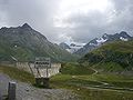
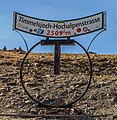 Timmelsjoch IMG 7468.jpg 3,585 × 3,666; 4.53 MB
-
 Triebener Tauern.jpg 640 × 480; 132 KB
-
 Weinebene Landesstraße L148 Passhöhe, 1666 m Seehöhe, Richtung Kärnten.jpg 3,438 × 2,138; 3.03 MB
-
 Weinebene Schilder Kärntner Seite.jpg 2,896 × 1,944; 4.03 MB
-
 Weinebene Wegweiser Ri Kärnten.jpg 1,944 × 2,896; 5.08 MB
-
-
 Windische Höhe.jpg 2,816 × 2,112; 3.69 MB
-
 Wurzenpass, bordje bergpas Wurzenpass 2011-07-18 17.35.jpg 4,416 × 3,312; 6.24 MB
-
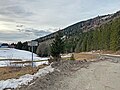
 Zellerrain (1125 m) - Bushaltestelle.jpg 3,655 × 5,482; 13.58 MB


.jpg)
_K%C3%A4rnten.jpg)


_-_Bushaltestelle.jpg)