Category:Mountains of Saga prefecture


Wikimedia category | |||||
| Upload media | |||||
| Instance of | |||||
|---|---|---|---|---|---|
| Category combines topics | |||||
| Saga Prefecture | |||||
prefecture of Japan      | |||||
| Instance of | |||||
| Named after |
| ||||
| Location | Japan | ||||
| Located in or next to body of water | |||||
| Capital | |||||
| Legislative body |
| ||||
| Executive body |
| ||||
| Anthem |
| ||||
| Head of government |
| ||||
| Legal form |
| ||||
| Highest point | |||||
| Population |
| ||||
| Area |
| ||||
| Replaces |
| ||||
| official website | |||||
 | |||||
日本語: 佐賀県の山
English: Mountains of Saga prefecture, Japan
Subcategories
This category has the following 9 subcategories, out of 9 total.
K
- Mount Koshi (Saga) (5 F)
- Mount Kurokami (Saga) (4 F)
M
S
T
- Mount Tara (34 F)
- Mount Ten (Saga) (13 F)
Media in category "Mountains of Saga prefecture"
The following 61 files are in this category, out of 61 total.
-
 1955年 脊振山.png 2,742 × 2,072; 5.48 MB
-
 Botayama Wanpaku Park and Mount Hijiri.jpg 4,400 × 2,200; 3.77 MB
-
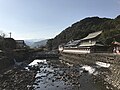
 Gate of Takeo Hot Spring and Mount Sakurayama.jpg 4,032 × 3,024; 2.62 MB
-
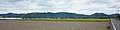
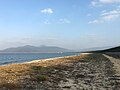 Hamasaki Beach (30683688114).jpg 3,905 × 2,933; 2.14 MB
-
 Hamasaki Beach 20160830-1.jpg 3,194 × 2,395; 2.25 MB
-
 Hata Castle ruin hills and Mount Kishidake.jpg 5,456 × 2,728; 8.25 MB
-
 Joyama Katsunoo Castle and Fort seen from the foot.jpg 5,000 × 2,000; 6.16 MB
-
 Kanayama116.png 640 × 425; 513 KB
-
 Kimpagawa River from Shinkyo Bridge of Yutoku Inari Shrine (south).jpg 3,941 × 2,956; 3.33 MB
-
 Motoyama Bridge of Karatsu Line.jpg 5,448 × 3,632; 11.71 MB
-
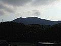
 Mount Asahiyama 20170423.jpg 4,032 × 3,024; 4.12 MB
-
 Mount Asahiyama near Shin-Tosu Station.jpg 3,962 × 2,972; 4.1 MB
-
 Mount Chinzei from Torigoe.jpg 3,600 × 2,400; 2.66 MB
-
 Mount Hachiman from Nishitaku.jpg 5,448 × 3,632; 10.94 MB
-
 Mount Jinnoyama from train of Karatsu Line.jpg 3,162 × 2,372; 2.07 MB
-
 Mount Kishidake from mountain path in Hieda, Kitahata.jpg 5,448 × 3,632; 14.34 MB
-
 Mount Kishima from Fukuda, Shroishi.jpg 5,456 × 1,364; 3.75 MB
-
 Mount Kizan from Kiyama Parking Area.jpg 3,264 × 2,448; 990 KB
-
 Mount Momi-dake village's 100th memorial and Sakura forest.jpg 5,400 × 3,600; 13.55 MB
-
 Mount Obukuma in Saga 2016.JPG 4,400 × 2,200; 3.57 MB
-
 Mount Oninohana peak from Park.jpg 5,448 × 3,632; 10 MB
-
 Mount Oninohana ridge line from Takumachi, Taku.jpg 5,000 × 2,500; 7.85 MB
-
 Mount Onna and Mount Hachiman from Nishitaku.jpg 5,400 × 2,700; 8.77 MB
-
 Mount Onna from Nishitaku.jpg 5,448 × 3,632; 12.16 MB
-
 Mount Tosen from Minami, Gochoda.jpg 4,032 × 2,688; 2.86 MB
-
 Mt. Kyogatake.jpg 1,600 × 1,200; 550 KB
-
 Mt.Kanayama.jpg 3,264 × 2,448; 1.23 MB
-
 Mt.Kokuzou.jpg 1,600 × 1,200; 510 KB
-
 Mt.Sakurei OUCHI-TOWN.jpg 1,297 × 973; 844 KB
-
 Mt.Taradake.jpg 1,600 × 1,200; 758 KB
-
 MtHinokuma Saga Japan 2008.jpg 1,920 × 1,080; 514 KB
-
 Mukaibarugawa River and Mount Asahiyama.jpg 4,013 × 3,010; 4.37 MB
-
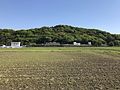
 Paddy fields near Iwaya Station from train of Karatsu Line.jpg 3,264 × 2,448; 1.98 MB
-
 Path for Stele of Ri Sampei 3.jpg 4,032 × 3,024; 4.56 MB
-
 Platform of Hamasaki Station.jpg 3,177 × 2,383; 2.16 MB
-
 Radio stations at the peak of Mount Hachiman, taken from Nishitaku.jpg 5,448 × 3,632; 9.28 MB
-
 Route385 yoshinogari.jpg 1,024 × 768; 484 KB
-
 Saga341 Yamasaki Chogiri Ouchi City.jpg 1,440 × 1,080; 823 KB
-
 Sasebo Line in front of Sueyama Shrine.jpg 3,916 × 2,937; 4.36 MB
-
 Street near Hamasaki Beach.jpg 3,175 × 2,381; 2.38 MB
-
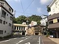 Street view in front of Hotel Nakamasu in Takeo, Saga.jpg 4,009 × 3,007; 3.37 MB
-
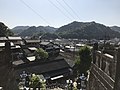
 Takeo basin from Hizen Inuyama Castle.jpg 5,456 × 2,728; 7.18 MB
-
 Taradake Volcano Relief Map, SRTM.jpg 1,500 × 1,500; 1.21 MB
-
 Tokusuegawa River and Mount Yuhiyama from train of Karatsu Line.jpg 3,109 × 2,332; 1.88 MB
-
 Uratagawa River and Mount Asahiyama.jpg 4,007 × 3,005; 4.32 MB
-
 Ushizuegawa River and Mount Futagoyama.jpg 4,032 × 3,024; 2.87 MB
-
 View from Arita Porcelain Park (north).JPG 3,264 × 2,448; 3.38 MB
-
 View from Maizuru Park (Niji no Matsubara and Mount Tomboyama).jpg 3,264 × 2,448; 2.66 MB
-
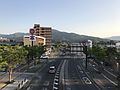
 View from overpass of Arita Station (east).jpg 4,032 × 3,024; 2.63 MB
-
 View from overpass of Hizen-Yamaguchi Station (west) 3.jpg 4,032 × 3,024; 2.93 MB
-
 View from pedway of Imari Station (south).jpg 3,953 × 2,965; 2.95 MB
-
 View from platform of Arita Station.jpg 4,032 × 3,024; 3.71 MB
-
 View from Sueyama Shrine.jpg 4,032 × 3,024; 2.68 MB
-
 View of Arita Town near Stele of Ri Sampei 6.jpg 3,915 × 2,936; 4.87 MB
-
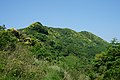
 View of Mount Rengeishiyama near Stele of Ri Sampei.jpg 3,956 × 2,967; 4.68 MB
-
 Wheat fields and Mount Asahiyama.jpg 4,032 × 3,024; 4.15 MB
-
 Yakigome Pond in Kitagata, Takeo and Oninohana-yama.jpg 5,448 × 3,632; 9.16 MB
-
 パノラマ展望岩01.jpg 4,032 × 2,268; 1.69 MB
-
 人生の並木路01.jpg 4,032 × 2,268; 3.95 MB
-
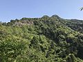
 作礼山01.jpg 5,184 × 3,456; 9.7 MB
-
 作礼山東峰 権現.jpg 5,184 × 3,456; 9.72 MB


.jpg)


.jpg)


.JPG)
.jpg)
.jpg)
_3.jpg)
.jpg)


