Category:Mudflats in Cumbria
Media in category "Mudflats in Cumbria"
The following 17 files are in this category, out of 17 total.
-
 4472 FLYING SCOTSMAN approaches Kents Bank station.jpg 1,024 × 768; 362 KB
-
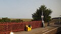
 Kents Bank station 2013 I.jpg 4,288 × 2,416; 2.65 MB
-
 Kents Bank station 2013 II.jpg 4,288 × 2,416; 2.62 MB
-
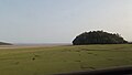
 Mudflats on the south coast of Cumbria 01.JPG 4,288 × 2,416; 2.45 MB
-
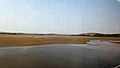
 Mudflats on the south coast of Cumbria 02.JPG 4,288 × 2,416; 2.28 MB
-
 Mudflats on the south coast of Cumbria 03.JPG 4,288 × 2,416; 2.47 MB
-
 Mudflats on the south coast of Cumbria 04.JPG 4,288 × 2,416; 2.93 MB
-
 Mudflats on the south coast of Cumbria 05.JPG 4,288 × 1,780; 1.96 MB
-
 Mudflats on the south coast of Cumbria 06.JPG 4,288 × 2,416; 4.23 MB
-
 Mudflats on the south coast of Cumbria 07.JPG 4,288 × 2,416; 2.61 MB
-
 Ravenglass & Eskdale railway 7.JPG 4,288 × 2,416; 2.57 MB
-
 Scar near Mawbray Bank - geograph.org.uk - 65422.jpg 640 × 480; 82 KB
-
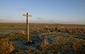 Cumbria Coastal Way - geograph.org.uk - 96670.jpg 640 × 406; 68 KB
-
 Morecambe Bay crossing - geograph.org.uk - 23300.jpg 640 × 411; 13 KB
-
 Morecambe Bay from Kents Bank - geograph.org.uk - 178165.jpg 640 × 480; 102 KB
-
 Plumpton Bight - geograph.org.uk - 190155.jpg 640 × 480; 77 KB
-
 Ulverston sands - geograph.org.uk - 612888.jpg 640 × 429; 90 KB


