Category:Mylor, Cornwall
civil parish in Cornwall, England, United Kingdom | |||||
| Upload media | |||||
| Instance of | |||||
|---|---|---|---|---|---|
| Location | Cornwall, South West England, England | ||||
| Population |
| ||||
 | |||||
Subcategories
This category has the following 7 subcategories, out of 7 total.
Media in category "Mylor, Cornwall"
The following 155 files are in this category, out of 155 total.
-
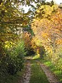
 A39 heading north - geograph.org.uk - 4238718.jpg 640 × 480; 85 KB
-

-
-
 Boat Hoist at Mylor Yacht Harbour - geograph.org.uk - 6624047.jpg 5,152 × 3,864; 2.44 MB
-
 Boat House on the Fal - geograph.org.uk - 2542775.jpg 640 × 480; 171 KB
-
 Boathouse at Greatwood - geograph.org.uk - 1377832.jpg 640 × 427; 89 KB
-
 Broadleaf woodland north of Stockdale - geograph.org.uk - 3215975.jpg 3,648 × 2,048; 2.04 MB
-
 Carclew Road crossroads with Passage Hill - geograph.org.uk - 3216038.jpg 3,113 × 1,963; 1.3 MB
-
 Carclew Road junction with Bell's Hill - geograph.org.uk - 3216019.jpg 2,874 × 2,047; 1 MB
-
 Carclew road junction with road to Perranarworthal - geograph.org.uk - 3215986.jpg 2,879 × 2,047; 1.55 MB
-
 Carclew Road within Mylor Clump - geograph.org.uk - 3216027.jpg 3,648 × 2,048; 1.4 MB
-
 Carrick Roads, Flushing - geograph.org.uk - 5479924.jpg 640 × 481; 479 KB
-

-
 Clock Tower, Mylor Bridge (25398540914).jpg 2,390 × 3,346; 7.99 MB
-
 Coast Path at Penarrow Point - geograph.org.uk - 6624481.jpg 4,847 × 2,868; 3.11 MB
-
 Coast Path beside Carrick Roads - geograph.org.uk - 6624591.jpg 4,739 × 2,907; 2.58 MB
-
 Coastal footpath from Mylor Churchtown - geograph.org.uk - 4638664.jpg 3,264 × 2,448; 2.02 MB
-
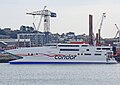 Condor (26011351465).jpg 3,198 × 2,261; 6.02 MB
-
 Cornwall , Country Lane - geograph.org.uk - 5384772.jpg 6,000 × 4,000; 6.85 MB
-
 Cornwall , The A39 - geograph.org.uk - 4611717.jpg 4,288 × 2,848; 5.62 MB
-
 Crowds of boats at Mylor Quay - geograph.org.uk - 5090878.jpg 1,799 × 1,911; 843 KB
-
 Crownick Farm - geograph.org.uk - 1557950.jpg 640 × 426; 124 KB
-

-
 Duck home at Restronguet Quay - geograph.org.uk - 6476263.jpg 2,686 × 2,602; 1.15 MB
-

-
 FH664 (13986301754).jpg 3,139 × 3,075; 7.16 MB
-
 Field of wheat above Trelew - geograph.org.uk - 921841.jpg 427 × 640; 80 KB
-
 Flushing from Falmouth, 1971 - geograph.org.uk - 2130722.jpg 640 × 428; 81 KB
-

-
 Flushing waterfront - geograph.org.uk - 2211602.jpg 640 × 480; 74 KB
-
 Flushing, Kiln Quay - geograph.org.uk - 5479927.jpg 640 × 480; 526 KB
-
 Footpath from Mylor Churchtown - geograph.org.uk - 4638639.jpg 2,448 × 3,264; 2.05 MB
-
 Footpath to Mylor - geograph.org.uk - 304865.jpg 640 × 427; 45 KB
-
 Footpath to Mylor - geograph.org.uk - 304866.jpg 640 × 427; 57 KB
-
 From the Quay at Mylor Churchtown - geograph.org.uk - 6624039.jpg 5,152 × 3,864; 3.38 MB
-
 Greatwood (26002543760).jpg 3,334 × 2,381; 6.73 MB
-
 Greatwood (28411744053).jpg 2,667 × 1,778; 4.14 MB
-
 Greatwood (29169640971).jpg 2,049 × 2,869; 5.27 MB
-
 Greatwood boathouse - geograph.org.uk - 4077740.jpg 767 × 431; 206 KB
-
 Greatwood Quay - geograph.org.uk - 780956.jpg 640 × 357; 69 KB
-
 Greatwood, Mylor - geograph.org.uk - 780346.jpg 640 × 375; 60 KB
-
 High Tide at Penarrow Point - geograph.org.uk - 6624065.jpg 4,848 × 3,395; 3.68 MB
-
 Houses in Flushing - geograph.org.uk - 1957734.jpg 640 × 426; 72 KB
-
 Houses near Weir Point - geograph.org.uk - 4433763.jpg 1,600 × 1,062; 551 KB
-
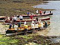 Launching pilot gigs, Flushing Beach - geograph.org.uk - 459478.jpg 640 × 480; 164 KB
-
 Lych Gate, Mylor Church - geograph.org.uk - 4556068.jpg 3,264 × 2,448; 3.51 MB
-
 Milestone (4269546988).jpg 1,572 × 2,358; 3.96 MB
-
 Moorings at Mylor Yacht Harbour - geograph.org.uk - 6624044.jpg 4,885 × 3,632; 2.69 MB
-
 Mylor (25875593681).jpg 3,804 × 2,536; 7.95 MB
-
 Mylor (26013209915).jpg 3,982 × 2,655; 8.35 MB
-
 Mylor (26203856232).jpg 3,573 × 2,010; 5.66 MB
-
 Mylor (26279413962).jpg 4,000 × 2,248; 7.38 MB
-
 Mylor (26395426265).jpg 3,396 × 2,912; 7.53 MB
-
 Mylor (28389706584).jpg 2,752 × 2,202; 5.55 MB
-
 Mylor (28723407510).jpg 3,793 × 3,034; 7.53 MB
-
 Mylor (28926529262).jpg 4,108 × 1,786; 6.4 MB
-
 Mylor (31860552170).jpg 3,340 × 2,672; 7.19 MB
-
 Mylor Church, Mylor Churchtown - geograph.org.uk - 4556047.jpg 3,264 × 2,448; 3.32 MB
-
 Mylor Creek - panoramio.jpg 1,112 × 1,569; 480 KB
-
 Mylor Harbour - geograph.org.uk - 6432196.jpg 1,200 × 814; 1.04 MB
-
 Mylor Quay, One of many sparrows here - geograph.org.uk - 4992358.jpg 2,452 × 1,639; 2.56 MB
-
 Mylor War Memorial - geograph.org.uk - 2022658.jpg 800 × 600; 474 KB
-
 Mylor War Memorial - geograph.org.uk - 4994591.jpg 3,470 × 3,264; 7.34 MB
-
 Mylor War Memorial and Church - geograph.org.uk - 2022668.jpg 800 × 600; 437 KB
-
 Mylor Yacht Harbour (official designation) - geograph.org.uk - 4994616.jpg 3,678 × 2,456; 4.78 MB
-
 Mylor Yacht Harbour (official designation) - geograph.org.uk - 4994619.jpg 3,678 × 2,456; 4.4 MB
-
 Mylor Yacht Harbour - geograph.org.uk - 1957722.jpg 640 × 426; 60 KB
-
 Mylor Yacht Harbour - geograph.org.uk - 2022624.jpg 800 × 600; 293 KB
-
 Mylor Yacht Harbour - geograph.org.uk - 2022692.jpg 800 × 600; 259 KB
-
 Mylor Yacht Harbour - geograph.org.uk - 4994613.jpg 3,678 × 2,456; 4.33 MB
-
 Mylor, "Show me the way to go home" - geograph.org.uk - 4992354.jpg 3,679 × 2,456; 3.78 MB
-
 Mylor, Cafe Mylor - geograph.org.uk - 4994614.jpg 5,520 × 3,680; 7.62 MB
-
 Mylor, Dinghy storage rack - geograph.org.uk - 4992343.jpg 3,678 × 2,455; 5.06 MB
-
 Mylor, St. Mylor Church - geograph.org.uk - 4994583.jpg 640 × 427; 85 KB
-
 Mylor, St. Mylor Church - geograph.org.uk - 4994584.jpg 3,582 × 2,294; 4.75 MB
-
 Mylor, St. Mylor Church and detached ancient belfry - geograph.org.uk - 4994593.jpg 3,855 × 2,559; 5.36 MB
-
 Mylor, St. Mylor Church and detached ancient belfry - geograph.org.uk - 4994596.jpg 3,678 × 2,456; 4.74 MB
-

-

-

-

-
 Mylor, St. Mylor Church, South porch exterior carving detail - geograph.org.uk - 4994598.jpg 3,678 × 2,455; 5.57 MB
-
 Mylor, St. Mylor Church, southern aspect - geograph.org.uk - 4994597.jpg 3,679 × 2,456; 4.85 MB
-
 Mylor, Telephone box by St. Mylor Church entrance - geograph.org.uk - 4994622.jpg 3,678 × 2,456; 5.49 MB
-
 Mylor, The Ganges Memorial - geograph.org.uk - 4992334.jpg 4,102 × 2,711; 5.88 MB
-
 Mylor, The St. Mylor churchyard robin - geograph.org.uk - 4992320.jpg 3,678 × 2,456; 4.47 MB
-
 New Quay House, Flushing - geograph.org.uk - 4552774.jpg 3,264 × 2,448; 2.49 MB
-
 North Quay House (4518213149).jpg 2,220 × 1,603; 3.02 MB
-
 Old AA Sign on Comfort Road, Mylor Bridge - geograph.org.uk - 6077228.jpg 1,177 × 1,098; 492 KB
-

-

-

-

-
 Old Direction Signpost by Rosehill, Mylor Bridge - geograph.org.uk - 6701934.jpg 1,024 × 689; 258 KB
-
 Old Direction Signpost, Mylor Bridge - geograph.org.uk - 6701947.jpg 1,024 × 768; 310 KB
-
 Old Milestone by Tregew Road - geograph.org.uk - 5623461.jpg 480 × 640; 185 KB
-
 Old Milestone north of Flushing - geograph.org.uk - 5623462.jpg 480 × 640; 177 KB
-

-
 Path (3867706919).jpg 1,712 × 2,560; 4.39 MB
-
 Path between Mylor and Flushing (29123268780).jpg 4,000 × 2,672; 8.34 MB
-
 Penryn River (4268797263).jpg 2,560 × 1,440; 3.55 MB
-
 Penryn River (4269543584).jpg 2,516 × 1,677; 3.68 MB
-
 Poached Egg (4518152271).jpg 2,471 × 1,589; 4.29 MB
-
 Precipitous Steps at Flushing Quay (3195047818).jpg 1,712 × 2,560; 3.74 MB
-
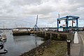
 Quay Road - geograph.org.uk - 6432199.jpg 1,200 × 800; 1,000 KB
-
 Rainbow over Flushing, Cornwall - geograph.org.uk - 5316032.jpg 700 × 1,050; 513 KB
-
 Restonguet Creek - geograph.org.uk - 5090885.jpg 2,592 × 1,944; 1,001 KB
-
 Restonguet Creek, Devoran, Feock - geograph.org.uk - 6156147.jpg 1,024 × 768; 185 KB
-
 Restronguet Creek - geograph.org.uk - 2032181.jpg 640 × 433; 82 KB
-
 Restronguet Creek - geograph.org.uk - 3538626.jpg 640 × 367; 58 KB
-
 Restronguet Creek - geograph.org.uk - 6432201.jpg 1,200 × 803; 1.18 MB
-
 Restronguet Creek from Restronguet Point - geograph.org.uk - 3217215.jpg 3,648 × 2,048; 1.93 MB
-
 Restronguet Creek, Feock - geograph.org.uk - 6144430.jpg 1,024 × 768; 260 KB
-
 Restronguet Tidal Ford - geograph.org.uk - 4682698.jpg 6,000 × 4,000; 6.38 MB
-
 River Kennall - geograph.org.uk - 4238738.jpg 640 × 480; 72 KB
-
 Riverside houses near Flushing - geograph.org.uk - 4433850.jpg 1,600 × 1,062; 549 KB
-
 Road Junction south of Mylor Bridge - geograph.org.uk - 850151.jpg 640 × 427; 116 KB
-
 Roadside monument at Restronguet - geograph.org.uk - 1042499.jpg 640 × 480; 131 KB
-
 Rough grazing towards woodland - geograph.org.uk - 4238742.jpg 640 × 480; 47 KB
-
 Sad Boat at Sailor's Creek on the Penryn River (6056187178).jpg 2,667 × 4,000; 10.04 MB
-
 Sailors Creek across the Penryn River - geograph.org.uk - 3185193.jpg 3,648 × 2,736; 1.5 MB
-
 Seven Stars, Flushing - geograph.org.uk - 4552776.jpg 3,264 × 2,448; 2.18 MB
-
 Shore and Path to Penarrow Point - geograph.org.uk - 2022696.jpg 800 × 600; 358 KB
-
 Slope down to the Sea - geograph.org.uk - 6624460.jpg 5,152 × 3,864; 4.35 MB
-
 St Mylor Church - geograph.org.uk - 2022627.jpg 800 × 600; 310 KB
-
 St Mylor Church - geograph.org.uk - 2022634.jpg 800 × 600; 407 KB
-
 St Mylor Church - geograph.org.uk - 2022712.jpg 800 × 600; 420 KB
-
 St Mylor Church - geograph.org.uk - 2032187.jpg 640 × 433; 93 KB
-
 Still fields of corn to harvest - geograph.org.uk - 1479283.jpg 640 × 427; 74 KB
-
 Summer flowers and boats at Mylor - geograph.org.uk - 6634255.jpg 1,600 × 1,200; 662 KB
-
 The A39 - geograph.org.uk - 4179177.jpg 3,239 × 2,256; 3.35 MB
-

-
 The Quay at Mylor Churchtown - geograph.org.uk - 2022618.jpg 800 × 600; 293 KB
-
 The Red Arrows - geograph.org.uk - 2017884.jpg 427 × 640; 47 KB
-
 The Red Arrows above Trefusis - geograph.org.uk - 4127889.jpg 479 × 640; 24 KB
-
 The Red Arrows above Trefusis Point - geograph.org.uk - 2556395.jpg 640 × 480; 56 KB
-
 The Red Arrows above Trefusis Point - geograph.org.uk - 4128381.jpg 479 × 640; 43 KB
-
 To us they're dead - but now they live with THEE (26282904132).jpg 2,118 × 3,530; 8.26 MB
-
 Towards Falmouth Docks from Trefusis Point - geograph.org.uk - 6624529.jpg 1,600 × 1,128; 547 KB
-
 Tree carvings 1996 - geograph.org.uk - 6476302.jpg 2,736 × 3,222; 3.46 MB
-
 Trees (26349124705).jpg 3,406 × 2,433; 8.06 MB
-
 Trefusis Barton - geograph.org.uk - 6500175.jpg 1,024 × 768; 103 KB
-
 Tregew - geograph.org.uk - 2022764.jpg 800 × 600; 344 KB
-
 Tregew Farm - geograph.org.uk - 2022775.jpg 800 × 600; 209 KB
-
 Tregoweth farmhouse - geograph.org.uk - 1069107.jpg 480 × 640; 56 KB
-
 Tregunwith - geograph.org.uk - 6476298.jpg 2,736 × 3,048; 2.76 MB
-
 Tregunwith wood - geograph.org.uk - 6476286.jpg 2,736 × 3,648; 4.11 MB
-
 Unnamed lane junction with Carclew Road - geograph.org.uk - 3216009.jpg 3,648 × 2,048; 1.61 MB
-
 Unnamed lane north of Tregarthen - geograph.org.uk - 3215999.jpg 3,648 × 2,048; 1.92 MB
-
 Unnamed road north of Poplar Farm - geograph.org.uk - 3215963.jpg 2,910 × 2,048; 1.19 MB
-
 View of Flushing from the Greenbanks Hotel - geograph.org.uk - 6413961.jpg 1,024 × 768; 180 KB
-
 View over Carrick Roads - geograph.org.uk - 6624588.jpg 5,152 × 3,206; 3.79 MB
-
 Waterfront in Flushing - geograph.org.uk - 1960195.jpg 640 × 426; 66 KB
-
 Weir. Restronguet Passage - geograph.org.uk - 1375339.jpg 640 × 427; 221 KB
-
 West boundary marker Falmouth Harbour - geograph.org.uk - 2542767.jpg 640 × 480; 170 KB


.jpg)


.jpg)


.jpg)


.jpg)


.jpg)
.jpg)
.jpg)


.jpg)

.jpg)
.jpg)
.jpg)
.jpg)
.jpg)
.jpg)
.jpg)
.jpg)
.jpg)


_-_geograph.org.uk_-_4994616.jpg)
_-_geograph.org.uk_-_4994619.jpg)


.jpg)

.jpg)


.jpg)
.jpg)
.jpg)
.jpg)
.jpg)
.jpg)


.jpg)


_in_the_Falmouth_Estuary_-_geograph.org.uk_-_601291.jpg)


.jpg)


.jpg)


