Category:Nanpean
village in United Kingdom  Nanpean Church - geograph.org.uk - 81160.jpg | |||||
| Upload media | |||||
| Instance of | |||||
|---|---|---|---|---|---|
| Location | St Stephen-in-Brannel, Cornwall, South West England, England | ||||
| Elevation above sea level |
| ||||
 | |||||
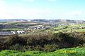
English: Nanpean (known locally as 'Namps') is a village and parish in mid-Cornwall, in England, UK. The village is on the B3279 road linking Newquay and St Austell. It is at the centre of the china clay district which encouraged the growth of the village to the present population of over 1,300. The principal villages of the parish are the Churchtown, Whitemoor, Currian and St. Stephen.
Subcategories
This category has the following 3 subcategories, out of 3 total.
Media in category "Nanpean"
The following 24 files are in this category, out of 24 total.
-
 Blackpool Pit - geograph.org.uk - 574494.jpg 640 × 257; 35 KB
-
 Derelict Buildings, Nanpean - geograph.org.uk - 81167.jpg 640 × 426; 119 KB
-

-
 Goonvean Cornish engine house - geograph.org.uk - 629782.jpg 428 × 640; 69 KB
-
 Inverness to Kyle Parkandillack37186187191183 (16928276465).jpg 3,747 × 1,601; 3.96 MB
-
 Inverness to Kyle Parkandillack37186191183 (16742081559).jpg 2,353 × 2,549; 3.59 MB
-
 Inverness to Kyle Parkandillack37187191183A (16742073239).jpg 3,647 × 1,645; 3.81 MB
-
 Loading Clay for Cliffe Vale - geograph.org.uk - 763288.jpg 640 × 477; 88 KB
-
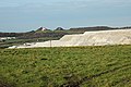
 New China Clay Spoil Heap - geograph.org.uk - 81152.jpg 640 × 415; 81 KB
-

-
 Railway through the China Clay Works - geograph.org.uk - 228834.jpg 640 × 427; 107 KB
-
 Shunting the clay wagons - geograph.org.uk - 1039455.jpg 640 × 392; 72 KB
-
 Waste Tips and Pasture - geograph.org.uk - 432176.jpg 640 × 426; 88 KB
-
 Cleers Hill - geograph.org.uk - 342757.jpg 640 × 427; 85 KB
-
 Cornish engine, Goonvean - geograph.org.uk - 629788.jpg 419 × 640; 81 KB
-
 Country Lane near Carloggas - geograph.org.uk - 432519.jpg 640 × 426; 130 KB
-
 Foxhole - geograph.org.uk - 288575.jpg 640 × 427; 87 KB
-
 Goonvean China Clay works - geograph.org.uk - 478355.jpg 640 × 429; 51 KB
-
 Goonvean Cornish engine house - geograph.org.uk - 629801.jpg 429 × 640; 85 KB
-
 Moonshine Barn - geograph.org.uk - 432338.jpg 640 × 426; 110 KB
-
 Nanpean Primary School - geograph.org.uk - 432257.jpg 640 × 426; 71 KB
-
 Roadside House at Goonamarris - geograph.org.uk - 432323.jpg 640 × 426; 84 KB
-

-
 The Valley at Foxhole - geograph.org.uk - 432150.jpg 640 × 426; 124 KB


.jpg)
.jpg)
.jpg)


