Category:National Cycle Network route 27

English cycling route  | |||||
| Upload media | |||||
| Instance of | |||||
|---|---|---|---|---|---|
| Part of | |||||
| Location | Devon, South West England, England | ||||
| Length |
| ||||
| official website | |||||
 | |||||
Subcategories
This category has the following 3 subcategories, out of 3 total.
D
G
Media in category "National Cycle Network route 27"
The following 13 files are in this category, out of 13 total.
-

-
 Downhill on route 27 - geograph.org.uk - 874988.jpg 640 × 427; 83 KB
-
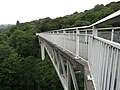
 Gem Bridge (1).jpg 5,152 × 3,864; 10.47 MB
-
 Gem Bridge (2).jpg 5,152 × 3,864; 9.2 MB
-
 Gem Bridge (3).jpg 3,864 × 5,152; 3.52 MB
-
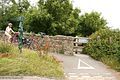
 National Cycle Route 27 at Bickenbridge - geograph.org.uk - 1345165.jpg 640 × 480; 168 KB
-
 NCN 27 - geograph.org.uk - 421211.jpg 640 × 480; 117 KB
-
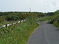
 NCN cycleway 27 at Youlditch Farm - geograph.org.uk - 595947.jpg 640 × 480; 112 KB
-
 Route 27 - geograph.org.uk - 874998.jpg 640 × 427; 118 KB
-
 Route 27 - geograph.org.uk - 875053.jpg 640 × 427; 89 KB
-
 Slade Valley, near Ilfracombe Devon - geograph.org.uk - 42682.jpg 640 × 427; 119 KB
-
 Tarka Trail, Lambert Moor - geograph.org.uk - 71788.jpg 480 × 640; 75 KB
-
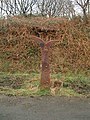
 Village signpost - geograph.org.uk - 1733445.jpg 640 × 480; 87 KB


.jpg)
.jpg)
.jpg)


