Category:National Register of Historic Places in Campbell County, Virginia
Counties of Virginia: Accomack · Albemarle · Alleghany · Amelia · Amherst · Appomattox · Arlington · Augusta · Bath · Bedford · Bland · Botetourt · Brunswick · Buchanan · Buckingham · Campbell · Caroline · Carroll · Charles City · Charlotte · Chesterfield · Clarke · Craig · Culpeper · Cumberland · Dickenson · Dinwiddie · Essex · Fairfax · Fauquier · Floyd · Fluvanna · Franklin · Frederick · Giles · Gloucester · Goochland · Grayson · Greene · Greensville · Halifax · Hanover · Henrico · Henry · Highland · Isle of Wight · James City · King and Queen · King George · King William · Lancaster · Lee · Loudoun · Louisa · Lunenburg · Madison · Mathews · Mecklenburg · Middlesex · Montgomery · Nelson · New Kent · Northampton · Northumberland · Nottoway · Orange · Page · Patrick · Pittsylvania · Powhatan · Prince Edward · Prince George · Prince William · Pulaski · Rappahannock · Richmond · Roanoke · Rockbridge · Rockingham · Russell · Scott · Shenandoah · Smyth · Southampton · Spotsylvania · Stafford · Surry · Sussex · Tazewell · Warren · Washington · Westmoreland · Wise · Wythe · York
Wikimedia category | |||||
| Upload media | |||||
| Instance of | |||||
|---|---|---|---|---|---|
| |||||
Subcategories
This category has the following 3 subcategories, out of 3 total.
Media in category "National Register of Historic Places in Campbell County, Virginia"
The following 13 files are in this category, out of 13 total.
-
 Blenheim driveway entrance.jpg 6,016 × 4,000; 6.45 MB
-
 Broad Street Altavista (3458022530).jpg 3,456 × 2,074; 4.09 MB
-
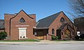
 Campbell County Training School.jpg 6,016 × 4,000; 6.19 MB
-
 Campbell County VA courthouse.jpg 1,024 × 768; 611 KB
-
 Caryswood driveway.jpg 6,016 × 4,000; 6.32 MB
-
 Federal Hill woodlands.jpg 6,016 × 4,000; 6.51 MB
-
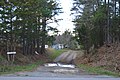
 Lawyers Road at Walnut Hill farmstead.jpg 6,016 × 4,000; 6.95 MB
-
 Mount Athos near Lynchburg.jpg 6,016 × 4,000; 7.23 MB
-
 Norfolk Southern Six Mile Bridge No. 58.jpg 6,016 × 4,000; 6.38 MB
-
 Oak Grove estate, eastern entrance.jpg 6,016 × 4,000; 6.43 MB
-
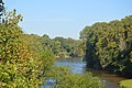 Roanoke River by Brookneal.jpg 6,016 × 4,000; 6.44 MB
-
 Rush east from Foundry, Brookneal.jpg 6,016 × 4,000; 6.66 MB
-
 Shady Grove from Mollies Creek Road.jpg 6,016 × 4,000; 6.18 MB

.jpg)


